Download
1 / 31
310 likes | 479 Views
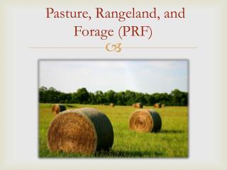
RMA Pasture, Range, and Forage--Vegetation Index. Jesslyn Brown jfbrown@usgs.gov Phone: 605-594-6003. Application of EROS NDVI to PRF Program. Source: EROS AVHRR NDVI data AVHRR (and future) timeline EROS processing flow Post-processing by GMS Temperature Constrained NDVI Index

E N D
RMA Pasture, Range, and Forage--Vegetation Index Jesslyn Brown jfbrown@usgs.gov Phone: 605-594-6003
Application of EROS NDVI to PRF Program • Source: EROS AVHRR NDVI data • AVHRR (and future) timeline • EROS processing flow • Post-processing by GMS • Temperature Constrained NDVI Index • 8 X 8 km grids (i.e., spatial averaging) • Intervals (i.e., 3-month averaging) • Determining “normal” (i.e. long-term maximum/minimum) • Issues and Recommendations • Future Plans
March 2007 U.S. Department of the Interior U.S. Geological Survey 2006 Satellite Vegetation Phenology for the Conterminous U.S. April 2, 2006 April 30, 2006 May 28, 2006 June 25, 2006 July 23, 2006 August 20, 2006 September 17, 2006 October 15, 2006 October 29, 2006
NDVI Normalized Difference Vegetation Index
NDVI changes in response to multiple terrestrial phenomena • Drought • Phenological cycles of emergence, maturity, scenesence • Flood • Pests • Hail • Wildfire • Land cover conversion
Advantages of NDVI • The NDVI is successful as a vegetation measure—it is sufficiently stable to permit meaningful comparisons of seasonal and inter-annual changes in vegetation growth and activity. • The strength of the NDVI is in its ratioing concept, which reduces (not removes) many forms of multiplicative noise present in different magnitudes in the red and NIR bands: • Illumination differences • Cloud and relief shadows • Atmospheric contamination • Certain topographic illumination variations
NDVI Limitations • The main limitation of the NDVI is the inherent non-linearity of ratio-based indices • Additive noise effects, such as atmospheric path radiance, are not removed by ratioing • The NDVI also exhibits scaling problems, asymptotic (saturated) signals over high biomass conditions • The NDVI is very sensitive to canopy background variations, with NDVI degradation particularly strong with higher canopy background brightness • NDVI of the same cover is different when derived by different sensors –due to spectral band pass differences (band width and spectral response) between sensors.
Calibration of the 1 km AVHRR time series Satellite Start Date End Date Source NOAA 11 09/26/1988 03/26/1989 prelaunch NOAA 11 03/27/1989 01/01/2020 Teillet and Holben (1994) NOAA 14 12/30/1994 06/30/1995 prelaunch NOAA-14 06/31/1995 01/01/2020 Vermote and Kaufman (1995) NOAA 16 09/01/2000 06/24/2003 prelaunch NOAA-16 06/25/2003 01/01/2020 NOAA NOAA-17 06/24/2002 12/31/2002 prelaunch NOAA-17 01/01/2003 01/01/2020 NOAA NOAA-18 05/20/2005 09/12/2005 prelaunch NOAA-18 09/13/2005 01/01/2020 NOAA
PRF-VI post-processing: Temperature Constrained NDVI Index • Process 1-km gridded NDVI to 8 x 8 km grid cells • Define Major Land Resource Area (MLRA) and elevation classes for the GRP NDVI grids so that temperature constraint variables could be assigned to the appropriate geographic areas and indexing interval • Calculate the daily temperature constrained NDVI values for each 8 x 8 km grid cells • Calculate the daily max/min index value for each 8 x 8 km grid cell and average these over the indexing interval • Calculate the final temperature constrained index value for each 8 x 8 km grid cell and interval Provided by J. Angerer, GMS in 2007
Intervals—3 month • Interval I: Apr 1 – Jun 30 • Interval II: Jul 1 – Sep 30 • Interval III: Oct 1 – Dec 31 • Interval IV: Jan 1 – Mar 31
Issues • Multiple cover types within 8 x 8 km grid cells • Forest • Irrigated agriculture • Intervals • Lack of transparency of methods
I IV II III
I I IV II II III
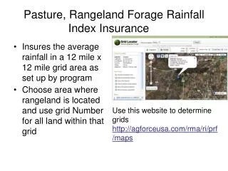
Recommendations • Eliminate option to purchase coverage outside of the growing season (i.e., in intervals where the NDVI will not be related to vegetative growth) • Focus on forage (i.e., screen out the cover types that aren’t covered by this insurance). Land cover (USGS--NLCD), Crop maps (USDA-NASS), and Irrigated agriculture (USGS) data are all available. • Please expand the description of the methodology on the RMA website. Documentation still points directly to EROS NDVI and this is misleading.
Summary • Accurate and frequent communication on multiple topics (sensors, NDVI time series, etc.) • Remove confusion from irrigated agriculture and other land cover types within 8 x 8 km grid cells • Insurance intervals need to make sense for the geographic region, consider removing intervals outside the growing season • Collaboration amongst government agencies will be critical to transition applications to VIIRS
eMODIS Production Flow User decision support systems eMODIS Historical Input Data Target: Monday 10:30 a.m. Terra MODIS T+10hrs LAADS USGS Drought Monitoring VegDRI MODAPS EDOS T+6hrs NIDIS Drought Portal MODIS L0 Data T+3hrs eMODIS Expedited NDMC Vegetation Drought Response Index U.S. Drought Monitor MODIS L2, L1B Data LANCE
Processing remote sensing data to create information Normalized Difference Vegetation Index (NDVI) Start of Season End of Season Length of Season Growing season production Greenness “to-date”
Percent of Average Seasonal Greenness (PASG) X SG(89-09)= 21 PASG(10)= 64.7% Seasonal Greenness 16 22 24 6/28/08 6/28/09 6/28/10
What is VegDRI? VegDRI is a new ‘hybrid’ drought index that integrates: • satellite-based observations of vegetation conditions • climate-based drought index data • biophysical characteristics of the environment to produce maps of drought-related vegetation stress that have high spatial resolution (1-km) and are regularly updated (1-week intervals) throughout the growing season.
National Irrigated Lands National Irrigation Mapping CONUS maps of irrigation status for 2002 and 2007 Journal publication on evaluation and validation http://dx.doi.org/10.3390/rs2102388 Analysis of irrigation change in progress. [CLICK TO CLOSE] [CLICK TO OPEN]
Validation of MIrAD-US • Error matrix