Download
1 / 81
810 likes | 816 Views
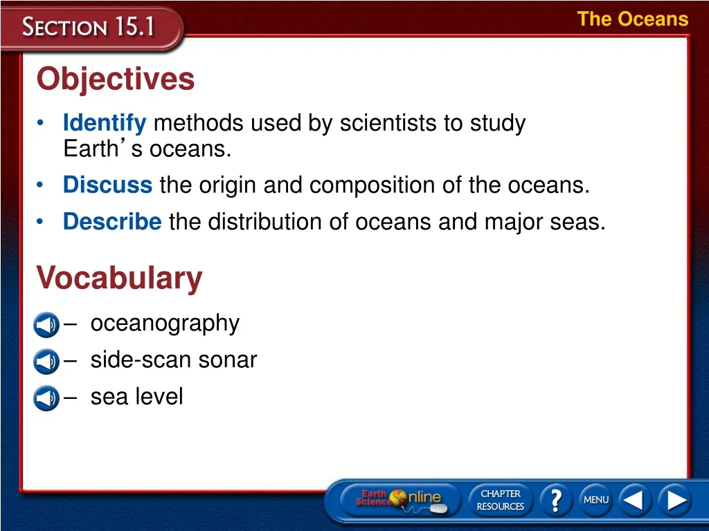
The Oceans. Objectives. Identify methods used by scientists to study Earth ’ s oceans. Discuss the origin and composition of the oceans. Describe the distribution of oceans and major seas. Vocabulary. oceanography side-scan sonar sea level. The Oceans. The Oceans.

E N D
The Oceans Objectives • Identify methods used by scientists to study Earth’s oceans. • Discuss the origin and composition of the oceans. • Describe the distribution of oceans and major seas. Vocabulary • oceanography • side-scan sonar • sea level
The Oceans The Oceans • In the late 1800s, the British Challenger expedition became the first research ship to use relatively sophisticated measuring devices to study the oceans. • Oceanography is the scientific study of Earth’s oceans, which is usually considered to have started with the Challenger expedition.
The Oceans Modern Oceanography • In the 1920s, the German research ship Meteor used sonar for the first time to map the seafloor features of the South Atlantic Ocean. • Sonar, which stands for sound navigation and ranging, uses the return time of an echo and the known velocity of sound in water to determine water depth. • The velocity of sound in water is 1500 m/s. • To calculate the distance to the ocean floor, multiply the time by 1500 m/s, then divide by 2.
The Oceans Modern Oceanography Advanced Technology • Satellites such as the Topex/Poseidon continually monitor the ocean’s surface temperatures, currents, and wave conditions. • Submersibles, or underwater vessels, investigate the deepest ocean trenches. • Large portions of the seafloor have been mapped using side-scan sonar. • Side-scan sonar is a technique that directs sound waves to the seafloor at an angle, so that the sides of underwater hills and other topographic features can be mapped.
The Oceans Origin of the Oceans • Studies of radioactive isotopes indicate that Earth is about 4.6 billion years old. • Radioactive studies and lava flows offer evidence that there has been abundant water throughout Earth’s geologic history.
The Oceans Origin of the Oceans Where did the water come from? • Scientists hypothesize that Earth’s water could have originated from two sources. • Comets occasionally collide with Earth and release water on impact–possibly enough to have filled the ocean basins over geologic time. • Studies of meteorites indicate that they may contain up to 0.5 percent water. • If the early Earth contained the same percentage of water, it would have been more than sufficient to form the early oceans.
The Oceans Origin of the Oceans Volcanism • Shortly after the formation of Earth, violent volcanism released huge amounts of water vapor, carbon dioxide, and other gases, which combined to form Earth’s early atmosphere. • As Earth’s crust cooled, the water vapor gradually condensed into oceans.
The Oceans Origin of the Oceans Volcanism • Volcanism still adds water to the hydrosphere, but the process is balanced by the continuous destruction of some water molecules by ultraviolet radiation from the Sun.
The Oceans Distribution of Earth’s Water • The oceans contain 97 percent of the water found on Earth. • The remaining 3 percent is freshwater located in the frozen ice caps of Greenland and Antarctica and in rivers, lakes, and underground sources. • The percentage of ice has ranged from near zero to as much as 10 percent of the hydrosphere over geologic time.
The Oceans Distribution of Earth’s Water • Global sea level is the level of the oceans’ surfaces. • Sea level has risen and fallen by hundreds of meters in response to melting ice during warm periods and expanding glaciers during ice ages. • Tectonic forces that lift or lower portions of the seafloor has also affected sea level.
The Oceans Distribution of Earth’s Water The Blue Planet • Approximately 71 percent of Earth’s surface is covered by oceans that have an average depth of 3800 m. • Because most landmasses are in the northern hemisphere, oceans only cover 61 percent of the surface. • Water covers 81 percent of the southern hemisphere.
The Oceans Distribution of Earth’s Water Major Oceans • There are three major oceans: • The largest ocean, the Pacific, contains roughly half of Earth’s seawater and is larger than all of Earth’s landmasses combined. • The second-largest ocean, the Atlantic, extends from Antarctica to the arctic circle, north of which it is often referred to as the Arctic Ocean. • The third-largest ocean, the Indian, is located mainly in the southern hemisphere. • The water surrounding Antarctica, south of 50° south latitude, is known as the Antarctic Ocean.
The Oceans Distribution of Earth’s Water Major Oceans
The Oceans Section Assessment 1. What is side-scan sonar? Side-scan sonar is a technique that directs sound waves to the seafloor at an angle, so that the sides of underwater hills and other topographic features can be mapped.
The Oceans Section Assessment 2. According to one hypothesis, how did volcanism play a part in forming Earth’s early oceans? During a period of massive volcanism that occurred shortly after the formation of Earth, huge quantities of water vapor, carbon dioxide, and other gases were released. These gases formed Earth’s early atmosphere. As Earth’s crust cooled, the water vapor gradually condensed into oceans.
The Oceans Section Assessment 3. Identify whether the following statements are true or false. ______ Oceans contain 97 percent of the water found on Earth. ______ Oceans cover 71 percent of Earth’s surface. ______ The Earth’s major oceans are isolated from each other by landmasses. ______ Presently, average global sea level is rising 1 to 2 cm per year. true true false false
Seawater Objectives • Compare and contrast the physical and chemical properties of seawater. • Explain ocean layering. • Describe the formation of deep-water masses. Vocabulary • salinity • temperature profile • thermocline
Seawater Seawater • Seawater is a solution of about 96.5 percent water and 3.5 percent dissolved salts. • The most abundant salt in seawater is sodium chloride (NaCl). • Most elements on Earth are present in seawater. • Because these substances are dissolved, they are in the form of ions.
Seawater Seawater
Seawater Chemical Properties of Seawater • Salinity is a measure of the amount of dissolved salts in seawater that is expressed as grams of salt per kilogram of water, or parts per thousand (ppt). • The total salt content of seawater is, on average, 35 ppt, or 3.5 percent. • Seawater also contains dissolved gases and nutrients.
Seawater Chemical Properties of Seawater Variations in Salinity • The actual salinities of the oceans vary from place to place. • Salinities may be as high as 37 ppt in subtropical regions where rates of evaporation exceed those of precipitation. • Salinities are lower in equatorial regions where precipitation is abundant. • Salinities of 32 or 33 ppt occur in polar regions where seawater is diluted by melting sea ice. • The lowest salinities often occur where large rivers empty into the oceans.
Seawater Chemical Properties of Seawater
Seawater Chemical Properties of Seawater Sources of Sea Salt • Geological evidence indicates that the salinity of ancient seas was not much different from that of today’s oceans. • The proportion of magnesium in the calcium-carbonate shells of some marine organisms depends on the overall salinity of the water in which the shells form. • Present-day shells contain about the same proportion of magnesium as similar shells throughout geologic time.
Seawater Chemical Properties of Seawater Sources of Sea Salt • The sources of sea salts has remained the same over time. • Chlorine and sulfur dioxide dissolve in water and form the chlorine and sulfate ions of seawater. • The weathering of crustal rocks generates most of the other abundant ions in seawater. • These ions are then flushed into rivers and transported to oceans.
Seawater Physical Properties of Seawater • Freshwater has a maximum density of 1.00 g/cm3. • Seawater is denser than freshwater because salt ions are heavier than water molecules. • The density of seawater ranges from about 1.02 g/cm3 to 1.03 g/cm3 depending on its salinity and temperature. • Because salt ions interfere with the formation of hydrogen bonds, the freezing point of seawater is –2°C.
Seawater Physical Properties of Seawater Absorption of Light • Water absorbs light, which gives rise to another physical property of oceans—they are dark. • In general, light penetrates only the upper 100 m of seawater. • Red light penetrates less than blue light. • Light sufficient for photosynthesis exists only in the top 100 m of the ocean.
Seawater Ocean Layering • Ocean surface temperatures range from –2°C in polar waters to 30°C in equatorial regions, with the average surface temperature being 15°C. • Ocean water temperatures decrease significantly with depth.
Seawater Ocean Layering • A typical ocean temperature profile plots changing water temperatures with depth.
Seawater Ocean Layering • Based on temperature variations, the ocean can be divided into three layers. • The first layer is a relatively warm, sunlit, surface layer some 100 m thick. • The thermocline is a transitional layer which is characterized by rapidly decreasing temperatures with depth. • The bottom layer is cold and dark with temperatures near freezing.
Seawater Ocean Layering
Seawater Ocean Layering • Both the thermocline and the warm surface layer are absent in polar seas, where water temperatures are cold from top to bottom. • In general, ocean layering is caused by density differences of warm and cold water.
Seawater Water Masses • Cold water migrates toward the equator as a cold, deep water mass along the ocean floor. • To start, sea ice that forms in the polar regions does not incorporate salt ions into growing ice crystals, causing them to accumulate beneath the ice. • As the cold water beneath the ice becomes saltier and denser than the surrounding seawater, it sinks. • Surface currents in the ocean also bring relatively salty midlatitude or subtropical waters into polar regions where they cool and sink. • The dense, salty water then migrates toward the equator as a cold, deep water mass along the ocean floor.
Seawater Water Masses • Three water masses account for most of the deep water in the Atlantic Ocean. 1. Antarctic Bottom Water forms when antarctic seas freeze during the winter and water temperature drops below 0°C. 2. North Atlantic Deep Water forms in a similar manner offshore from Greenland. 3. Antarctic Intermediate Water forms when the relatively salty waters of the Antarctic Ocean decrease in temperature during winter and sink.
Seawater Water Masses • The Indian and Pacific Oceans contain only the two deep antarctic water masses.
Seawater Section Assessment 1. By what processes are salts removed from seawater? Salts are removed from seawater through the formation of evaporites, sea spray that is carried inland by wind, and biological processes.
Seawater Section Assessment 2. What is a thermocline? A thermocline is a transitional layer between warm surface waters and cold bottom waters in a body of water that is characterized by rapidly declining temperatures with depth.
Seawater Section Assessment 3. Identify whether the following statements are true or false. ______ North Atlantic Deep Water overrides Antarctic Bottom Water. ______ Photosynthesis can occur to a depth of 200 m. ______ Sodium is the most prevalent ion in seawater. ______ Salt water is always denser than freshwater, regardless of temperature. true false false true
Ocean Movements Objectives • Describe the physical properties of waves. • Explain how tides form. • Compare and contrast various ocean currents. Vocabulary • wave • crest • trough • breaker • tide • density current • surface current • upwelling
Ocean Movements Ocean Movements • A wave is a rhythmic movement that carries energy through space or matter, such as ocean water. • As an ocean wave passes, the water moves up and down in a circular pattern and returns to its original position.
Ocean Movements Wave Characteristics • A crest is the highest point of a wave. • A trough is the lowest point of a wave. • The vertical distance between crest and trough is the wave height; the horizontal crest-to-crest distance is the wavelength.
Ocean Movements Wave Characteristics • The wavelength determines the wave base, which is the depth to which the wave disturbs the water. • Wave speed increases with wavelength.
Ocean Movements Wave Characteristics
Ocean Movements Wave Characteristics Wave Height • Wave heights depend upon three factors: wind speed, wind duration, and fetch. • Fetch refers to the expanse of water that the wind blows across. • Large storm waves can be much higher than average.
Ocean Movements Wave Characteristics Breaking Waves • Ocean waves begin to lose energy and slow down near the shore because of friction with the ocean bottom. • As the water becomes shallower, incoming wave crests gradually catch up with the slower wave crests ahead. • Breakers are waves where the crests collapse forward when the wave becomes higher, steeper, and unstable as it nears shore.
Ocean Movements Wave Characteristics Breaking Waves
Ocean Movements Tides • Tides are the periodic rise and fall of sea level. • The highest level to which water rises is known as high tide, and the lowest level is called low tide. • Because of differences in topography and latitude, the tidal range—the difference between high tide and low tide—varies from place to place. • Generally, a daily cycle of high and low tides takes 24 hours and 50 minutes.
Ocean Movements Tides Differences in topography and latitude cause three different daily tide cycles. Areas with semidiurnal cycles experience two high tides per day. Areas with mixed cycles have one pronounced and one smaller tide each day. Areas with diurnal cycles have one high tide per day.
Ocean Movements Causes of Tides • The basic causes of tides are the gravitational attraction among Earth, the Moon and the Sun, as well as the fact that gravitational attraction decreases with distance. • Both Earth and the Moon orbit around a common center of gravity. • As a result, Earth and the Moon experience gravitational and centrifugal forces that generate tidal bulges on opposite sides of Earth.