Download
1 / 24
240 likes | 243 Views
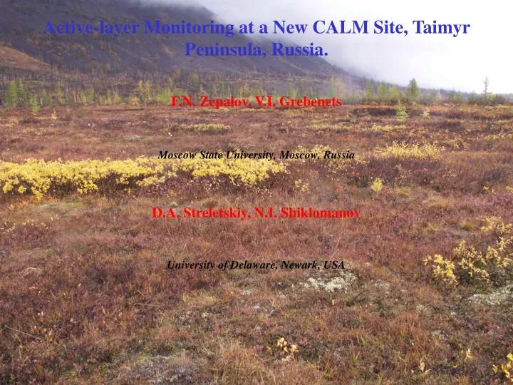
Active-layer Monitoring at a New CALM Site, Taimyr Peninsula, Russia. F.N. Zepalov, V.I. Grebenets. Moscow State University, Moscow, Russia. D.A. Streletskiy, N.I. Shiklomanov. University of Delaware, Newark, USA.

E N D
Active-layer Monitoring at a New CALM Site, Taimyr Peninsula, Russia. F.N. Zepalov, V.I. Grebenets Moscow State University, Moscow, Russia D.A. Streletskiy, N.I. Shiklomanov University of Delaware, Newark, USA
Talnakh sites is located in the northern part of Eastern Siberia on Taimyr Peninsula, at Noril-Rybnin interfluve, about 2.5 km south-east of the settlement of Talnakh (Norilsk Industrial Region). Kharaelakh Ridge of Putorana Mountains lays 1.5 km north of the site. (69о26’01” N, 88о28’03” E) Talnah site
Norilsk years Toc Annual temperature Middle winter temperature Tendency of winter temperature global temperature trend
Borehole 3959 About 200 m Borehole 3956 Borehole 3957
Study area Study area is subhorizontal surface with elevation decreasing in south-east direction. The small migrated frost heave mound 30 m in diameter and 1,5 m high occupies the portion of the site. The frost mound is surrounded by flow depressions and polygonized peatlands. Typical tundra vegetation occupies the site and consists of shrubs, dwarf-shrub and sedges. Mosses and likens are largely absent from the site. The environmental and geocryologic conditions of the site closely correspond to those of the south-western part of Taimyr Peninsula.
Methodology: 1)The regular 100 x 100 m (1 ha) grid was established . 2) There was typical types of landscapes. 3) The Large-scale Map of relief have been made. 4) Periodic annual active-layer measurements were initiated in 2005 at grid nodes separated by 10 m, yielding an array of 11 x 11 nodes across the grid. 5) Data from boreholes (temperature and sedimentology).
Flow depressions Migrated frost heave mound The Digital Elevation Model (DEM). The optical leveling will be continued annually and will be used to evaluate changes in position of ground surface associated with frost heave and thaw subsidence.
№ borehole Ground Depth of layers from-to, m 3959 Peat 0-0,3 Loam with pebbles to 5 % 0,3-0,8 Loam with pebbles to 10 % 0,8-4,3 3956 Peat 0-0,1 Loam 0,1-0,4 Sand 0,4-2,3 3957 Peat 0-0,2 Loamy sand 0,2-0,5 Sand 0,5-2,3 Sediments primarily consist of loam with small intrusions of pebbles and overplayed by a thin peat layer.
Microrelief on the area The thickness of the active layer for 3 years Middle value of ALT Minimum value of ALT Maximum value of ALT
Box-whisker plots of ALT in characteristic landscape units: I . Hillocks II. Polygonal peatland III.Hummocks IV.Flow depressions V.Bogs VI.Pingo VII.Patterned ground VIII.Depression surrounding pingo IX.Thaw lake depression Maximum value Maximum value for 3 years Minimum value for 3 years Minimum value
Results and discussion: • The thickness of the active layer varies from 45-50 cm to 125-150 cm, depending on landscape-specific conditions. The maximum thickness of active-layer is observed at landscapes represented by sparsely-vegetated patterned ground and dry hillocks. The minimum ALT was found in the polygonized peatlands.The maximum three-year grid average ALT is 87.3 cm, with minimum 50 cm, maximum 126.5 cm, standard deviation is relatively small and does not exceed 15 cm. • 2) The absence of global temperature trend in this area shows the absence common trend of ALT • Taimur is a cemetery of cyclons. Active layer depends on the thickness of snow cover. Snow cover melt down slowly in depressions than in other landscapes, which can provide smaller thickness of active layer. • Probably, late snow meltdown in depressions minimize the influence Climate Warming trend. • Varieties of active layer thickness depend on weather conditions, sedimentology,microrelief, cryogenic processes and vegetation. We have know answers for following questions: do the weather conditions influence on variability of ALT thickness? Is the peat-loam layer representative for CALM program? Does the CALM program researches shows the variety between different types of permafrost micro-relief?
Acknowledgments This study was conducted as part of research and educational plan of the Department of Geography at Moscow State University. We are also grateful to the U.S. National Science Foundation for their partial financial support through OPP-0352957 grant, administered by the University of Delaware.