Download
1 / 22
220 likes | 241 Views
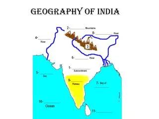
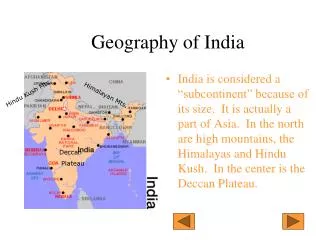
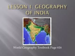
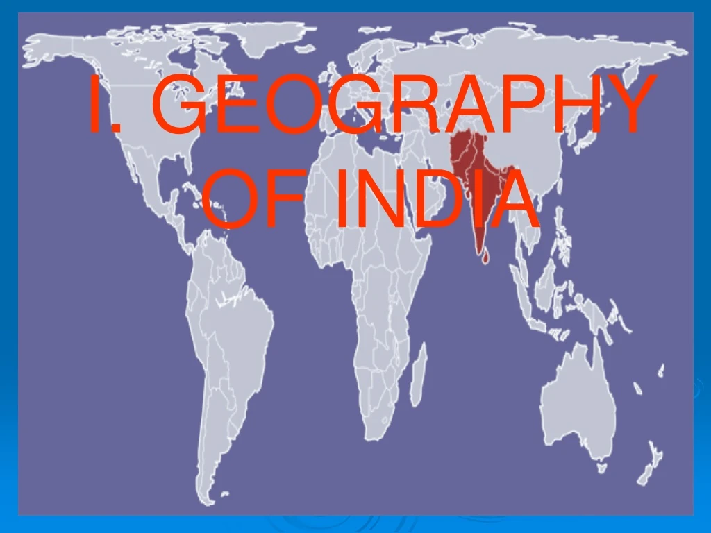
I. GEOGRAPHY OF INDIA. Indus R. Brahmaputra R. Ganges R. Bay of Bengal. Arabian Sea. Indian Ocean. India is: a Subcontinent (a major subdivision of a continent). a P eninsula - surrounded by water on 3 sides. Himalayas. Northern Plains. Deccan Plateau. Coastal Plains.

E N D
Indus R. Brahmaputra R. Ganges R. Bay ofBengal Arabian Sea Indian Ocean
India is: • a Subcontinent (a major subdivision of a continent). • a Peninsula- surrounded by water on 3 sides
Himalayas Northern Plains Deccan Plateau Coastal Plains Coastal Plains
2. India’s diverse (different) geography causes cultural diversity(differences in culture) • Fertile plains are watered by Snow melting off the Himalayas, the Ganges R. and the Indus R.
Mountains blocked trade and ideas, isolating it, (like China): • Eastern Himalayas- virtually impassable and the home of Mount Everest • Western Himalayas- the Khyber Pass allows invaders to pass through the mts.
The Himalayas • “him” [snow] • “aalaya” [home] • Mt. Everest is 29,035 feet, the highest peak in the world.
3. Monsoons- a seasonal wind Rain Store water Summer Monsoon 1 Grow crops with stored water Hot, dry air Winter monsoon 2
Pakistan India Bangladesh
DON’T WRITE! Crops die & Famine If summer monsoon is late Hot, dry air still there 3 Floods,Crops die, houses destroyed If summer monsoon is early Too much rain 4
Harappa and Mohenjo Daro Urban planning (organized city plan) shows math skills and a strong central gov’t Hill top structures, a Sewer system, a granary, and a grid system - 1. Two main cities:
The Aryans - A group of Indo-European nomads who eventually conquered the Indus Valley and became farmers. - Aryan tribes were led by chiefs called rajahs. - By 500 BCE, the Caste system (social class system), Hinduism (religion) and Sanskrit(writing) developed.
2. Aryan Invasion • The nomadic Aryans conquered the Indus cities who were weakened by a natural disaster. • They wrote about Aryan society in the Vedas • They developed Sanskrit (writing), Hinduism (religion) and divided Society by occupation.
III. Empires of India 1. Maurya Empire (321 BC-185 BC) • Chandragupta- ruler who built the largest capital of its time • Chandragupta’s gov’t was a bureaucracy and had a brutal secret police
Asoka (Chandragupta’s grandson) was the most honored Maurya emperor. • After a long, bloody war he converted to Buddhism, rejected violence, and ruled by moral example.
He sent missionaries all over India which helped spread Buddhism in Asia. • Asoka’s rule brought peace and prosperity, which helped unite his diverse people
2. Gupta Empire (350 CE-550 CE) • Power was in the hands of village and city gov’ts • Trade and farming flourished • Rajahs (local rulers) built temples, Buddhists built stupas (religious monument)
Achievements: • Math- the concept of zero and the decimal system. • Medicine- herbal cures, simple plastic surgery, setting broken bones, and vaccines. • This was considered a Golden Age.