Download

1 / 21
210 likes | 226 Views
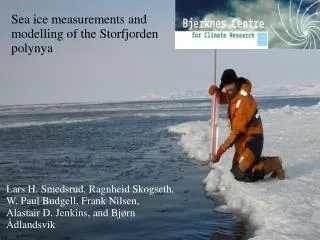
Hydrographical Properties of the Storfjorden Polynya. Ragnheid Skogseth 1 , Lars H. Smedsrud 2 and Frank Nilsen 1,3 1 The University Centre in Svalbard 2 Bjerknes Centre for Climate Research 3 Geophysical Institute, University of Bergen. CTD Stations in Storfjorden April 2004 and 2006.

E N D
Hydrographical Properties of the Storfjorden Polynya Ragnheid Skogseth1, Lars H. Smedsrud2 and Frank Nilsen1,3 1The University Centre in Svalbard 2Bjerknes Centre for Climate Research 3Geophysical Institute, University of Bergen
TS-Diagram • 2004: poor brine year S < 34.8 • 2006: average brine year S ~ 35.2 • Super-cooled saline water in the polynya when freezing • Exchange of watermass in polynya with changing wind directions • Isopycnal mixing with warmer inflowing water over the sill • Mixing between warmer less saline inflowing water and cold saline brine water in the overflow at the sill
Downflow of Brine-enriched Shelf Water • 2004: Downflow of denser water from shallow area to the deep basins inside Storfjorden
Downflow of Brine-enriched Shelf Water • 2004: Downflow of denser water from shallow area to the deep basins inside Storfjorden
Downflow of Brine-enriched Shelf Water • 2006: Downflow of dense BSW from shallow area to the deep basins inside Storfjorden following trenches along the path
Downflow of Brine-enriched Shelf Water • 2006: Downflow of dense BSW from shallow area to the deep basins inside Storfjorden following trenches along the path
Downflow of Brine-enriched Shelf Water • 2006: Observed section (along depth contour) of downflow of dense BSW from shallow area to the deep basins inside Storfjorden • Densest BSW towards the steepest path
Downflow of Brine-enriched Shelf Water • 2006: Observed section (along depth contour) of downflow of dense BSW from shallow area to the deep basins inside Storfjorden • Densest BSW towards the steepest path
Downflow of Brine-enriched Shelf Water • 2006: No observed section (along depth contour) of downflow of BSW from shallow to deep area off Storfjorden-banken outside the sill • North-south density gradient across the sill latitude
Downflow of Brine-enriched Shelf Water • 2006: No observed section (along depth contour) of downflow of BSW from shallow to deep area off Storfjorden-banken outside the sill • North-south density gradient across the sill latitude
Bergen Ocean Model (BOM) • January 1 – May 1 1999 • Wind forcing derived from MM5 in mean polynya area and along West Spitsbergen • Salt and heat flux in mean polynya area derived from polynya model in winter 1999 • Salt flux: 2.05 10-5 psu m/s (893 109 kg in 120 days) • Heat flux: 4.71 10-5 C m/s (193 W/m2) • Mean polynya area: 3.0 109 m2 (812 grid points in selected area)
Downflow of BSW estimated with BOM • Day 8: Downflow of BSW starts from shallow to deep basins inside Storfjorden at designated areas • No modelled downflow of BSW from shallow to deep area off Storfjorden-banken outside the sill
Downflow of BSW estimated with BOM • Day 29: Deep basins inside Storfjorden are filled up to sill level with BSW due to the downflow from the shallow polynya area • Overflow of BSW begins at the sill
Downflow of BSW estimated with BOM • Day 56: Inner Storfjorden is filled with BSW up to the ridge level • Overflow starts across the ridge in addition to the overflow across the sill • The BSW plume reaches the shelf break
Conclusions • Winter 2004 poor brine year with S < 34.8 • Winter 2006 average brine year with S ~ 35.2 in the BSW overflow • Source water of BSW changes with wind direction • Inflow of warmer water at the sill during the overflow • Downflow of BSW from the shallow areas in the polynya is only observed inside Storfjorden and not off Storfjordenbanken south of the sill • Observations and BOM simulations indicate that the downflow of BSW inside Storfjorden occurs at topographically favoured areas • BOM simulations show that overflow occurs both across the sill and the submarine ridge when Storfjorden is filled with BSW up to ridge level