Download
1 / 57
600 likes | 840 Views
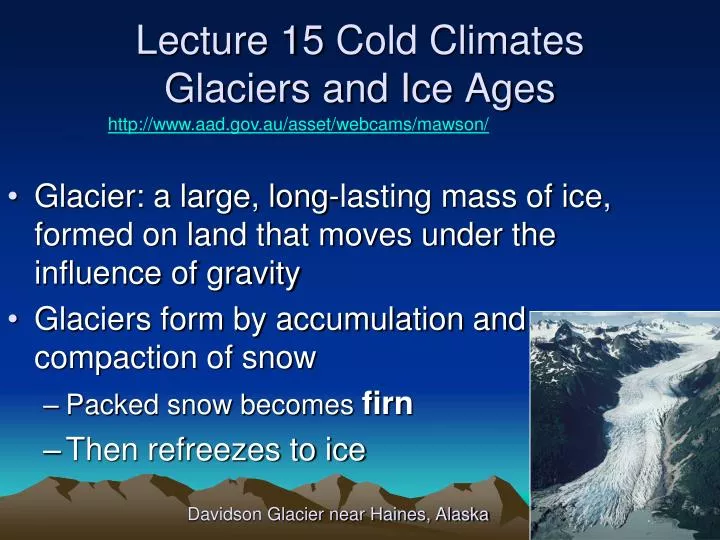
Glacier: a large, long-lasting mass of ice, formed on land that moves under the influence of gravity Glaciers form by accumulation and compaction of snow Packed snow becomes firn Then refreezes to ice. Lecture 15 Cold Climates Glaciers and Ice Ages.

E N D
Glacier: a large, long-lasting mass of ice, formed on land that moves under the influence of gravity Glaciers form by accumulation and compaction of snow Packed snow becomes firn Then refreezes to ice Lecture 15 Cold ClimatesGlaciers and Ice Ages http://www.aad.gov.au/asset/webcams/mawson/ Davidson Glacier near Haines, Alaska
Formation of Glacial Ice from Snow snowball iceball Alpine Glacier: it is just a frozen river
Types of Glaciers Continental Alpine Alpine glaciation: found in mountainous regions Continental glaciation: exists where a large part of a continent is covered by glacial ice Cover vast areas
Alpine Glaciers– Cirque Glacier Mount Edith Cavell, Jasper National Park, Canada
Alpine Glaciers – Valley Glacier Lateral and medial moraines Tongas National Forest, Alaska
Types of Glaciers – Icecap and Continental http://www.nmm.ac.uk/server/show/conWebDoc.1221 Sentinal Range, Antarctica • Antarctica is the broadest high place on Earth, the ice cap is up to 4km thick • and covers the continent • Antarctica is a desert, with only 15 cm (6 inches) of snowfall a year around • the South Pole. The air is too cold to hold much moisture. • The lowest recorded temperature is -89.2 °C. • There is no life in Antarctica except near the coast
Types of Glaciers – Piedmont & Tidewater Piedmont: Originally confined alpine, spread at foot of mountains Source:Jim Wark/Peter Arnold, Inc. Calving
Iceberg Calving – Hubbard Glacier, Wrangell-St. Elias National Park, Alaska
A Glacier’s Budget • Budget = Gain – Loss • Gains snow in zone of accumulation • Loses ice in zone of ablation • Budget can be positive (net growth) • Static • or negative (net melting)
A Glacier’s Budget Year round Snow Summer Rain Note that a glacier is a river. Even if the terminus doesn’t advance, it still flows downhill
Mechanics of Glacial Flow • Internal deformation • Ice crystals slide past one another • Basal Sliding Entire glacier slides downhill on a thin film of meltwater at its base. • Glacier always flows toward zone of ablation Basal Sliding Discussion:Ice skates and sleds
Erosion 1: Glacial Abrasion in Bedrock Glaciers cause erosion Rock embedded in Ice Source:Tom Bean
Glacial Erosion – Roche Moutonée 2. Quarrying FROST WEDGING
Glacial Erosion – Roche Moutonée Yosemite NP, Calif
Erosion by Glaciers (cont.) • Alpine glaciers erode mountain slopes into horseshoe shaped basins called cirques • Melting forms cirque lake (tarn) • Erosion of two or more cirques erodes intervening rock • Horns :pointy peaks made by trios • Arêtes: long serrated ridges by pairs • Cols: passes through the arêtes
Alpine Glacial Erosion Cirque and valley glaciers form in river valleys, cut U-shapes
Alpine Glacial Erosion Cirque glaciers erode uphill, widen Valley glaciers enlarge Arêtes, Horn, Col, HANGING VALLEYS
U-Shaped Glacial Valley in Southeastern Alaska Valley glaciers erode a large quantity of bedrock and sediment Convert V-shaped stream valleys into U-shaped glacial valleys.
Seawater Flooded U-ShapedValleys: Fjords Bela Bela Fjord, BC Sea Level rose as glaciers melted
Erosion by Continental Glaciation • Erosional Landforms much larger in scale than alpine glaciers • Whalebacks – huge Roche Moutonée • Huge U-shaped troughs – Finger Lakes, Great Lakes, Puget Sound, Loch Ness were all once stream valleys excavated by Ice Sheets
Erosion by Continental Glaciation (Great Lakes, Finger Lakes) Superior Huron Michigan Ontario Erie Source:U.S. Dept. of Interior, USGS Eros Date Center
Glacial Deposits - Drift • Collectively called Glacial Drift • TYPE 1: UNSORTED • Glacial Till: unsorted, unstratified sediments deposited by melting ice. • May contain glacial erratics • Often accumulates at glacier’s terminus as a TerminalMoraine: hills of sediment left by a glacier’s retreat. • Moraines may be reshaped by a later glacial advance into Drumlins: rounded elongated hills
Advance & Retreat: Moraines Note moraine, no matter direction Analogy: Escalator
Discussion: Advance & Retreat of Glaciers and Terminal Moraines
Large Granite Erratics Favored by climbers with families
Wrangell-St. Elias NP, SE AK Medial Moraines – Kennicott Glacier
The Origin of Drumlins Glacier retreats, leaving a terminal moraine. Then it advances again, and redistributes the drift as a spoon shaped hill called a drumlin.
Glacial Deposits - Drift • TYPE 2: SORTED • Outwash: sorted stratified sediments deposited by meltwater streams • Loess: wind erosion of drying outwash silt. • Eskers: sinuous meltwater deposits of sand and gravel underneath ice
Effects of Glaciation • Change Climate –increase precipitation pluvial lakes • Depress continents & lateral rebound • Drop sea-level:alter coastlines • Moraines form Dams – Proglacial Lakes • Divert streams – Ohio and Missouri rivers
Lowered Sea-level - Land bridge Bering Glacier grows, sea-level drops
Lowered Sea-level exposed continental shelf Massive extinctions of shallow-water marine organisms
The Creation of Glacial Lake Missoula Purcell Lobe blocks Clark Fork River
The Draining of Glacial Lake Missoula Repeated many times, last time 13000 kya
Giant Ripples of the Missoula Flooding Flood kills everything in its path, 26 times Giant Ripples Country road for scale
Max Glacier Distribution 20,000 ya Maximum glaciation occurs at coincidence of three astronomical cycles if high land in polar latitudes
Causes of Ice Ages • Plate Tectonics Moves Continents to Poles Raises mountains above snowline Albedo increases, colder, spread • Orbit distance, Axis Tilt and Wobble • Moderates solar radiation past 65o Latitude • Croll-Milankovitch Cycles ~ every 100,000 years • With many smaller cycles between • Need low summertime radiation past 65o Latitude less melting, glaciers expand
Milankovitch Cycles http://en.wikipedia.org/wiki/Milankovitch_cycles The energy of solar radiation drops off as the square of the distance Further away Not as hot 100,000 years
High latitude getting more sunlight in winter Warm Wet Winter Cool Summer Snow doesn’t melt Glaciers grow High latitude getting less sunlight in summer Cold Dry Winter Hot Summer Snow melts Glaciers shrink High latitude getting more sunlight in summer 41,000 years
at Perihelion at Perihelion Determines which hemisphere gets conditions suitable for glaciation 25,700 years
One More Point On This • The orbital affects that Milankovitch suggested as a partial cause for ice ages each have a different period. • They combine at irregular intervals • Many glaciation peaks are about 100,000 years apart, but that is ONLY an average. This suggests that orbital ellipticity is important. The worst glaciations occur when minimum tilt coincides with maximum ellipticity.
Earth’s Past Ice Ages • Tertiary to Quaternary cooling – Pleistocene • None in Mesozoic • Late Pennsylvanian & Permian in southern continents (Gondwana) • Ordovician glaciation (Gondwana) • Area that is now the Sahara at South Pole • PreCambrian Tillites (Lithified Till) • Three, maybe four,episodes • Oldest 2.8 bya • 750 mya ice from poles to tropic “Snowball Earth” Cenozoic Mesozoic Paleozoic Paleozoic PreCambrian