Download

1 / 20
200 likes | 340 Views
Utah Verification 12Z April 5- 12z April 6. Nicole, Sam, Mike, Chris, Sergey. Satellite imagery. http://www.atmos.uiuc.edu/weather/tree/viewer.pl?launch/satconusenhir. 12z nam analysis monday. 12z nam analysis tuesday. 06z gfs forecast tuesday. 12z gfs forecast tuesday.

E N D
Utah Verification12Z April 5- 12z April 6 Nicole, Sam, Mike, Chris, Sergey
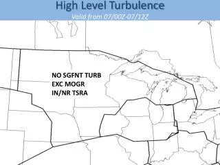
Satellite imagery • http://www.atmos.uiuc.edu/weather/tree/viewer.pl?launch/satconusenhir
Automatic Eliminations • Ice Storm • Blowing Dust • Smoke • Extreme Chill • Flash, Stream, River Floods • Severe Thunderstorm
Snow Flurries: 1-4, 6,7,9,11,13-17,19,20,23 Snow Shower: 2-4,6,7,9,14-16,23 Light Snow: 3,4,6,7,9,16 Moderate Snow: 3,4,6,7 Heavy Snow: 3,4,6 Very Heavy Snow: 3,4,6
Blowing Snow: Zones 1, 2, 3, 6, 16, 17, 20 • Logan: • KLGU 060451Z AUTO 28007KT 1/2SM SN FZFG BKN001 OVC008 M01/M02 A2981 RMK AO2 SLP099 P0009 T10111022= • Milford: • KMLF 052252Z AUTO 27015G28KT 1/2SM SN FG BKN010 BKN065 01/M01 A2970= • Salt Lake City: • KSLC 060253Z 31015KT 1/2SM -SN BR OVC003 01/00 A2977 RMK AO2 PK WND 28037/0205 SFC VIS 3/4 SLP075 P0007 60016 T00060000 53044 RVRNO $ • Ogden: • KOGD 060353Z AUTO 31013G20KT 1/4SM +SN FZFG OVC003 M01/M01 A2980 RMK AO2 SLP084 P0014 T10061011 • Bryce Canyon: • KBCE 060053Z AUTO 29024G33KT M1/4SM +SN FZFG VV001 M03/M04 A2978 RMK AO2 PK WND 28043/0043 WSHFT 0031 SLP052 P0006 T10331039 TSNO $=
Unknown PrecipitationZone 1 • KLGU 051351Z AUTO 35005KT 9SM UP BKN041 OVC050 02/01 A2962 RMK AO2 UPB16 SLP024 P0000 T00220011= • KLGU 051451Z AUTO 00000KT 10SM FEW070 03/02 A2962 RMK AO2 UPE1357 SLP023 P0000 60000 T00330017 56005= • SLEET • Well above freezing at surface • 2 hours before reported UP • In SLC instead of Logan
High and Severe WindsZones: 3, 16, 19, 27 • KSLC 060203Z 28031G37KT 1/2SM -SN BR VV004 01/00 A2971 RMK AO2 PK WND 29037/0203 SFC VIS 1 P0001 RVRNO $ • KMLF 052201Z AUTO 22035G45KT 6SM RA FEW016 BKN025 04/02 A2966 RMK AO2 PK WND 23045/2201 PRESRR P0000 TSNO • KSGU 052115Z AUTO 26034G39KT 10SM BKN070 BKN095 OVC110 14/00 A2970 RMK AO1 • KCNY 052153Z AUTO 24030G43KT 8SM FEW110 19/M11 A2955 RMK AO2 PK WND 26043/2149 SLP963 T01891111
Precipitation >= .5 1-12, 14-17
Visibility ≤ 0.5 MileSZones: 1-3, 6, 7, 9, 11, 13-17, 20, 23 • Hill Air Force Base • KHIF 060355Z 31012KT 1/4SM R14/0900V1000FT +SN BR VV005 M01/M01 A2980 RMK AO2A SLP085 P0008 T10101014 • KHIF 060338Z 31009KT 1/4SM R14/0700V1000FT +SN BR VV005 M01/M01 A2979 RMK AO2A SLP082 • Salt Lake City • KSLC 060703Z 03005KT 1/2SM SN FZFG VV003 M01/M01 A2988 RMK AO2 P0001 RVRNO $ • KSLC 060653Z 02006KT 1/2SM SN FZFG BKN005 OVC010 M01/M01 A2987 RMK AO2 TWR VIS 3 SLP111 P0003 T10061011 401171006 RVRNO $ SPECI • KLGU 060417Z AUTO 29005G15KT 1/2SM SN FZFG BKN003 BKN006 OVC010 M01/M02 A2980 RMK AO2 P0005
summary • Weather in Utah can change rapidly • Blowing dust is possible in this state as soil is of a sandy consistency • Moderate to strong winds in wake of fast-moving cold front • Winds in the mountains vary in direction and speed • Cold fronts are likely to spark thunderstorms • Snow can be heavy in high elevations, especially with convection from cold front • 850 and 700mb analysis charts practically serve as the surface in the mountains • In mountains, downsloping and upsloping important for amount of precipitation and winds • Freezing levels drop with approach of upper trough and lowering heights • QPF can be inaccurate in high elevations • Do NOT forecast for the West without the proper amount of coffee