Download
1 / 21
220 likes | 341 Views
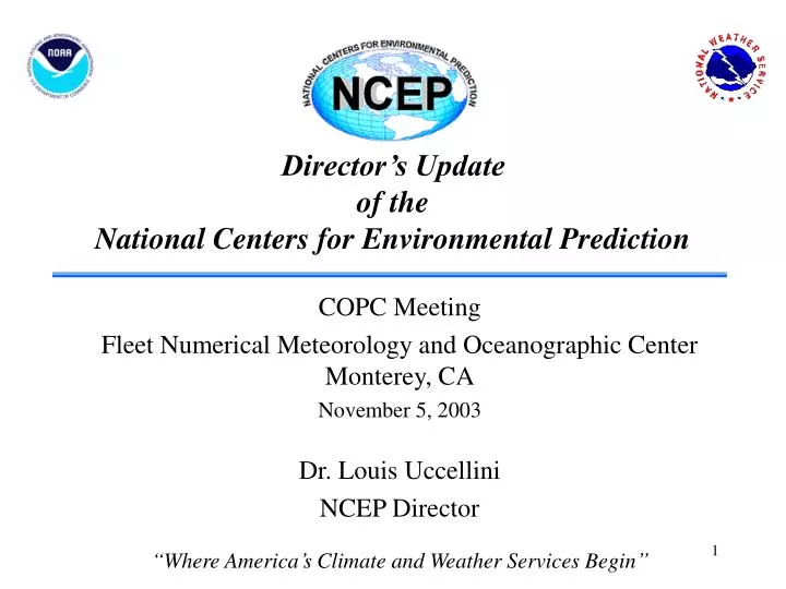
Director’s Update of the National Centers for Environmental Prediction. COPC Meeting Fleet Numerical Meteorology and Oceanographic Center Monterey, CA November 5, 2003 Dr. Louis Uccellini NCEP Director “Where America’s Climate and Weather Services Begin”. Overview.

E N D
Director’s Updateof theNational Centers for Environmental Prediction COPC Meeting Fleet Numerical Meteorology and Oceanographic Center Monterey, CA November 5, 2003 Dr. Louis Uccellini NCEP Director “Where America’s Climate and Weather Services Begin”
Overview • Status of Computer and Models • Recent Advancements • Hurricanes • Climate Models • WRF
Computing Capability $20M/Year Investment Commissioned/Operational IBM Supercomputer in Gaithersburg, MD (June 6, 2003) • Receives Over 116 Million Global Observations Daily • Sustained Computational Speed: 450 Billion Calculations/Sec • Generates More Than 5.7 Million Model Fields Each Day • Global Models (Weather, Ocean, Climate) • Regional Models (Aviation, Severe Weather, Fire Weather) • Hazards Models (Hurricane, Volcanic Ash, Dispersion)
NCEP Operational Models Eta 12 km, 60 levels, 84 hrs at 0 , 6, 12 and 18Z Global Forecast System (GFS) T254 (~55 km) to 3.5 days (84 hrs), 64 levels T170 (~75 km) to 7.5 days (180 hrs), 42 levels T126 (~105 km) to 16 days (384 hrs), 28 levels 16 days (384 hrs)/4 times per day RUC 20 km, 50 levels 12 hrs at 0,3,6,9,12,15,18,21Z 3 hrs at 1,2,4,5,7,8,10,11,13,14, 16,17,19,20,22,23Z Climate T62 (~200 km), 28 levels, 7 months (20 members) Ensembles global 10 members at 0 and 12Z T126 (~105 km) to 84 hrs, T62 (210 km) to 384 hrs 28 levels, 16 days (384 hrs) regional 10 members at 0 and 12Z 48 km, 45 levels, 63 hrs from 9 and 21Z Wave Model global - 1.25 x 1.0 deg lat/lon Alaskan Regional - .5 x .25 deg lat/lon Western North Atlantic - .25 x .25 deg lat/lon Eastern North Pacific - .25 x .25 deg lat/lon 1 level, 168 hrs/4 times per day North Atlantic Hurricane (seasonal) North Pacific Hurricane (seasonal) .25 x .25 deg lat/lon 1 level 78 hours/4 times per day GFDL Hurricane Model coupled ocean-atmosphere Two nests (0.5, 1/6 deg lat/lon) 42 levels 126 hrs at 00, 06, 12 and 18Z
Tiling for Higher Resolution Applications • 6 High Resolution (all 8 km except 10 km Alaska) Window nested runs - once per day to 48 hours
Tiling for Higher Resolution Applications • Fire weather runs – 8 km NMM runs on demand in one of 26 areas of coverage, each about 900 km square up to 4/day • Dispersion models run on demand using 4 km NMM for Homeland Security
Hurricane Claudette5-Day Hurricane Forecast Radar 10:45 AM July 15, 2003
Thursday, 9/18/03 12 PM EDT 5-day forecast Hurricane Isabel 3-day forecast
new model required WAVEWATCH III • New model design with emphasis on transparency, vectorization and parallelization (plug compatible, portable). • More general governing transport equation, allowing for later full coupling with ocean models. • Improved propagation schemes (third order). • Improved physics integration scheme (follows small time scale evolution more closely, yet more economical than conventional schemes). • Improved physics of wave growth and decay.
WAVEWATCH III • Run by Navy and NCEP • Runs from global and GFDL hurricane models • Very successful for recent hurricanes
Isabel 18/9/2003, 12 UTC 12h forecast nowcast Intensity and location of forecast waves consistent and confirmed by altimeter and buoy observations. At 48h forecast lower wave heights due to earlier landfall. 24h forecast 48h forecast wave height 50+ ft (45+ ft)
Isabel at Field Research Facility Duck NC 9/18 14:00 EDT 9/29 14:00 EDT Maximum observed wave height at the end of the pier 26.6ft, which is roughly the maximum sustainable wave height for the local water depth. Wave height 2 miles offshore reported up to 49 ft. pictures from US Army Corps Of Engineers Field Research Facility webcam
Climate Model • Current operational climate model • 200 km, 28 levels, runs to 7 months each month • Linked to SSTs in Pacific basin only • Improved operational climate model • Fully coupled ocean-atmosphere system • NCEP operational Global Forecast System (GFS) atmospheric model • 200 km resolution, 64 levels, model top 0.2 mb • MOM3 ocean model (GFDL) • 100 km resolution, 40 levels, 30 km between 10 deg N and 10 deg S • Global; between 65 deg N and 75 deg S • Global Ocean Data Assimilation System (GODAS)
Coupled Model Simulation ENSO SST cycles Nino 3.4 SST Anomalies Simulated 2002-2040 (top) Observed 1965-2003 (bottom)
Coupled Model Simulation SST Interannual Variability Observed 28 Level Atm 64 Level Atm
Weather Research and Forecast (WRF) Model (D/M/I) Task Task Completion Baseline Milestone Director: Louis W. Uccellini PM: Stephen J. Lord Prime Contractors: NOAA G Schedule (FY) Performance Parameters G Budget/Funding ($M FY04 PB) Key Issues/Risks Y Y • Risk • Inadequate funding for transition to operations adds risk to implementing model improvements twice as fast as today (from 12 mos to the 6 mos threshold in the above quadrant). Program Is Executable Stephen Lord/W/NP2/September 30, 2003 NP-3