Download
1 / 23
230 likes | 359 Views
NRCS Kansas GIS Implementation May 1, 2007 National GIS strategy meeting Fort Worth, Texas. Kansas GIS implementation. Geodata Management Conservation Programs Conservation Planning tools Engineering tools Partnerships. Geospatial Data Management. Standardized Symbology

E N D
NRCS Kansas GIS Implementation May 1, 2007 National GIS strategy meeting Fort Worth, Texas
Kansas GIS implementation • Geodata Management • Conservation Programs • Conservation Planning tools • Engineering tools • Partnerships
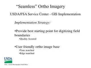
Geospatial Data Management Standardized Symbology • Time Savings • Consistent Cartographic product • Legible maps for customers
Geospatial Data Management Geodata tools allows users to manage their data through an easy to use interface reducing the time it takes to perform tasks and eliminates the chance of errors.
Geospatial Data Management Quickly Loads Data into an ArcGIS map document Saves the user from having to know where the data resides and keeps them from having to search through the geodata directory structure to load the data needed.
Geospatial Data Management Kansas ArcGIS Toolbar Remap Button
Available EQIP Geospatial Resource Data • Sensitive Ground Water Areas - KGS • Total Maximum Daily Load (TMDL) Areas - KDHE • Receiving Water Body Buffer 180 Ft. and 300 Ft. - NRCS • 1:24000 Hydrography - USGS/NRCS • Federal Reservoirs – USGS/NRCS • Hydrologic Unit Boundaries – USGS/NRCS • Flooding Frequency - NRCS Soils • Water Erosion Index - NRCS Soils • Wind Erosion Index - NRCS Soils • Leaching Potential - NRCS Soils • Species in Need of Conservation - KBS, KDWP • Declining Aquifer Priority Areas – KGS • Kansas Source Water Assessment - KDHE
EQIP Application Evaluation Worksheet • EQIP Evaluation Report
Advantagesof Automation with GIS and AV-EQIP • Statewide consistency • Significant time savings • Reduced risk of error • Small amount of training required • Imports existing fields boundaries • Standard report generated • Application boundaries in a digital format • Analysis of EQIP application boundary with resource data
Conservation Planning Tools • Creating information out of data through the use of GIS for planning purposes. • Saves time in obtaining information. • Consistent information since it comes from know data sources. • Some information is not obtainable without GIS and tools because of the cost involved to collect the information is to high, so we are now able to evaluate more information than in the past to help make resource decisions.
Partnership Advantages • Input into data development projects for the state. • Ability to leverage dollars from many different agencies to accomplish data development needs. • Better cost when developing data for large geographic areas.
Partnership Products • Land Use / Land cover Mapping Initiative • LIDAR acquisition • Color Infrared Imagery from NAIP • 10 meter DEM generation • Update National Hydrogray Dataset
What have we done to be successful • Taken as much of the data management burden away from the Field as possible and automated the rest of it. • Geospatially enabled and automated conservation program application evaluation to get the best applications funded using scientifically collected resource information. • Geospatially enabled and automated common functions performed by our Field staff in conservation planning. • Continually looking for ways to streamline the use of GIS for non GIS specialists. • Partnership with state and other federal agencies to develop the best data to meet the needs of our agency.
Key thoughts to develop a GIS strategy • Non GIS professionals are looking for information not data and data management headaches, a lot of their informational needs can be met with geospatial data. • It is our job to make information out of geospatial data though data development, standardized data structures and application development. • The question truly is what information derived from geospatial data is needed by the different disciplines in our agency to help them do their jobs more efficiently and effectively.
Key thoughts to develop a GIS strategy • State government is now in the process of building GIS strategy documents with the help of the FGDC and the National States Geographic Information Council. This will change how data gets developed. We need to be in a position to help make decisions on data standards for the data we have interest in as an agency and be willing to cost share to get our needs met.