Download
1 / 67
670 likes | 700 Views
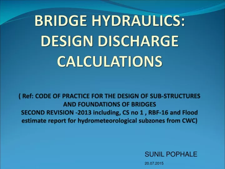
BRIDGE HYDRAULICS: DESIGN DISCHARGE CALCULATIONS ( Ref: CODE OF PRACTICE FOR THE DESIGN OF SUB-STRUCTURES AND FOUNDATIONS OF BRIDGES SECOND REVISION -2013 including, CS no 1 , RBF-16 and Flood estimate report for hydrometeorological subzones from CWC). SUNIL POPHALE 20.07.2015.

E N D
BRIDGE HYDRAULICS:DESIGN DISCHARGE CALCULATIONS( Ref: CODE OF PRACTICE FOR THE DESIGN OF SUB-STRUCTURES AND FOUNDATIONS OF BRIDGESSECOND REVISION -2013 including, CS no 1 , RBF-16 and Flood estimate report for hydrometeorological subzones from CWC) SUNIL POPHALE 20.07.2015
IR and Flood Management • Severe breaches in 1956 at many places • Railway Board appointed Khosla committee to review the methods of estimating the maximum flood discharge for the design of bridges • The issue of breaches in IR was also discussed at a conference of the Chief Ministers with the Railway Minister on 5th June, 1957
RAILWAY AFFECTINGTANKS • All tanks within 0.5 km of the Railway line, irrespective of their capacity and having FTL higher than the formation level • Tanks within 10 km of Railway line having capacities of 0.05 million cum or more • Tanks between 10 to 15 km of the Railway line having capacities of 0.15 million cum or more.
All dams/ tanks situated downstream of the Railway line with their FTL upto or beyond the Railway line irrespective of their capacities • All dams located within 50 km upstream of the Railway line, all barrages and weirs located within 15 km upstream of the Railway line and • all dams, barrages and weirs located downstream having their full reservoir level higher than the danger level of the Railway bridges
Flood/weather forecasting in consultation with IMD and other agencies like CWC, State Government, local bodies etc. Development of system of collecting data using modern techniques. Monitoring of land slides, flood danger to bridges, bridge approaches causing interruption to traffic Management of floods(RDSO’s letter of Aug 08)
What is design discharge ? • It is the discharge for which a bridge, hydrological structure and or its appurtenances are designed .
Why and how design discharge? • Adequate water way • Design of foundations and protection works - afflux - Scour depth - DL - free board and clearance - etc.
Why design discharge ? • It is required for properand economicaldesign,construction and maintenanceof • Bridge water way • Foundations • Protection works • Other parameters • Afflux • Free board & vertical clearances
Design discharge • Para 4 of substructure code –Hydrological design investigations “4.2.1 The estimation of design discharge for waterway shall preferably be based, wherever possible, on procedures evolved from actual hydro meteorological observations of the same or similar catchments.”
Design discharge • Estimation of design discharge : • Para 4.2.2 of Substructure code says 50 year return period. • Discretion rests with the PCE/CBE to change the recurrence interval depending on the importance of line
4.3 Methods of Estimation of Design Discharge • From actual data (Generally not available) • By statistical methods – not used generally on IR • By unit hydrograph (For rivers where actual data is available) • By synthetic unit hydrograph • By other methods (RBF-16)
From actual data • 4.3.1 Stream flow records (yearly peak discharges) are available for the desired recurrence interval or more - design discharge shall be the computed flood for the desired recurrence interval.
By Statistical Methods • 4.3.2 Where Stream flow records exist for less thanthe desired recurrence interval but sufficient for the statistical analysis- design discharge may be computed statistically for the desired recurrence interval.
Statistical Methods • Design flood Q with return period ‘T’ with a risk factor chosen by designer • Steps • Selection of suitable data series • Treatment of data by suitable sampling techniques • Evaluation of recurrence interval • Plotting data and curve fitting (probability distribution curves)
Statistical Models • The models are • Annual Maxima model • Peak-over threshold (POT) model. • Regional flood frequency model
4.3.3 Where records of floods are not ofsufficient length to permit reliable statisticalanalysis but where rainfall pattern and intensity records are available for sufficient length of time and where it is possible to carry out at least limited observations of rainfall and discharge, unit hydrographs based on such observations may be developed and design discharge of the desired recurrence interval computed by applying appropriate design storm.
Unit Hydrograph Method-(For Catchment Area 25 to 2500 SqKms) • Concurrent rainfall-runoff observations available are small, but long term rain fall data are available • Definition: • Unit hydrograph is defined as a hydrograph of direct surface run off resulting from unit effective excess rainfall generated uniformly over catchment area for a specified period (Unit duration) • Limitations: • It reflects combined effects of rainfall, loss rate, physiographic factors. These factors may change with time
Unit Hydrograph Method- For a given watershed • Storms of equal duration will produce runoff hydrographs with equivalent time bases regardless the intensity of rain. • Inst. discharge will be proportional to volume of surface runoff produced by storms of equal duration. • Time distribution of runoff from a given storm period is independent of precipitation from antecedent or subsequent storm periods
Typical Unit Hydrograph
Unit Hydrograph Method (cont) • Limitations • Non-areal distribution over large catchments • Not applicable for catchments >5000sq km????? • This method is not applicable for runoff from snow or ice melt • Assumes no changes in topographical & physiographical features
Estimation of design discharge by unit hydrograph • Derivation of unit hydrograph • Selection and evaluation of design storm • Assessment of design loss-rate • Assessment of effective rainfall of unit duration • Construction of unit hydrograph and addition of base flow • Work out flood hydrograph
Selection and evaluation of design storm • Duration of design storm td = 1.1 tp • Point rainfall • By statistical analysis or isopluvial maps • Point to areal rainfall • Available subzonal /regional wise • Distribution of design storm
Typical river system Q Q Q Q Q Q Q Q Q = Discharge
Shape, size and slope of the catchment A catchment that is shaped in the form of a pear, with the narrow end towards the upstream and the broader end nearer the catchment outlet (Figure 1a) shall have a hydrograph that is fast rising and has a rather concentrated high peak
Shape, size and slope of the catchment… A catchment with the same area but shaped with its narrow end towards the outlet (oblong shape) has a hydrograph that is slow rising and with a somewhat lower peak (Figure 2) for the same amount of rainfall.
Synthetic Unit Hydrograph • Concurrent rainfall-runoff observations are not available • Hydro-meteorological homogeneous regions or such zones are identified as unit • equations developed to derive synthetic unit hydrographs • Steps to calculate flood discharge are similar to unit hydrograph
r t 1 Cm RAINFALL EXCESS p t TYPICAL UNIT HYDROGRAPH W 75 W R75 3 Q p W DISCHARGE IN m /s 50 W R50 s T TIME IN HOURS
Other Methods • Simplified equations for various sub zones Q50 = CAmLnSpRqtd Used for preliminary survey/checks or temporary structure
Simplified equations for various sub zones • Q50 = CAmLnSpRqtd Used for preliminary survey/checks or temporary structure For medium size catchments i.e. 25 to 5000 sq km Q50 =K Φ (A, L, Lc,Se/ Sst, R td) K= a factor depending on catchment size (different for various sub-zones) A= Catchment area L= length of longest stream Lc=length of main stream opposite to a point on centroid Se= Equivalent stream slope (m/Km) Sst = Statistical stream slope (m/Km) R td = Pt. rainfall of 50 years return period and td duration
Hydro meteorological zones Use of flood estimation reports : The country has been divided into 7 hydro meteorological zones and 26 subzones .Flood estimation reports have been published. (a joint work of CWC, RDSO, IMD, and MOST)
Flood estimation for small catchments : area < 25 sq km – RDSO report RBF-16
Very Small Catchment This term has not been defined specifically but has bearing on one or more of the following aspects Size of bridge opening Size of drainage area Predominance of overland flow Quick response time Greater influence of rainfall characteristics Drainage basin having steeper slope with little or no storage CATCHMENT WITH AREA < 25 Sq.KM
Catchment characteristics Almost uniform distribution of rainfall for time equal to tc (time of concentration) Flood stages rises quickly and attains a peak in short time Nature of soil, slope and vegetation are such that they do not delay the runoff tc is very small therefore we need UH of very small unit duration. Such data of small intervals are generally not available.
Modified rational formula RBF-16 suggests to use modified rational formula which incorporate s recurrence interval concept over the normal rational formula C= runoff coefficient I50 : 50 year rainfall intensity mm/hr = R50(tc)/tc A : catchment area in sq KM
Runoff coefficient • Depends upon nature of soil, soil cover and location of catchment : R = 50 year 24 hrs point rainfall (cm) from figure given in the report for the country F : Areal reduction factor X : 0.249 to 0.498 depends on soil type and location
Runoff coefficient…… In absence of no description of catchment is available then Where : 50 year tc hour point rainfall and tc is given by For normal situations H : Elevation of farthest point above the elevation of the bridge For steep slopes in upper reaches and flat slope in lower reaches, here Sl is average slope from source to site in %
Computation of I50 Computation of I Computation of tc (Bhatnagar’s Formula) tc = (L3/H)0.345 ; L=Length of the longest sream in km, : H= difference in height between farthest point and location of proposed br Obtain 50 year 1 hour rainfall value using rainfall map of the sub-zone. If the 50 year 1 hour rainfall maps are not available for the sub zone then use 50 year 24 hour rainfall data for the sub zone and compute 50 year I hr rainfall data using ratios for conversion If both these are not available then use all India Map for 24 hour 50 year rainfall and multiply by 0.37
Computation of I50 Computation of I50 iii. Computation of R50tc Use Figure 4 to find out ratio for tc and for I hr and find K K = (tc ratio/I hr ratio) R50tc = K x R50(1) (iv) Find Rainfall Intensity I I50 = R50tc/tc
Catchment Parameters AREA OF CATCHMENT -A 5 LENGTH OF LONGEST STREAM : L CG OF THE CATCHMENT LENGTH OF STREAM FROM NEAREST TO CG TO THE BRIDGE SITE – Lc 4 EQ. OR STASTICAL STREAM SLOPE 3 L Lc 2 1