Download
1 / 19
190 likes | 194 Views
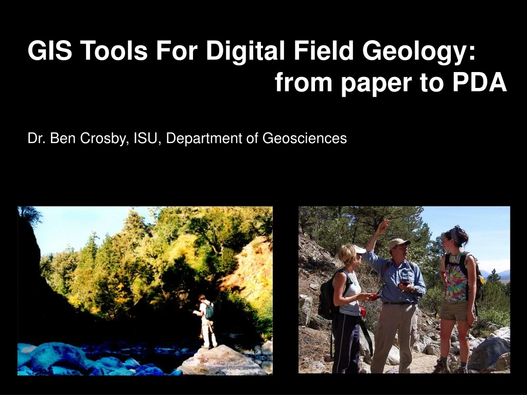
GIS Tools For Digital Field Geology: from paper to PDA Dr. Ben Crosby, ISU, Department of Geosciences. Traditional Geologic Mapping. Traditional Analog Tools Are: Durable Light weight Easy and fast to learn/teach No batteries (easier field logistics)

E N D
GIS Tools For Digital Field Geology: from paper to PDA Dr. Ben Crosby, ISU, Department of Geosciences
Traditional Geologic Mapping • Traditional Analog Tools Are: • Durable • Light weight • Easy and fast to learn/teach • No batteries (easier field logistics) • Inexpensive (to obtain or replace)
Digital Geologic Mapping: • given the benefits of traditional methods, why go digital? • Increasing demand for • space exploration tools (read: funding) • Technology is ready to be • applied, active development • Visualization of multiple layers of data • in the field = better mapping: • Multi-band satellite imagery • High resolution aerial photos • Climate or vegetation data • Geophysical data • Gravity or magnetometer • Seismic data • Previous geologic maps • Demand from employers/industry
Digital Geologic Mapping: • given the benefits of traditional methods, why go digital? • Integrate data in single source (sensors) • (photos, laser rangefinder, chemical) • Rapid transition from data collection • to map production (past hurdle) • (no data entry or digitizing) • Accurate location using GPS • Real-time visualization of collected data
Who’s on the bandwagon? Idaho State University! Bowling Green State University University of California at Berkeley Massachusetts Institute of Technology Texas A&M Arizona State University University of Kansas University of Wisconsin, Eau Claire and MANY, MANY others • Some words of caution: • mixing students with immature/buggy technology detracts from learning geology • equipment is expensive, heavy and easily broken • compared to paper, screens are small and often difficult to read in sunlight • batteries run out, computers crash and data is lost • BUT, there is huge potential for the future (this is the future)
So what’s the potential? • Full integration of all (modern and traditional) tools for collecting geologic field data • digital compass • digital camera • sensors for chemical composition • distance measurement devices • hardward gets better every month (smaller, lighter, more durable and readable) • wireless communication with base camp and other geologists • (base station and rover concept: observe other maps evolve)
What are the tools available? • Right now, not a lot • Straight-up ArcPad • Custom scripts running within ArcPad • Custom Scripts running within ArcGIS • Independent software
An Example: Mapsmith (MIT) An ArcPad extension with a suite of editing and text tools that integrate with GPS for the collection of point data. (Essentially a Digital Field book with some coarse mapping tools)
Digital Field Surveying Tools for Geomorphology • Wireless GPS Receiver • GIS-Enabled Handheld Computer • Compass-Equipped Laser Rangefinder • = collect and visualize 3D data in real-time!
Ash Deposits Terrace Gravels Bedrock Channel and Valley Width Channel Depth Terrace Heights, Fill thicknesses Sediment Size, Character, Lithology Bedrock Orientation, etc…
Perihohonu fan. Yellow dots are stations from laser surveys of channel profiles from 2005. 17 km of the mainstem and ~18 km of tributaries (n = 13) were surveyed in the Waihuka
(m) Perihohonu fan. Knickpoint Ash Deposits Terrace Gravels Bedrock (m)
Everyone else is doing it, so why can’t we? There are a number of shortfalls/difficulties/technical reasons why What resources are there? http://geopad.org/ http://serc.carleton.edu/research_education/geopad/index.html