Download
1 / 8
110 likes | 271 Views
GIS in Geology. Milo š Marjanovi ć. Lesson 7. GIS in Geophysical Exploration. Geophysical deterministic modeling with GIS implementation for 2D map models. Case study of Juan de Fuca oceanic ridge. Accent on coupling GIS with external packages for modeling/simulation of complex systems.

E N D
GIS in Geology Miloš Marjanović Lesson 7
GIS in Geophysical Exploration • Geophysical deterministic modeling with GIS implementation for 2D map models. Case study of Juan de Fuca oceanic ridge. • Accent on coupling GIS with external packages for modeling/simulation of complex systems
GIS in Geophysical Exploration Database Management Systems (DBMS) Image Processing (IP) Computer Aided Drawing (CAD) Desktop mapping Geographic Information System (GIS) Artificial Intelligence(AI) Desktop and Web publishing Geostatistics Spread- sheets Contouring and surface modeling General statistics
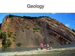
GIS in Geophysical Exploration • Geophysical deterministic modeling with GIS implementation for 2D map models. Case study of Juan de Fuca oceanic ridge. • Plate tectonics • Earth’s structure • Plates and plate’s boundaries • Mid-oceanic ridges • Geophysical methods
GIS in Geophysical Exploration • Geophysical deterministic modeling with GIS implementation for 2D map models. Case study of Juan de Fuca oceanic ridge. • Detailed study on topography of Juan de Fuca ridge • Case study • Modeling process and GIS implementation • Bathymetry • Gravimetric methods (density distribution): • Instruments (platform-born) • Corrections • Bouguer anomalies (Air-free, Mantle, Residual Mantle) • Multichannel seismic methods (boundaries of layers) • Relation of two methods • Importance of data accuracy and the role of GIS
GIS in Geophysical Exploration • Geophysical deterministic modeling with GIS implementation for 2D map models. Case study of Juan de Fuca oceanic ridge. • Results:
GIS in Geophysical Exploration • Geophysical deterministic modeling with GIS implementation for 2D map models. Case study of Juan de Fuca oceanic ridge. • To wrap-up: Models showed the thicker crust due to the enhanced melt supply (probably due to presence of nearby hotspots), yet the southern orientated trend of shallow magma chambers (per each segment, and the ridge as a whole), which means warmer magma regime toward the south is to be explained. One opinion is the northward migration of the entire ridge or accumulation of subaxial flow at the traverse with Blanco fracture zone (southernmost transversal fault line).
GIS in Geophysical Exploration • www.geomapapp.org