Download
1 / 14
140 likes | 147 Views
UPDATE. DEVELOPMENT OF A REMOTE-SENSING TESTBED FOR TROPOSPHERIC AIR QUALITY AND WINDS. University of Alabama in Huntsville Mike Newchurch, Sundar Christopher, David Bowdle, Kevin Knupp, John Mecikalski , Walt Petersen, Mike Botts, Dick McNider, Rochelle Williams

E N D
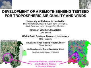
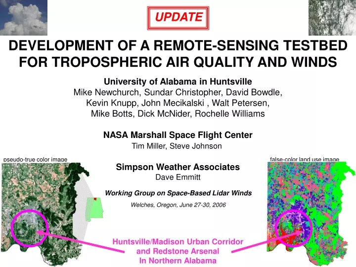
UPDATE DEVELOPMENT OF A REMOTE-SENSING TESTBED FOR TROPOSPHERIC AIR QUALITY AND WINDS University of Alabama in Huntsville Mike Newchurch, Sundar Christopher, David Bowdle, Kevin Knupp, John Mecikalski , Walt Petersen, Mike Botts, Dick McNider, Rochelle Williams NASA Marshall Space Flight Center Tim Miller, Steve Johnson Simpson Weather Associates Dave Emmitt pseudo-true color image false-color land use image Working Group on Space-Based Lidar Winds Welches, Oregon, June 27-30, 2006 Huntsville/Madison Urban Corridor and Redstone Arsenal In Northern Alabama
Presentation Outline • hosting Army Workshop • installing Doppler lidar scanner • integrating lidar winds with radar winds • initiating NOAA Air Quality research • integrating Huntsville assets
Workshop on a Soldier-Scale Atmospheric Testbed (SSATB) March 29-31, 2006, Huntsville, Alabama Sponsored by the Army Research Office (ARO, Walter Bach) Coordinated by the Aviation and Missile Research, Development, and Engineering Center (AMRDEC, Henry Everitt) Hosted by the University of Alabama in Huntsville (UAH, Mike Newchurch) • ATTENDANCE • 30 attendees, civilian (UAH, NASA/MSFC) and military (Army, Air Force) • ISSUES • improved characterization of the atmospheric boundary layer • comparison of model results to observations • high spatial and temporal resolution • data collection requirements • FOLLOWUP • pending review
Installation of Doppler Lidar Scanner transceiver status –operating scanner mount design – completed scanner mount assembly – completed scanner mirror recoating – in progress scanner installation – summer 2006 scanner georegistration – summer 2006 lidar characterization – fall 2006 2 µm Doppler lidar transceiver provided by Earth Science Office (ESO) NASA Marshall Space Flight Center (MSFC) DFM alt/azimuth scanner provided by Simpson Weather Associates mount location retractable grating cable conduit Doppler lidar chimney – interior view Doppler lidar chimney – exterior view
Installation of Doppler Lidar Scanner National Space Science and Technology Center: View from West Penthouse Rooftop Platform 1 Doppler lidar chimney Main Rooftop Platform 2 Platform 3: NE Rooftop RAPCD / AmOR Laboratories 4th Floor Under Penthouse Lightning Tower NW Rooftop
Integrating Lidar Winds with Radar Winds DWL = Doppler Wind Lidar ARMOR = Advanced Radar for Meteorological and Operational Research (dual polarization) MAX = Mobile Alabama X-Band Radar (dual polarization)
Integrating Lidar Winds with Radar Winds • emphasize clear-air wind analyses in the atmospheric boundary layer (ABL) • dual polarization radars minimize contamination from birds and insects • dual Doppler radar coverage centered over Doppler lidar domain • in-house tests show Advanced Regional Prediction System (ARPS) Data Analysis System (ADAS) superior to Local Analysis and Prediction System LAPS) • high-resolution nested mesoscale models generate gridded wind fields • minimizes need for 4-D variational assimilation of Doppler lidar data • routine wind fields for studying ABL structures and processes
NOAA Air Quality Research Initiative Regional Atmospheric Profiling RAPCD Center for Discovery Objective : To study and predict the impact of air pollution on climate, health and other environmental applications Objective : Develop improved transferable air quality models for the Huntsville-Madison-Decatur transportation corridor. ozone sondes ozone lidar ozone aerosols Enhanced RAPCD Instruments Improved Satellite Retrievals Doppler lidar aerosol lidar HCHO NO2 Air quality models gases initialize assess aerosols High-Res Satellite Observations Intelligent Sensor Web surface clouds improve Anticipated Start: Summer 2006
Integration of Related Components, Sources, Sponsors, and Collaborators UAH UAH UAH UAH ARMY/RSA Soldier-Scale Atmospheric Test Bed PBL Air Chemistry Weather Radar ASSIMILATION NOAA NOAA/NASA QUANTIFY UNCERTAINTY Air Quality Forecasting Test Bed Hazardous Weather Test Bed MODELING NASA/MSFC OGC Sensor-Web Enablement (SWE) PBL Dynamics Sensor-Web Atmospheric Test Bed coordinated multi-agency research and development, with rapid-prototyping user-responsive transition to transferable operations
Integration of Research Activities and Huntsville Distinctives UAH UAH UAH UAH ARMY/RSA Soldier-Scale Atmospheric Test Bed PBL Air Chemistry Weather Radar diverse weather diverse airmasses multiple parameters routine operation other agencies multiple applications stationary sensors complementary sensors ASSIMILATION NOAA NOAA/NASA QUANTIFY UNCERTAINTY Air Quality Forecasting Test Bed Hazardous Weather Test Bed MODELING nested observations nested models satellite data analysis surface energetics guest investigators intensive ops periods complex terrain diverse land usage NASA/MSFC OGC Sensor-Web Enablement (SWE) PBL Dynamics Sensor-Web Atmospheric Test Bed coordinated multi-agency research and development, with rapid-prototyping user-responsive transition to transferable operations
Integration of Multi-Institutional Multi-Disciplinary Research Staff UAH UAH UAH UAH ARMY/RSA PBL Air Chemistry Mike Newchurch David Bowdle Kirk Fuller Steve Johnson (MSFC) Soldier-Scale Atmospheric Test Bed Henry Everitt (AMRDEC) Dan Schmitt (RTTC) Walter Bach (ARO) Weather Radar Walter Petersen Kevin Knupp diverse weather diverse airmasses multiple parameters routine operation other agencies multiple applications John Case (ENSCO) stationary sensors complementary sensors ASSIMILATION NOAA NOAA/NASA John Mecikalski Air Quality Forecasting Test Bed Mike Newchurch (UAH) Sundar Christopher (UAH) Chris Darden (NWS), Dale Quattrochi (MSFC) Arastoo Biazar, Noor Gillani (UAH) Quingyuan Han (UAH) QUANTIFY UNCERTAINTY Hazardous Weather Test Bed Bill Lapenta, Gary Jedlovec (MSFC) Rich Blakeslee, Dan Cecil (MSFC) Kevin Knupp, Walter Petersen (UAH) Chris Darden (NWS) Udaysankar Nair MODELING Dick McNider Bill Lapenta nested observations nested models satellite data analysis surface energetics Kevin Doty guest investigators intensive ops periods complex terrain diverse land usage NASA/MSFC Sensor-Web Atmospheric Test Bed Bill Lapenta, Gary Jedlovec (MSFC) Robbie Hood, Rich Blakeslee (MSFC) Tom Sever, Dan Irwin (MSFC) Mike Botts (UAH) OGC Sensor-Web Enablement (SWE) Mike Botts PBL Dynamics Dick McNider Kevin Knupp coordinated multi-agency research and development, with rapid-prototyping user-responsive transition to transferable operations
Integration of Existing/Planned Assets (Most Installed in or Near Huntsville) UAH UAH UAH UAH ARMY/RSA PBL Air Chemistry ozone sondes ozone lidar aerosol lidar Doppler wind lidar spectroscopy lab chemistry trailer Soldier-Scale Atmospheric Test Bed Weather Radar dual polarization Doppler radars C-band, X-band W-band 100-meter mega-tower, surface network, Doppler lidar, Doppler radar, radiosondes, instrumented UAV’s, tracer releases, AutoNowcaster, incident simulations, laser test facility, scintillometers, ceilometer, microsats diverse weather diverse airmasses multiple parameters routine operation other agencies multiple applications stationary sensors complementary sensors ASSIMILATION NOAA NOAA/NSAA Air Quality Forecasting Test Bed Hazardous Weather Test Bed QUANTIFY UNCERTAINTY HSV NWS Forecast Office operational satellite sensors geostationary satellite risk reduction AERONET multispectral sunphotometer MPL-NET Micropulse Lidar HSV NWS Forecast Office Short-Term Prediction Research/Transition Center NEXRAD Doppler radar network satellite-based sensors significant weather events MODELING nested observations nested models satellite data analysis surface energetics guest investigators intensive ops periods complex terrain diverse land usage NASA/MSFC PBL Dynamics ceilometer, tethersonde Doppler sodars 915 MHz profiler µ-wave radiometer surface energy flux mobile platforms Sensor-Web Atmospheric Test Bed OGC Sensor-Web Enablement (SWE) SensorML development SWE architecture Short-Term Prediction Research/Transition Center Regional Visualization & Monitoring System research satellite sensors, microsats, Lightning Mapping Array instrumented UAV’s coordinated multi-agency research and development, with rapid-prototyping user-responsive transition to transferable operations
Focus of Integrated Research Activities UAH UAH QUANTIFY UNCERTAINTY with user acceptance UAH UAH ARMY/RSA Soldier-Scale Atmospheric Test Bed PBL Air Chemistry ozone sondes ozone lidar aerosol lidar Doppler wind lidar spectroscopy lab Weather Radar dual polarization Doppler radar C-band, X-band W-band 100-meter mega-tower, surface network, Doppler lidar, Doppler radar, radiosondes, instrumented UAV’s, tracer releases, AutoNowcaster, incident simulations, laser test facility, scintillometers, microsats diverse weather diverse airmasses multiple parameters routine operation other agencies multiple applications ASSIMILATION stationary sensors complementary sensors improved PBL diagnostics theory, knowledge base NOAA NOAA/NSAA GSI, ADAS (VDRAS? VLAS?) Air Quality Forecasting Test Bed Hazardous Weather Test Bed HSV NWS Forecast Office operational satellite sensors geostationary satellite risk reduction AERONET multispectral sunphotometer MPL-NET Micropulse Lidar HSV NWS Forecast Office Short-Term Prediction Research/Transition Center NEXRAD Doppler radar network satellite-based sensors significant weather events MM5WRFRAMS, CMAQ; LES decision support tools improved PBL forecasts nested observations nested models satellite data analysis surface energetics MODELING guest investigators intensive ops periods complex terrain diverse land usage NASA/MSFC PBL Dynamics ceilometer, tethersondes Doppler sodars 915 MHz profiler µ-wave radiometer surface energy flux mobile platforms Sensor-Web Atmospheric Test Bed OGC Sensor-Web Enablement (SWE) SensorML development SWE architecture Short-Term Prediction Research/Transition Center Regional Visualization & Monitoring System research satellite sensors, microsats, Lightning Mapping Array instrumented UAV’s coordinated multi-agency research and development, with rapid-prototyping user-responsive transition to transferable operations
Conclusions • developing university-coordinated multi-agency partnership • exploit existing, pending, proposed, and planned assets • attract other agencies and local Army/NASA support contractors • create national asset for boundary layer research and operations • meet emerging weather needs for testing, training, and operations • transfer knowledge and user-validated decision-making tools to other areas