Download
1 / 31
320 likes | 505 Views
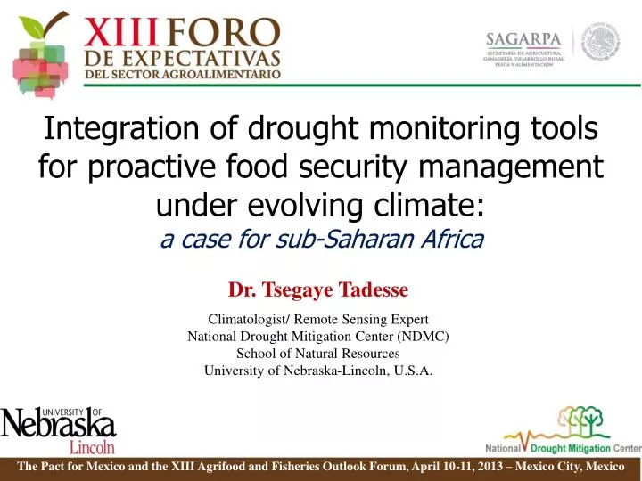
Integration of drought monitoring tools for proactive food security management under evolving climate: a case for sub-Saharan Africa. Dr. Tsegaye Tadesse Climatologist/ Remote Sensing Expert National Drought Mitigation Center (NDMC) School of Natural Resources

E N D
Integration of drought monitoring tools for proactive food security management under evolving climate: a case for sub-Saharan Africa Dr. Tsegaye Tadesse Climatologist/ Remote Sensing Expert National Drought Mitigation Center (NDMC) School of Natural Resources University of Nebraska-Lincoln, U.S.A. The Pact for Mexico and the XIII Agrifoodand Fisheries Outlook Forum, April 10-11, 2013 – Mexico City, Mexico
Presentation Outline • Overview of Drought and its impact • Drought indicators • Types of drought and indicators/indices • Crisis vs. Risk management • Drought Early Warning systems/Indicators • Climate-based indicators • Satellite-based indicators • Hybrid indicators • Global Drought Monitoring: Monitoring products • Famine Early Warning Systems Network (FEWS NET) • Global Climate change impacts • Africa (Highlight of the IPCC Report) • Final Thoughts
Introduction Drought and its impact - affects lives causing considerable damages Agriculture Water Supply Energy Forestry Society
Introduction Drought impacts take different forms in each country, and region because of differences in economy, culture, and government/institutions. Overall impact could be : - economic losses &/or - famine & loss of lives Need to address drought impacts on food security and mitigation/adaptation strategies.
Overview of Drought Drought: A deficiency of precipitation (intensity) from expected or “normal” that extends over a season or longer period of time (duration) … Meteorological Drought and is sufficient to meet the demands of human activities and the environment (impacts). Agricultural Drought Hydrological Drought Socio-economic Drought Users
Drought Types • Meteorological drought (defined on the basis of degree of dryness) • Simply expressed in terms of a rainfall deficit in relation to some average amount and duration of drought period. • Definitions must be considered as region specific (some definitions identify as number of days with precipitation less than some threshold value) • Longer term rainfall time series data should be available • Hydrological drought: Effects of periods of rain shortfall on surface and subsurface water supply • They lag behind meteorological and agrometeorological droughts • Groundwater drought is outlined by lower than average annual recharge for more than one year • Socioeconomic drought: associate the supply and demand of some economic good with elements of meteorological, hydrological, and agricultural drought. • occurs when the demand for an economic good exceeds supply as a result of a weather-related shortfall in water supply.
Agricultural drought: • Links various categories of meteorological and hydrological drought to agricultural impacts, focusing primarily on soil water deficits and differences between actual and potential evapotranspiration • Should consider situations with insufficient soil moisture level to meet the plant needs during growing season • Should be able to account for the variable susceptibility of crops during different stages of crop development, from emergence to maturity • Can be caused by an abrupt and marked increase in air temperature while soil temperature remains low • Affected by temporal variability of water availability (precipitation distribution during growing season)
Natural and Social Dimensions of Drought Decreasing emphasis on the natural event (precipitation deficit) Increasing emphasis on the water/natural resources management Increasing complexity of impacts and conflicts Hydrological Agricultural Meteorological Socio-economic Source: D. Wilhite Time/Duration of the event
Crisis vs Risk Management Source: D. Wilhite
Early Warning Systems • Data and information on climate and water supply, including seasonal forecasts, must be integrated to provide decision makers with a comprehensive picture or representation of current conditions and future outlooks. • Integration of meteorological, hydrological, and agricultural services. • Potential users of climate information must be educated on how that information can be applied to reduce the risks associated with drought. • Improved delivery systems (e.g. web delivery) must be developed to get information in the hands of decision makers in a timely manner. • This requires a better understanding of user needs and their preferences on how this information is displayed or presented.
Key Indicators For Monitoring Drought • climate data (precipitation, temperature) • soil moisture • stream flow • ground water • reservoir and lake levels • snow pack • short, medium, and long range forecasts • vegetation health/stress and fire danger Source: D. Wilhite
Climate-based Drought Indices • Percent of Normal • Standardized Precipitation Index • Palmer Drought Severity Index • Crop Moisture Index • Surface Water Supply Index • Reclamation Drought Index • Deciles Source: http://drought.unl.edu/Planning/Monitoring/ComparisonofIndicesIntro.aspx
Remote Sensing for Environmental Monitoring Satellite-based remote sensing has been widely used over the past ~ 30 years for national to global-scale many environmental monitoring activities, including drought monitoring.
Advantages of Remote Sensing for Drought Monitoring • Spatial continuous measurements across large geographic areas. - Important in locations where weather stations or other ground observations (human) are sparse or non-existent. • Frequent revisit time for image acquisition - Several satellites acquire image data every 1-2 days or a 1-2 week basis for same location. 3. Historical record of conditions - Several instruments (AVHRR and Landsat) provide 30+ years of information with some newer sensors (MODIS) approaching 10+ years of observations. - In Africa, other satellite data sources e.g., METEOSAT and SPOT Satellite image of relative vegetation greenness for Ethiopia
Remote Sensing of Drought Monitoring • Rainfall Estimate (RFE) • Uses a combination of satellite-based observations • (cloud temperature and cold cloud duration) and • ground-based rain gauge information. • RFEs updated at multiple time intervals • daily - dekad • weekly - monthly • Satellites: • Meteosat (used since 1995) • Special Sensor Microwave/Imager (SSMI)** • Advanced Microwave Sounding Unit (AMSU)** • **Implemented in 2000.
Satellite Remote Sensing of Drought The Traditional Approach Normalized Difference Vegetation Index (NDVI) Geographic patterns of seasonal vegetation greenness for the U.S. as observed from a time-series NOAA AVHRR NDVI data. (Animation produced by NOAA /NESDIS). NDVI as operational tool: The visible red and NIR bands were readily available on ‘global imagers’ such as the Advanced Very High Resolution Radiometer (AVHRR) since the 1980s, which has provide near-daily global observations of the Earth’s land surface for operational activities such as drought monitoring Historical Records: data from satellite have been used for ~30 years for a wide range of large-area environmental applications including drought monitoring and early warning
Drought Monitoring Efforts Using NDVI Many drought monitoring efforts are using long-term, time-series NDVI data sets that include: - U.S. Drought Monitor (USDM) - North American Drought Monitor (NADM) - USDA National Agricultural Statistics Service (NASS) - Famine Early Warning System (FEWS) - USDA Foreign Agricultural Service Global Crop Monitoring - Australian Bureau of Meteorology Drought Monitoring Most efforts rely on NDVI anomaly measures that compares the current vegetation conditions (as expressed by NDVI) to historical conditions. - Percent of historical average - Departure from a prior date (month or year)
NDVI and Vegetation Monitoring • Challenges for Drought Monitoring: • 1) Discrimination of drought-impacted • areas from locations experiencing • other types of stress (pests, plant • disease, flooding, and fire) or • land use/land cover change. • 2) Classification of different drought severity • levels (e.g., moderate, severe, and extreme). Drought, fire, or pests? Severe? Moderate? Extreme?
Climate Data* Satellite Data* Biophysical Data Historical Database + + Vegetation Drought Response Index (VegDRI) • Land Use/Land Cover Type • Irrigation • Soil Available Water Capacity • Elevation • Ecoregion • PASG • SOSA • Out of Season • 36-week SPI • self-calibrated PDSI * 20-year historical record of observations (1989 – 2008) Step 3 Gridded image generation of near real-time data inputs Step 1 Step 2 Step 4 Training Data Historical database development of satellite, climate, and biophysical data extracted for 2,000+ weather station locations. Regression tree analysis to develop bi-weekly VegDRI models (rules) Application of bi-weekly model to near real-time gridded inputs for VegDRI map generation Operational VegDRIMap Production
Hybrid (Climate- and satellite-based) Drought Monitoring • International Interest on hybrid drought monitoring models • Canada – seamless U.S.-Canada coverage for North American Drought Monitor • Mexico • Czech Republic • India – Indian Agricultural research Center • China • Ethiopia and Great Horn of Africa
Current and Future satellite-based Monitoring • New Remote Sensing Data • - will be considered as inputs for transitioning and/or maintaining data continuity as well as improving the models and products • The Visible Infrared Imager/Radiometer Suite (VIIRS) • Landsat Data Continuity Mission (LDCM): • the operational land imager (OLI) and the thermal infrared sensor (TIRS) • The Global Precipitation Measurement Mission (GPM) • Soil Moisture Active-Passive Mission (SMAP) Source: NASA website
Global Monitoring Global products (examples): NASA TRMM Near-real time global rainfall NASA TRMM 30-day avg. rainfall and anomalies Daily NOAA GFS 1-day forecast Daily NOAA GFS 7-day total forecast Daily Potential Evapotranspiration (PET) Daily Northern Hemisphere Snow Depth http://trmm.gsfc.nasa.gov/ http://earlywarning.usgs.gov/fews/global/index.php
USAID/FEWS NET: Global Monitoring of food security Estimated food security conditions, 2nd Quarter 2013 (April-June 2013) East Africa: Ethiopia Central America: Guatemala Source: http://www.fews.net/Pages/default.aspx
Impact of Global Climate Change: Many countries will experience major changes in water resources and Agricultural production Increase in temperatures result in: Higher water demand of vegetation – less Ground Water recharge Higher evaporation from surface waters, including reservoirs Figure 10.8. Multi-model mean of annual mean surface warming (surface air temperature change, °C) for the scenarios B1 (top), A1B (middle) and A2 (bottom), and three time periods, 2011 to 2030 (left), 2046 to 2065 (middle) and 2080 to 2099 (right). Stippling is omitted for clarity (see text). Anomalies are relative to the average of the period 1980 to 1999. Source: IPCC 2007 Higher water demand of all economic sectors, esp. agriculture
Impacts of Global Climate Change Storms Floods Droughts Increased frequency of extreme weather events
By 2020, between 75 and 250 million of people are projected to be exposed to increased water stress due to climate change. {WGII 9.4, SPM} By 2020, in some countries, yields from rain-fed agriculture could be reduced by up to 50%. Agricultural production, including access to food, in many African countries is projected to be severely compromised. This would further adversely affect food security and exacerbate malnutrition. {WGII 9.4, SPM} Towards the end of the 21st century, projected sea level rise will affect low-lying coastal areas with large populations. The cost of adaptation could amount to at least 5 to 10% of GDP. {WGII 9.4, SPM} By 2080, an increase of 5 to 8% of arid and semi-arid land in Africa is projected under a range of climate scenarios (high confidence). {WGII Box TS.6, 9.4.4} Africa – Climate Change & its impact What experts indicated:
Final Thoughts • The integration of existing drought monitoring tools for all regions of the world is essential for improving food security systems to reduce the impacts of drought and famine on society in this region. • The field of remote sensing offers many new opportunities to support research not only in the area of drought, but also other natural disasters to address issues related to agriculture, climate, ecology, natural resources, and water. • A hybrid (climate- & satellite-based) monitoring ‘tool kit’ is rapidly emerging to characterize key components of the hydrologic cycle related to drought. • Drought monitoring and prediction models should consider the ever increasing climate change to provide reliable information for decision makers to support adaptation strategies.
Thank you for your attention! For additional information, please contact: Dr. Tsegaye Tadesse National Drought Mitigation Center School of Natural Resources University of Nebraska-Lincoln ttadesse2@unl.edu