Download
1 / 14
140 likes | 244 Views
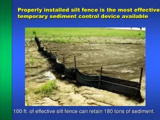
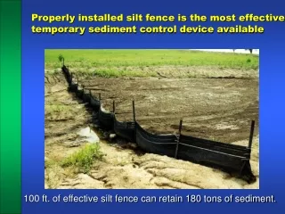
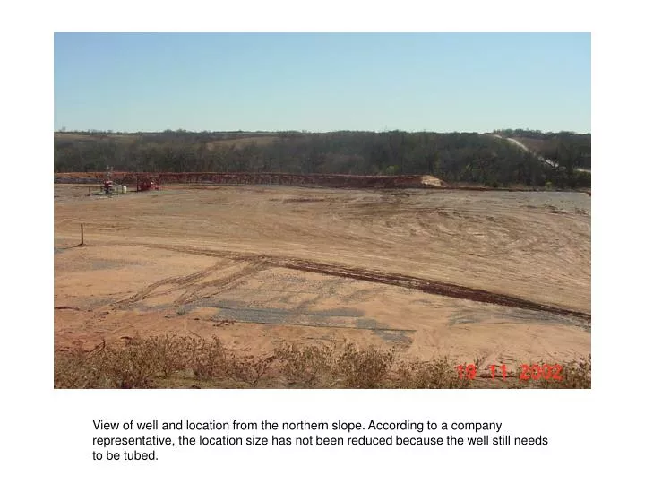
View of well and location from the northern slope. According to a company representative, the location size has not been reduced because the well still needs to be tubed. Silt fence barrier preventing some of the sediment transport off-site. Location where silt fence needs to be repaired.

E N D
View of well and location from the northern slope. According to a company representative, the location size has not been reduced because the well still needs to be tubed.
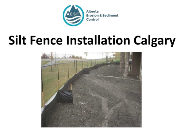
Silt fence barrier preventing some of the sediment transport off-site.
Previous location of mud pit was on this sideslope.. Mud pit location
Tree pile and creek flow path towards catchment basin on west side of location. Catchment basin Creek flow path
Picture 7. Taken southwest. Lease road near bridge. Grading done. Water is cloudy from soil runoff. No cover on slopes along road.
Picture 2. Taken north. Northeast corner of pad. Erosion rills in drainage trench with hay bales as velocity dissipater. Trench continues down hill to the north.
Hill cut. The backside of this hill has also been removed, leaving a a small strip of trees on top. Photo taken south.
Photo taken north. Erosion on north slope of pad into a nearby creek.
Photo taken north. This is a lease road running on the west side of the well pad. The north and south drainage creeks run into the north flowing creek. Again, note how the creek is attempting to run over the road. Note also how the pad encroaches on the creek.
Western edge of the mud pit constructed for the location. Silt fence surrounding perimeter.
Western slope of the location. This is the resulting cut bank for the hillside removed to generate fill material.
Lease road view east. This slope needs some stabilization to reduce the risk of erosion into the stream channel. I recommended that they grade this slope, or stabilize with rip-rap and seed.