Download
1 / 49
520 likes | 976 Views
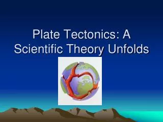
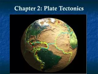
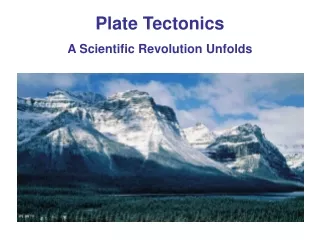
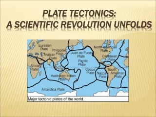
Chapter 2 Plate Tectonics: A Scientific Revolution Unfolds. Continental drift: An idea before its time. Alfred Wegener First proposed his continental drift hypothesis in 1915 Published The Origin of Continents and Oceans Continental drift hypothesis

E N D
Continental drift: An idea before its time • Alfred Wegener • First proposed his continental drift hypothesis in 1915 • Published The Origin of Continents and Oceans • Continental drift hypothesis • Supercontinent called Pangaea began breaking apart about 200 million years ago
Pangaea approximately 200 million years ago Figure 2.2
Continental drift: An idea before its time • Continental drift hypothesis • Continents "drifted" to present positions • Evidence used in support of continental drift hypothesis • Fit of the continents • Fossil evidence • Rock type and structural similarities • Paleoclimatic evidence
Matching mountain ranges Figure 2.6
Paleoclimatic evidence Figure 2.7
The great debate • Objections to the continental drift hypothesis • Lack of a mechanism for moving continents • Wegener incorrectly suggested that continents broke through the ocean crust, much like ice breakers cut through ice • Strong opposition to the hypothesis from all areas of the scientific community
The great debate • Continental drift and the scientific method • Wegener’s hypothesis was correct in principle, but contained incorrect details • A few scientists considered Wegener’s ideas plausible and continued the search
Continental drift and paleomagnetism • Renewed interest in continental drift initially came from rock magnetism • Magnetized minerals in rocks • Show the direction to Earth’s magnetic poles • Provide a means of determining their latitude of origin
Continental drift and paleomagnetism • Polar wandering • The apparent movement of the magnetic poles illustrated in magnetized rocks indicates that the continents have moved • Indicates Europe was much closer to the equator when coal-producing swamps existed
Continental drift and paleomagnetism • Polar wandering • Curves for North America and Europe have similar paths but are separated by about 24 of longitude • Differences between the paths can be reconciled if the continents are placed next to one another
Polar-wandering paths for Eurasia and North America Figure 2.11
A scientific revolution begins • During the 1950s and 1960s technological strides permitted extensive mapping of the ocean floor • Seafloor spreading hypothesiswas proposed by Harry Hess in the early 1960s
A scientific revolution begins • Geomagnetic reversals • Earth's magnetic field periodically reverses polarity – the north magnetic pole becomes the south magnetic pole, and vice versa • Dates when the polarity of Earth’s magnetism changed were determined from lava flows
A scientific revolution begins • Geomagnetic reversals • Geomagnetic reversals are recorded in the ocean crust • In 1963 Vine and Matthews tied the discovery of magnetic stripes in the ocean crust near ridges to Hess’s concept of seafloor spreading
Paleomagnetic reversals recorded in oceanic crust Figure 2.16
A scientific revolution begins • Geomagnetic reversal • Paleomagnetism was the most convincing evidence set forth to support the concepts of continental drift and seafloor spreading
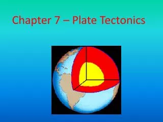
Plate tectonics: The new paradigm • Earth’s major plates • Associated with Earth's strong, rigid outer layer • Known as the lithosphere • Consists of uppermost mantle and overlying crust • Overlies a weaker region in the mantle called the asthenosphere
Plate tectonics: The new paradigm • Earth’s major plates • Seven major lithospheric plates • Plates are in motion and continually changing in shape and size • Largest plate is the Pacific plate • Several plates include an entire continent plus a large area of seafloor
Earth’s plates Figure 2.19 (left side)
Earth’s plates Figure 2.19 (right side)
Plate tectonics: The new paradigm • Earth’s major plates • Plates move relative to each other at a very slow but continuous rate • About 5 centimeters (2 inches) per year • Cooler, denser slabs of oceanic lithosphere descend into the mantle
Plate tectonics: The new paradigm • Plate boundaries • Interactions among individual plates occur along their boundaries • Types of plate boundaries • Divergent plate boundaries (constructive margins) • Convergent plate boundaries (destructive margins) • Transform fault boundaries (conservative margins)
Plate tectonics: The new paradigm • Plate boundaries • Each plate is bounded by a combination of the three types of boundaries • New plate boundaries can be created in response to changing forces
Divergent plate boundaries • Most are located along the crests of oceanic ridges • Oceanic ridges and seafloor spreading • Along well-developed divergent plate boundaries, the seafloor is elevated forming oceanic ridges
Divergent plate boundaries • Oceanic ridges and seafloor spreading • Seafloor spreading occurs along the oceanic ridge system • Spreading rates and ridge topography • Ridge systems exhibit topographic differences • These differences are controlled by spreading rates
Divergent plate boundary Figure 2.20
Divergent plate boundaries • Continental rifting • Splits landmasses into two or more smaller segments along a continental rift • Examples include the East African rift valleys and the Rhine Valley in northern Europe • Produced by extensional forces acting on lithospheric plates
Continental rifting Figure 2.21
Convergent plate boundaries • Older portions of oceanic plates are returned to the mantle in these destructive plate margins • Surface expression of the descending plate is an ocean trench • Also called subduction zones • Average angle of subduction = 45
Convergent plate boundaries • Types of convergent boundaries • Oceanic-continental convergence • Denser oceanic slab sinks into the asthenosphere • Along the descending plate partial melting of mantle rock generates magma • Resulting volcanic mountain chain is called a continental volcanic arc (Andes and Cascades)
Oceanic-continental convergence Figure 2.22 A
Convergent plate boundaries • Types of convergent boundaries • Oceanic-oceanic convergence • When two oceanic slabs converge, one descends beneath the other • Often forms volcanoes on the ocean floor • If the volcanoes emerge as islands, a volcanic island arc is formed (Japan, Aleutian islands, Tonga islands)
Oceanic-oceanic convergence Figure 2.22 B
Convergent plate boundaries • Types of convergent boundaries • Continental-continental convergence • Continued subduction can bring two continents together • Less dense, buoyant continental lithosphere does not subduct • Resulting collision between two continental blocksproduces mountains (Himalayas, Alps, Appalachians)
Continental-continental convergence Figure 2.22 B
Transform fault boundaries • Plates slide past one another and no new lithosphere is created or destroyed • Transform faults • Most join two segments of a mid-ocean ridge along breaks in the oceanic crust known as fracture zones • A few (the San Andreas fault and the Alpine fault of New Zealand) cut through continental crust
Transform faults Figure 2.24
Testing the plate tectonics model • Evidence from ocean drilling • Some of the most convincing evidence confirming seafloor spreading has come from drilling directly into ocean-floor sediment • Age of deepest sediments • Thickness of ocean-floor sediments verifies seafloor spreading
Testing the plate tectonics model • Hot spots and mantle plumes • Caused by rising plumes of mantle material • Volcanoes can form over them (Hawaiian Island chain) • Mantle plumes • Long-lived structures • Some originate at great depth, perhaps at the mantle-core boundary
The Hawaiian Islands Figure 2.27
Measuring plate motion • Paleomagnetism and plate motions • Paleomagnetism stored in rocks on the ocean floor provides a method for determining plate motions • Both the direction and rate of seafloor spreading can be established
Measuring plate motion • Measuring plate velocities from space • Accomplished by establishing exact locations on opposite sides of a plate boundary and measuring relative motions • Two methods are used • Very Long Baseline Interferometry (VLBI) • Global Positioning System (GPS)
Plate motions Figure 2.29
What drives plate motions • Researchers agree that convective flow in the mantle is the basic driving force of plate tectonics • Forces that drive plate motion • Slab-pull • Ridge-push • Slab suction
Forces driving plate motions Figure 2.30
What drives plate motions • Models of plate-mantle convection • Any model must be consistent with observed physical and chemical properties of the mantle • Models • Layering at 660 kilometers • Whole-mantle convection • Deep-layer model
Importance of plate tectonics • The theory provides explanations for • Earth’s major surface processes • The geologic distribution of earthquakes, volcanoes, and mountains • The distribution of ancient organisms and mineral deposits