Download
1 / 20
200 likes | 202 Views
OVER space “ Observing Virginia’s Environmental Resources from Space”. What is GIS?. Barbara Murray OVERspace Project Director brmurray@odu.edu. Virginia Space Grant Consortium Educational Programs Manager. GIS. GPS. OVERspace.

E N D
OVERspace“Observing Virginia’s Environmental Resources from Space” What is GIS? Barbara Murray OVERspace Project Director brmurray@odu.edu Virginia Space Grant Consortium Educational Programs Manager
GIS GPS OVERspace
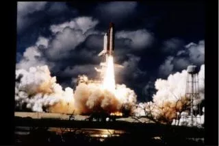
The goal of the OVERspace project is to develop and implement for Virginia’s educators , a state-wide professional development program and network for using remotely sensed data, GIS, and GPS as effective teaching and learning tools.
Geographic Information SystemsA Definition of GIS • GIS is a Systemofcomputer software, hardware and data, and personnel to help manipulate, analyze and present information that is tied to a spatial location – • spatial location– usually a geographic location • information– visualization of analysis of data • system - linking software, hardware, data • personnel– a thinking explorer who is key to the power of GIS-
What is GIS ? • A method tovisualize, manipulate, analyze, and display spatial datato study the world • “Smart Maps”linking a database to the map, creating dynamic displays
Five Data Layers “Alike” Features Rivers Capitals Roads States Lakes
Some Ways GIS is Used • Emergency Services • Environmental • Natural Disasters • Education • Government • Medical • Industry, Businesses • Defense Whereever Spatial Data is needed
What is Not GIS ? • GPS –Global Positioning System • Astatic map– paper or digital • Maps are often a “product” of a GIS • A way to visualize the analysis • Asoftwarepackage
Visualization “Worth a Thousand Words” Learning with GIS dynamic maps
12 OVERspace GIS related lesson plans in development include: • Upper Roanoke River Watershed-A Learning Adventure • Nifty Fifty! – (Studies of VA provinces and regions) • Water, Water Everywhere, But not a Drop to Drink! (Water supply issues) • Medical Geography- Vaccination in the U.S. -( Mapping disease spread) • Colonial Economics and Immigration- (Mapping historic sites & battles) • Living Life on the Edge! -(GIS uses in natural disasters ) • Light My Fire! -(Studies of controlled burns and wildfires & satellite data)) • A Bird’s EyeView -( Studies of the NASA SATS aircraft with GPS) • It’s Raining, It’s Pouring! -( Studies of precipitation and its impacts) • Virginia Physiography -( A study of the specific provinces of VA) • MicroClimates - (Student data collection and analysis of climate types) • Healthy Chesapeake? -(Studies of Virginia’s watersheds)
Geographic Information Systems “GIS” @ your school • Science • ES.1, ES.2, ES.3, ES.9 • Social Studies • Computer Technology • Math skills • English (communications) • 8.5, 9.2, 9.6, 10.1, 10.7, 10.9 Example Virginia SOLs
Who uses GIS? Where are they?
Why use GIS?? • GIS helps learners of any age think critically, learn in an integrated fashion, and exercise multiple intelligences. • The infinite variations possible in topic of study, scale of exploration, data engaged, analyses used, and questions asked help teachers model the importance of being a lifelong learner.
GIS @ your school • You need: • Computers • Software (free or commercial) • Some experience • Lots of enthusiasm • Applicable lesson plans for integration in current curriculum
What is GPS? • The Global Positioning System (GPS) is a satellite-based navigation system made up of a network of 24 satellites placed into orbit by the U.S. department of Defense. • GPS was originally intended for military applications, but in the 1980s, the government made the system available for civilian use. • GPS works in any weather conditions, anywhere in the world, 24 hours a day. • There are no subscription fees or setup charges to use GPS.
GPS for classroom use GPS 76 • Set of GPS units for classroom use is available for use, through VSGC. • VDOE provided grant for 1st class set. Other grants will provide for more equipment • OVERspace teachers were provided with a high quality GPS unit • Future plans: 8 classroom sets in Virginia for loan in teaching students