Download
1 / 24
240 likes | 348 Views
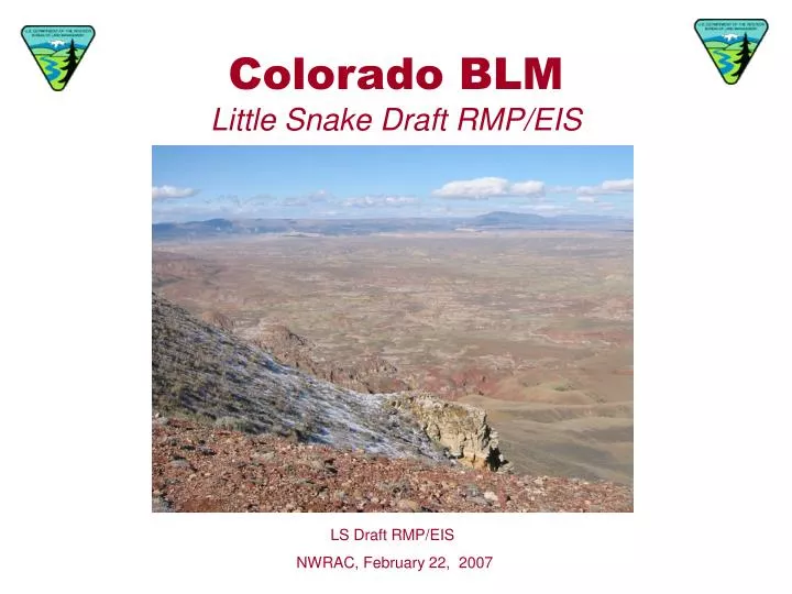
Colorado BLM Little Snake Draft RMP/EIS. LS Draft RMP/EIS NWRAC, February 22, 2007. What is an RMP?. A Resource Management Plan (RMP) is set of comprehensive long-range decisions concerning the use and management of resources administered by the BLM.

E N D
Colorado BLMLittle Snake Draft RMP/EIS LS Draft RMP/EIS NWRAC, February 22, 2007
What is an RMP? A Resource Management Plan (RMP) is set of comprehensive long-range decisions concerning the use and management of resources administered by the BLM. The LSFO is located in northwest Colorado. The planning area comprises about 1.3 million acres of surface BLM ownership and 1.1 million acres of federal mineral estate overlain by private and State lands. The Field Office lies mostly within Moffat and Routt Counties.
RMP Revision Background • 1989: Little Snake RMP approved • 1994: BLM receives Citizen Wilderness Proposals from Colorado Environmental Coalition. • 2003: Partnered with Moffat County to form a broad based community group dedicated to natural resource management issues. • 2003: LSFO funded in FY04 for RMP Amendment for Vermillion Basin. Strong push from partners to do a RMP revision instead. • 2004: LSFO initiates RMP revision
RMP Schedule • Winter 2004: Scoping began • Spring 2005: Gathered baseline data and completed AMS. • Spring/Summer 2005: Alternatives development • Fall/Winter 2005: Impact Analysis • Feb 2007: NOA and release of Draft RMP/EIS for 90-day public comment period • Nov 2007: Distribution of Proposed RMP/Final EIS • July 2008: Signed ROD
Public Outreach • BLM has signed MOUs with five Cooperating Agencies: • Moffat County • Colorado Department of Natural Resources • U.S. Fish and Wildlife Service • Juniper Water Conservancy District • City of Steamboat Springs • BLM has initiated Native American consultation with four Tribes: • Shoshone Tribal Council • Ute Mountain Tribal Council • Uintah and Ouray Tribal Council • Southern Ute Indian Tribe
Public Outreach An independent community stewardship group called The Northwest Colorado Stewardship (NWCOS) has provided input into the Draft RMP/EIS. NWCOS has a balance of interests, ranging from gas companies, environmental organizations, local ranchers and cooperating agencies. The public process BLM is undertaking with NWCOS supplements the required public process. Cooperating Agencies worked through the NWCOS process and also independently from NWCOS. In Spring 2006, the Cooperators developed two consensus proposals on sagebrush fragmentation and management of Vermillion Basin.
Major Planning Issues Issue 1: Oil and Gas Development • Oil and gas leasing categories • Management of Vermillion Basin Issue 2: Special Management Areas • ACECs by management alternative • Wild and Scenic River Study Issue 3: Lands with Wilderness Characteristics • Management of lands with wilderness characteristics, including Vermillion Basin, is a contentious issue addressed in the plan. Issue 4: Wildlife Habitat • Cooperating Agency proposal to reduce sagebrush habitat fragmentation • Issue 5: Travel Management • OHV designations
Alternatives Maintain present uses by continuing present management direction and activities. Mineral and energy development and unrestricted OHV travel would be allowed throughout the majority of the planning area. Maintain the level of resource functionality to meet Standards for Public Land Health. Alternative A Current Management Allow greatest extent of resource use within the planning area. Constraints on commodity production for the protection of sensitive resources would be the least restrictive possible within the policy limits. Alternative B Emphasize multiple resource use by protecting sensitive resources using performance based approach. Commodity production would be balanced with providing protection for wildlife and vegetation. Alternative C Preferred Alternative Alternative D Allow the greatest extent of resource protection within the planning area, while still allowing resource uses. Commodity production would be constrained to protect natural resource values or to accelerate improvement in their condition.
Oil and Gas: Preferred Alternative Oil and Gas Designations Designation* Acres Open w/ STC Open w/ TLS CSU NSO Defer leasing 417,790 Key Defer leasing 1,216,190 NSO 184,840 CSU 216,040 * To make this map more legible, timing limitations as well as some NSO and CSU areas not related to land use allocations are not displayed (sage grouse NSO buffers, fragile soils CSU areas, etc). 160,870
Oil and Gas: Comparison of Alternatives Oil and Gas Designation Acres by Alternative
Deferred Leasing and Oil and Gas Potential Key High Potential Medium Potential Low Potential No Known Potential Discretionary Deferral WSA Closure
Oil and Gas: Vermillion Basin A New Vermillion Basin Proposal: • Cooperating Agencies want to allow for organized and regulated development of Vermillion Basin while protecting natural and scenic values. • All development would take place within federal units of a minimum of 10,240 acres. • No more than 1 percent of the total acres leased may be disturbed at any one time, including well pads, new roads and associated disturbance. • Operators must submit a Plan of Development to the BLM illustrating a strategy to reduce impacts to natural values.
Special Management Areas: Preferred Alternative Alternative C ACEC: Irish Canyon ACEC Current ACECs not designated in C: Suitable Wild & Scenic Segments Yampa Segment 1: 2.8 miles, recreational Limestone Ridge Lookout Mountain Cross Mountain Canyon Yampa Segment 2: 13.9 miles, scenic Yampa Segment 3: 3.3 miles, wild
Special Management Areas: Comparison of Alternatives Suitable Wild and Scenic River Segments
Lands with Wilderness Characteristics:Preferred Alternative 1 2 3 4 Lands W/ Wilderness Characteristics outside WSAs Area 1: Manage to protect naturalness, opportunities for semi-primitive recreation, and solitude. Area 2: Allow for energy development while protecting natural and scenic values. Area 3: Manage to protect naturalness, opportunities for semi-primitive recreation, and solitude. Area 4: Identified as an SRMA to manage for flatwater boating and related camping opportunities. Existing WSAs
Wildlife Habitat – An Incentive-based Proposal Sagebrush Habitat Fragmentation • Cooperating Agencies wanted greater protection for sagebrush habitats and more opportunities to allow year-round drilling. • Wildlife timing limitation stipulations do not protect habitat over the long term. • The proposal would allow oil and gas operators to opt into a voluntary trade-off, where BLM would grant an exception to wildlife timing stipulations if operators stay within certain surface disturbance parameters. The proposal applies to critical sagebrush patches and areas within a 4-mile radius of a sage grouse lek. Operators would be required to limit surface disturbance to 5% of a lease and submit a Plan of Development for approval. In return, big game and sage grouse timing limitations would be excepted, allowing year-round drilling in these areas.
Key Within 4 miles of sage grouse lek Critical sagebrush patch
Travel Management – Comparison of Alternatives * Alternative C: Manage as limited to existing roads and trials until route designation is initiated through the adaptive OHV designation process . Areas limited to existing roads and trails would be prioritized for transportation planning, eventually leading to designation of routes across the entire Field Office. ** Another 161,810 acres in Sand Wash Basin are seasonally closed to OHVs in Alternative D (foaling season)
Adaptive Management • Alternative C would be implemented utilizing an adaptive management process. Outcomes are defined and indicators are monitored to determine if the outcomes are being reached. • Appendix M in the RMP describes the AM process to be employed at both the system-level and project-level. • Although the Draft does not contain quantified outcomes/objectives, these will be developed in a subsequent document called the Assessment Guidance Document. • Standards for Public Lands Health serve as the system-level outcomes and indicators. • Prescriptive fallbacks in the RMP would be enforced if monitoring cannot be performed.
Give Us Your Input • Comments submitted to BLM on the Draft EIS will be fully evaluated and responses will be prepared for substantive comments that raise significant issues regarding the Draft EIS. • The 90-day public comment period ends May 16, 2007. • Email your comments to colsrmp@blm.gov • To download the Draft RMP and view fact sheets, visit the project website at http://www.co.blm.gov/lsra/rmp/
Contact Information To request a CD copy of the Draft RMP/EIS, submit written comments, or if you have any questions, contact: Jeremy Casterson Planning and Environmental Coordinator Little Snake Field Office 455 Emerson Street Craig, CO 81625 (970) 826-5071