Download
1 / 27
270 likes | 383 Views
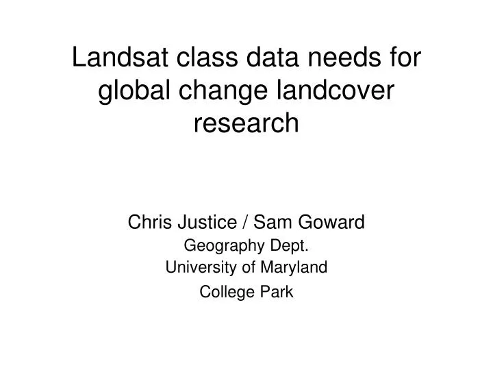
Landsat class data needs for global change landcover research. Chris Justice / Sam Goward Geography Dept. University of Maryland College Park. General Requirements. Continuous operational global acquisition of science-quality Landsat class resolution data

E N D
Landsat class data needs for global change landcover research Chris Justice / Sam Goward Geography Dept. University of Maryland College Park
General Requirements • Continuous operational global acquisition of science-quality Landsat class resolution data • Operational replacement of instruments as needed to maintain data coverage • A well characterized long term data record • Recognizing the need for dynamic product continuity • A pricing policy that makes the data affordable for the science community • A data policy that enables free and open sharing of data • Data archives that are well preserved and easily accessible
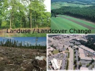
US Climate Change Science Program • Land Use / Land Cover Change (LULCC) is a new interdisciplinary element of the CCSP – requiring a combination of physical and social science • Land Use Change is recognized as a major and immediate form of global environmental change • Land Use Change Research is of direct societal relevance • Land Use and Cover Change occurs at a local scale but with national, regional and global significance
Practical Importance • Land use is key to addressing societal vulnerability and resilience and is integral to local and regional policy, resource management and development issues. • We need to understand the positive and negative impacts of land use decisions. • Better scientific understanding of land cover/land use change is needed for carbon trading, food supply, water quality, air quality and for assessing potential impacts of climate variability – food security, flooding • Realistic projections of land use change are needed for water resource and ecosystem management and urban and regional planning – these projections cannot be made without an explicit understanding of the land use processes including socio-economic, demographic factors and environmental constraints.
Example National (US) Land Use Issues • There are national and local questions which require a better scientific understanding of land use and can benefit from the rigor of global change research e.g. • How are land cover and land use and the associated infrastructures changing and how will they change in the future? • What are the societal and environmental impacts of these changes? • What is the impact of land use change on water quality, water supply and human health? • What land use/land cover changes are taking place in the coastal zone, what are the impacts on nutrient cycling, wetlands loss and replacement? • What land use/land cover changes are taking place at the urban / rural interface – what are the various impacts and is there a loss of agricultural land? • Are forested lands increasing or decreasing and what are the impacts of different forest and fire management practices? • How have past changes and will future changes in land use and management practices effect the carbon budget
Where’s the Sprawl? Goetz et al UMd/WHRC NASA/LCLUC
Clearing Epoch 1985-88 1988-91 1991-95 1995-99 1999-01 Undisturbed Forest Disturbance History Example: Virginia Masek et al. GSFC
Analysis of multiple, multi-date Landsat scenes of data Disturbance / loss Regrowth / gain Mid-Atlantic Forest Disturbance, 1990-2000 ~0.5% forest disturbed/yr (~80,000 Ha/yr) Masek et al. GSFC
Built Agriculture Other vegetation Forest Lake Wetland Michigan Land Use Projections, 2040 Models Initiated with Current Land Use and Trends (Skole et al. MSU)
High Resolution Data Needsfor LULCC research and applications • Dynamic data continuity essential with no data gaps • Science quality data essential (calibrated sensors) • Global acquisition strategy implemented to meet science needs • Co-locating moderate and high resolution land imagers • EOS AM MODIS / ASTER combination is the science prototype • LDCM and VIIRS will allow operational integrated products • Must have a data policy to enable LULCC science • Workable data pricing structure, especially for large volume data analyses • Open data policy allowing data sharing and exchange • Targeted hyperspatial (1m) data will be needed as part of the national information infrastructure • CCSP Land Use Interagency Working Group • Develop research opportunities for large volume data analysis
Global Land Remote Sensing in Landsat 7 Era: providing high resolution coverage everywhere Year 2000 L7 “low-cloud” 95% Global Coverage – USGS EROS
The International Case • A number of international programs have evaluated land observation needs • IGBP DIS (1990’s) – high resolution project • GTOS Global Observation of Forest Cover /Global Observation of Landcover Dynamics (GOFC/GOLD) • GCOS 2nd Adequacy Report • IGOS-P Integrated Global Observation of Land (New) • Group on Earth Observation System of Systems (GEOSS) – strategic plan • All have stated the need for continued provision of Landsat class data
Example Global/Regional Issues • There are a number of questions which require a better understanding of land use e.g. • Are current land use practices sustainable? • Where is land cover changing and what is the extent? • How does land use change affect human health? • How will land use change to feed the Worlds growing population? • How are the Worlds Mega-cities changing and with what impact on the environment and the quality of life? • How is land use change impacting regional and global climates? • How will a changing climate impact land use? • What is the role land use change on the global carbon cycle? • How will climate and land use change combine to impact human well being and environmental quality? • How are current land use changes impacting biodiversity? • How are regional changes in land use and cover affecting water availability and will this fuel regional conflict?
LANDSAT 7 AMAZON Logging, Deforestation , Regrowth at Local Scales ETM Sharpened Showing Logging Patios Skole et al..MSU
TM and ETM Deforestation & Regeneration 1992 - 2002 Wall to Wall Mapping at Fine Scale for multiple Years Skole et al. MSU
Data Needs Beyond Landsat 7 • The data gap is now – there are currently major gaps in our observations – at best we are capable of obtaining global semi annual coverage • Need for immediate solutions to the data gap - this will require substantive funding FY 06! • Coordinated global data buy for 2005/2006 to extend the NASA 1990/2000 data buys – possibly using alternative systems • International coordination of acquisition will be needed • OLI to be launched in 2010? - but what do we do in the interim • The Marburger ‘bridging mission” is the right thing to do • bridging between Landsat 7 and OLI on NPOESS • providing risk reduction for the OLI
Congo Basin: A Case in Point • Congo Basin Forest Partnership Announced by President Bush at the WSSD • US AID’s Central Africa Regional Project for the Environment (CARPE) – a US contribution • Landsat primary tool for determining rates of forest loss and hot spots of land use change – Landscape metrics • No local Landsat ground station • Cloud cover limits use of composited products • Immediate solution needed to obtain basin wide data coverage • Cloud clear L7 feasibility pilot? • IRS Ground Station or data buy?
Landsat Tropical Deforestation (DRC, Central Africa) • Wall to wall mapping based on Landsat imagery • Hampered by scarcity of data for the region due to clouds and irregular archiving. 16 pairs of Landsat imagery within DRC used to estimate forest extent and deforestation. Observed annual rates of deforestation (1984-1998) ranged from 0.1 – 0.7 %; estimated overall deforestation rate for DRC of 0.4% What can we do for 2005? .
Thoughts on Landsat Program • Last time Landsat concept seriously reviewed and documented ~ 1975 (when the Thematic Mapper Sensor was designed). • Opportunities to evaluate L4-7 TM data have been constrained by commercialization and data costs • Current L7 costs are prohibitively expensive for regional multi-date studies • NASA Global Data Buys have been an exceptional contribution to the science and international collaboration and the primary means for conducting regional scale land use science.
Atmospheric Attenuation Cloud Contamination Temporal Repeat Frequency Geo-registration and Mapping Standards International Collaboration on data acquistion Complimentary Hyper-spatial Observations Landsat Class Observation Issues that need Immediate Attention
Atmospheric AttenuationR21 Science Advisory Board Recommendations Goward, Pecora 15 Presentation
Cloud Contamination from a 16 day repeatcycle (L7 16-Day Temporal Repeat – Washington DC region, 2000) May 11 May 27 June 12 June 28 July 14 July 30
N Geo-registration for EO1 -ALI image of Oahu Orthorectification essential for NASA EO-1 ALI – topographic effect on band alignment The same will be requirement for OLI Orthorectification requires decision on World Mapping Standards
International Collaboration Stoney, 2004
Hyper-Spatial Resolution Imagery 2000 acquisition Ikonos Sample hyperspatial data needed for global land use change research and Validation of Landsat Class data products
An Operational Land Imager • Operational Landsat Class Instrument on NPOESS: an excellent concept – (what is a realistic launch date?) • Need to ensure that the OLI meets the needs of the science community – a transparent process • Involve the science community in the design and development of the OLI system – ensure science quality data • Develop a structure to organize the science community interface with the instrument e.g. through a Land Sciences Institute • Ensure pricing policy which enables science use of large volume data with periodic compilation of global data sets • Free and open sharing of data as with the meteorological satellites • Prototyping of merged products (VIIRS/OLI) • Institutional data archive needed • Low cost data distribution systems to be prototyped by the research community e.g. Global Land Cover Facility (UMd), Landsat.org (MSU)
Additional Needs Beyond OLI • If US is to maintain a leadership role in earth observation and make a substantive contribution to the imaging needs of GEOSS - then we need to address the additional needs beyond OLI • Increased temporal coverage needed to achieve 7 day repeat clear views • A constellation of low cost small satellites providing data continuity to the Landsat class of observations using OLI as the calibration standard • A technology development challenge for the country