Download
1 / 18
180 likes | 191 Views
New TauDEM Tools for Deriving Hydrologic Information from Digital Elevation Models. David G. Tarboton Kimberly A. T. Schreuders Matthew E. Baker david.tarboton@usu.edu. http://www.engineering.usu.edu/dtarb. Hydrologic Terrain Analysis Information Model. DEM Sink Removal Flow Field

E N D
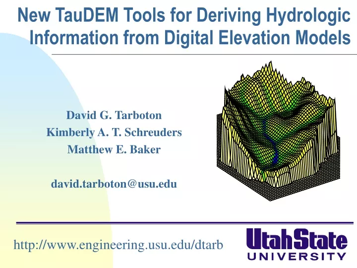
New TauDEM Tools for Deriving Hydrologic Information from Digital Elevation Models David G. Tarboton Kimberly A. T. Schreuders Matthew E. Baker david.tarboton@usu.edu http://www.engineering.usu.edu/dtarb
Hydrologic Terrain Analysis Information Model • DEM • Sink Removal • Flow Field • Flow Related Terrain Information
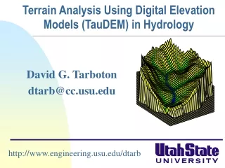
Models for the digital representation of terrain a) Grid c) Contour and flowline b) Triangulated Irregular Network
Representation of Flow Field Steepest single direction 48 52 56 67 D D8
<1 ha 1-4 ha 4-8 ha >8 ha Contributing Area using D Contributing Area using D8
Multiple Flow Direction Grid TIN - Base Voronoi Grid Contour-Flow-Tube Grid Physical Network Physical Network Physical Network 2 5 2 2 4 4 6 6 1 6 3 1 7 4 5 1 1 5 5 3 3 2 3 4 Topological Network Topological Network Topological Network 2 2 1 1 6 6 2 2 4 1 3 P P =0.5 =0.5 P P =0.7 =0.7 P =1 P =0.4 12 12 25 25 36 13 P =1 P =1 4 P 24 5 5 46 =0.3 =0.3 =0.5 =0.5 =0.6 14 P =0.6 =0.7 =1 47 24 24 13 13 P =1 P P P P 14 36 P P 34 P =0.4 P =0.3 P =1 P =1 13 35 25 7 3 3 57 1 5 4 4 2 3 5 More general flow field representations.
Flow Algebra r(x) x
Grid cell y 1 0 0 0 0.5 0.5 0 1 0 0.6 0.4 0 0.6 0.4 0 Influence function of grid cell y Useful for example to track where sediment or contaminant moves
0.6 0 0 0.3 0.3 0 0 0.6 0 0 0 1 0 0 1 Grid cells y Dependence function of grid cells y Useful for example to track where a contaminant may come from
Weighted distance to target set. Example to quantify effectiveness of riparian zone sediment capture based on buffer potential
30*0.5 15 15+42.4*0.7 44.7 44.7 44.7 44.7 44.7 Buffer potential weighted distance to stream downslope recursion 0 0 0 0 0 44.7 30
Useful for a tracking contaminant or compound subject to decay or attenuation
å = + - D S T T å = + in out T min{ S T , T } = ca 2 2 T tan( b ) out in cap cap Transport limited accumulation Supply Capacity Transport Deposition S Useful for modeling erosion and sediment delivery, the spatial dependence of sediment delivery ratio and contaminant that adheres to sediment
Avalanche Runout Upslope recursion to determine elevation and distance to point in trigger zone that has the highest alpha angle
Conclusions • Terrain based flow data model enriches the information content of digital elevation data • Flow algebra generalizes the recursive flow accumulation methodology • Downslope and upslope recursion • Several new flow algebra functions • Concepts not limited to grids