Download
1 / 20
220 likes | 400 Views
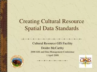
National Park Service Cultural Resource Spatial Data Transfer Standards. Resource Information Management Conference Cultural Resource GIS Facility National Park Service 22 April 2010. The Cultural Resource GIS Facility National Park Service Heritage Documentation Programs.

E N D
National Park Service Cultural Resource Spatial Data Transfer Standards Resource Information Management Conference Cultural Resource GIS Facility National Park Service 22 April 2010
The Cultural Resource GIS FacilityNational Park ServiceHeritage Documentation Programs • Geographic Information Systems (GIS) • Global Positioning Systems (GPS) Survey • GIS Analysis • Cartography and Output • GIS Programming • GIS and GPS Training Our primary mission is to assist State/Tribal Historic Preservation Offices and National Park Units in automating data, collecting data, and exploring the use of technology with cultural resource management.
Cultural Resource Subcommittee • The Cultural Resource Subcommittee is chartered by the NPS GIS Council • CRS is co-chaired by CRGIS and the Midwest Archaeological Center • It has 16 voting members representing each region, the major NPS cultural resource databases, NPS programs and park cultural resource GIS programs • The CRS is tasked with developing cultural resource spatial data standards, developing implementation models for those standards, tools for the use of these standards and in general guiding the NPS cultural resource community in the utilization of GIS and GPS technologies to better manage and steward our resources
Locating Cultural Resources • Locational information is a key factor in understanding cultural resources, and how to care for them • Knowing the location of a resource on the ground provides more than an understanding of “where” the resource is • Geographic clues provide information about the human and environmental influences on cultural resources, helping to explain “why” the resource exists and “how” it relates to others • A geographical context provides managers with a different perspective on our resources, allowing us to see the interaction of resources, and larger trends
Understanding Cultural Resources • Spatially, we consider each resource a single entity • Each individual resource is viewed from several perspectives however: built features, archaeological sites, cultural landscapes, museum objects, etc. • Any one resource may be viewed from multiple perspectives or disciplines Colonial National Historical Park Shown: Core and study areas of Revolutionary War battle and historic features from Civil War battle Databases involved: landscapes, landscape elements, built features, archaeological sites, museum objects, Historic American Buildings Survey documented structures, List of Classified Structures features
The Database Problem • There is no umbrella organization or methodology for linking all of the cultural resource databases together • The existing databases serve important purposes and maintain specific data that can not be collapsed into a single cultural resource database • Geography can be used as a means of integrating the databases however • One location can be used to reference multiple databases
The Location Problem • If geography is used to tie the cultural resource databases together, it must be standardized to insure consistency and quality • There are few requirements now to collect coordinates in a specific way, other than those provided with the National Register of Historic Places • There are conflicting requirements on the level of detail required for resource locations Detail can be important for the users of our data. Looking at an historic district boundary provides very different information from the contributing resources within the district.
The Need for Cultural Resource Spatial Data Standards • Standards and guidelines for both legacy and future data are needed in a number of key areas: • We need standards for collecting cultural resource spatial data: geometry, accuracy, datum, coordinate systems, sub-entities etc. • We need guidelines that relate cultural resource spatial data to cultural resource attribute data • We need standards that address how to safeguard sensitive spatial data • We need metadata standards at the data set and feature levels
CRGIS Work Toward the Development of Cultural Resource Spatial Data Standards • CRGIS has participated in multi-agency cultural resource data standard creation efforts since 1999 and created a cultural resource work group within the Federal Geographic Data Committee to facilitate such efforts • CRGIS initiated efforts within the NPS through a Cultural Resource Database Managers workshop in Oct. 2003 • CRGIS held a second NPS Cultural Resource Database Managers workshop in Oct. 2005 • CRGIS developed a first draft data model reflecting the needs outlined by the NPS data managers in Oct. 2005 • CRGIS partnered with FEMA in response to hurricane Katrina and had the opportunity to field test draft standards and a draft data model beginning in Nov. 2005 • Based on field testing and other efforts, CRGIS developed a second draft of the data model in Oct. 2006 • The standards represented by the data model were first posted as draft standards on the NPS data store in Oct. 2006, refined and posted twice more through 2008 and in 2009, with a final draft finally posted in 2010 • The Cultural Resource Subcommittee served as the body through which testing of the standards were coordinated and comments vetted to reach the final version of the standards
Current Status of the NPS Cultural Resource Spatial Data Standards • The NPS cultural resource spatial data standards are currently in their final form, having been released service-wide for commenting twice • The final draft was presented to the NPS GIS Council and adopted in February 2010 • The Cultural Resource Subcommittee has been building a data model that uses a file GeoDatabase allowing users to link from the geography to external cultural resource databases which contain descriptive information about multiple resources • A series of feature classes describes various cultural resource types (buildings, objects, structures, districts, archaeological sites, cultural landscapes, ethnographic resources, survey boundaries, and other features) • A group of parks and regional representatives in the Pacific West region has been testing the standards, adding their data into the GeoDatabase model • This has resulted in refining the standards, as well as the generation of documentation to accompany the standards
Basic Principles the Cultural Resource Standards Try to Adhere To • Spatial representation of cultural resources is important for their protection and management • Each cultural resource database needs to remain autonomous • A unique ID needs to be created for each cultural resource entity to enable linking between databases and use in a GIS • Each unique feature will have a unique spatial representation • Discipline experts for the predominant characterization of a feature should be responsible for the spatial boundary determination • Standards should be defined for how each resource type will be represented, and at what level of accuracy, scale and resolution • Standards may need to be different for legacy data and new data • Questions we are asking of these datasets should drive the resolution and accuracy of spatial data layers
Standards for Creating Cultural Resource Spatial Data • A cultural resource should be represented by a point, line or polygon feature • A newly inventoried cultural resource should be defined by a polygon when appropriate • Contributing cultural resources to a historic district or landscape should be represented at a minimum by a point or line feature • The location of vertices defining the polygon boundary of a cultural resource must meet USGS National Mapping Standard for 1:24,000 scale maps • The positional accuracy for vertices defining polygon boundaries of newly inventoried resources should be within 3 meters of their true position for 90% of the vertices • Address fields created for the purpose of geo-coding locations of newly inventoried resources must follow the FGDC Address Content Standard • Legacy data may be used as a source for creating spatial data for cultural resources, if feature level metadata can be completed • User defined coordinate systems, e.g. an archaeological site grid must be tied into a real world coordinate system
Standards Establish Links From Spatial Data to Cultural Resource Databases • A point, line or polygon boundary for a cultural resource must be linked to attribute tables that describe the resource • Cross-walk tables should be used and completely filled out when data on any single cultural resource appears in multiple databases
Standards Require Feature Level Metadata • Dataset level metadata for point, line or polygon data must be FGDC compliant for spatial metadata • Feature level metadata for individual points, lines or polygons must be able to address the following questions: • Feature level metadata is entered into fields in the spatial attribute table • Does the boundary represent a single cultural resource or an aggregate cultural resource? • Does the boundary circumscribe, buffer, or represent the actual boundary of the resource? • What method was used to locate and plot the resource? (e.g. address matching, GPS survey, triangulation w/ compass, triangulation with transit, trilateration with tape, trilateration by pacing, unknown etc.? • When was the boundary created? • When was the boundary last updated? • Who or what institution created the boundary? • What map datum was used in plotting the location of the cultural resource? • What coordinate system was used in plotting the location of the cultural resource? • If using GPS what was the level of accuracy? • What use constraints are there on the boundary? e.g. suitable for Section 106 compliance, National Register boundary , or limited to research etc.
What OMB Circular A-16 Defines for the NPS • Circular A-16, the same document that creates the FGDC, designates the National Park Service as the lead agency for cultural resources, responsible for the stewardship of the cultural resource data theme for all Federal agencies • Within the National Park Service the Cultural Resources Geographic Information Services (CRGIS) office has been given this responsibility • Tasks Included in this Responsibility: • assess existing standards and identify needs • develop and implement FGDC standards • develop plan for the implementation of standards and population of the data set • collect and analyze information regarding user needs • publish data online
The Cultural Resource Geospatial Data Transfer Standard Proposal • Outlines the need for cultural resource spatial data standards and the regulatory requirements for the creation of cultural resource spatial data • Explains the decentralized nature of Historic Preservation within the United States with emphasis on State and Tribal Historic Preservation Offices • Focuses on an approach to developing standards that address the geographic representation of cultural resources, linking descriptive data to spatial data, security of data, and feature level metadata • Emphasizes the need for consensus among Federal, State, Tribal and local historic preservation professionals in the standard creation process • Does not propose or create a specific standard • Does not propose to create standards that address descriptive information • Does not propose to create one central repository of spatial or descriptive information related to cultural resources • Standards created and implemented by the NPS serve as one example of the type of standards needed • These standards are designed to serve as a starting point for the larger standards discussion • The FGDC Standards Working Group unanimously approved the Cultural Resource standard proposal in February 2008
CRGIS Plan for Continuing with the Standard Creation Effort • Now an approved FGDC standard project, CRGIS is working with the Subcommittee on Cultural and Demographic Data and has re-chartered the existing Cultural Resource Work Group • CRGIS is working to include Federal, State, Tribal, and local government representatives, as well as private sector and academic historic preservationists to participate in the standard creation process • As part of the consensus building process, CRGIS hosted a summit of these participants in March 2009 to begin moving forward on the FGDC effort. The summit resulted in a set of principles to guide the direction of the effort as well as a set of best practices to incorporate • CRGIS will continue to follow the FGDC standard creation process fostering public comment from the cultural resource and GIS communities
What Does All of This Mean for the NPS Cultural Resource Programs? • The implementation of cultural resource spatial data standards will not affect any of the existing cultural resource databases maintained by the various NPS cultural resource programs • The creation of cultural resource spatial data standards should help cultural resource specialists improve the quality and accuracy of their locational data and simplify the collection of that data • Migrating legacy cultural resource data into the existing data model provides a template for creating geographic data compliant with the approved standards • The standards provide structure for the creation of new cultural resource geographic data
What Does All of This Mean for the NPS Cultural Resource Programs? • The Cultural Resource Subcommittee will provide assistance and guidance to parks, regions and programs in understanding the standards and how to meet the standards • The Cultural Resource Subcommittee will generate guidance documentation, tools and training to assist parks, regions and programs in migrating data • The Cultural Resource Subcommittee is currently working on developing an implementation plan for the standards which will most likely build on the existing relationships between parks and regional offices to collect/migrate cultural resource data • The NPS cultural resource spatial data standards will inform the larger FGDC cultural resource spatial data creation process, which will probably be similar to the NPS standards but slightly less detailed • Having established cultural resource spatial data standards will pre-position the NPS to comply with FGDC standards once they are adopted • Ultimately, having NPS standards will allow cultural resource specialists within the NPS share data more effectively and better access the data within our various databases • Similarly, an FGDC cultural resource spatial data transfer standard will allow cultural resource specialists to share data among all Federal agencies • Most especially, this will allow cultural resource specialists to better plan for resources, protecting them from all manner of potential threats
Author Information Deidre McCarthy, GISP Architectural historian Cultural Resource GIS Facility Heritage Documentation Programs National Park Service Department of the Interior 1849 C Street, N.W. (2270) Washington, D.C. 20240-0001 Voice: 202.354.2141 Fax: 202.371.6473 Deidre_McCarthy@nps.gov http://www.cr.nps.gov/hdp/crgis/