Download
1 / 20
220 likes | 521 Views
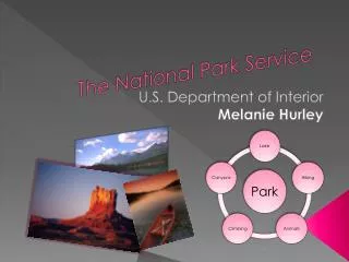
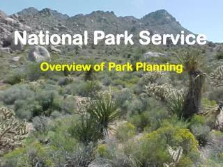
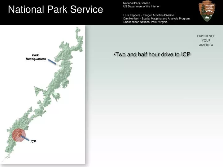
National Park Service. National Park Service US Department of the Interior. Lora Peppers - Ranger Activities Division Dan Hurlbert - Spatial Mapping and Analysis Program Shenandoah National Park, Virginia. Two and half hour drive to ICP. Park Headquarters. ICP. National Park Service.

E N D
National Park Service National Park Service US Department of the Interior Lora Peppers - Ranger Activities Division Dan Hurlbert - Spatial Mapping and Analysis Program Shenandoah National Park, Virginia • Two and half hour drive to ICP Park Headquarters ICP
National Park Service National Park Service US Department of the Interior Lora Peppers - Ranger Activities Division Dan Hurlbert - Spatial Mapping and Analysis Program Shenandoah National Park, Virginia
National Park Service National Park Service US Department of the Interior Lora Peppers - Ranger Activities Division Dan Hurlbert - Spatial Mapping and Analysis Program Shenandoah National Park, Virginia Day 1 September 30 • Albemarle County SO contacts Park – 4pm • Park assembles search team
National Park Service National Park Service US Department of the Interior Lora Peppers - Ranger Activities Division Dan Hurlbert - Spatial Mapping and Analysis Program Shenandoah National Park, Virginia Day 2 October 1 • ICP established near LKP • Begin joint command w/Albemarle SO • Search commences • Remote location, no cell, no electricity
National Park Service National Park Service US Department of the Interior Lora Peppers - Ranger Activities Division Dan Hurlbert - Spatial Mapping and Analysis Program Shenandoah National Park, Virginia Day 3 October 2 • Items in subjects possession • Digging tool • Collection bag • Cigarette pack
National Park Service National Park Service US Department of the Interior Lora Peppers - Ranger Activities Division Dan Hurlbert - Spatial Mapping and Analysis Program Shenandoah National Park, Virginia Day 4 October 3 • Plagued by distraction
National Park Service National Park Service US Department of the Interior Lora Peppers - Ranger Activities Division Dan Hurlbert - Spatial Mapping and Analysis Program Shenandoah National Park, Virginia Day 5 October 4 • Terrain challenges field teams • GPS units keep teams on task
National Park Service National Park Service US Department of the Interior Lora Peppers - Ranger Activities Division Dan Hurlbert - Spatial Mapping and Analysis Program Shenandoah National Park, Virginia Day 6 October 5 • Standard line style and marker symbol • Hasty • Ground • Dog • Man tracker
National Park Service National Park Service US Department of the Interior Lora Peppers - Ranger Activities Division Dan Hurlbert - Spatial Mapping and Analysis Program Shenandoah National Park, Virginia Day 7 October 6
National Park Service National Park Service US Department of the Interior Lora Peppers - Ranger Activities Division Dan Hurlbert - Spatial Mapping and Analysis Program Shenandoah National Park, Virginia Day 8 October 7 • Clues discovered believed to be subjects • Late afternoon
National Park Service National Park Service US Department of the Interior Lora Peppers - Ranger Activities Division Dan Hurlbert - Spatial Mapping and Analysis Program Shenandoah National Park, Virginia Day 9 October 8 • Moved ICP to Church
National Park Service National Park Service US Department of the Interior Lora Peppers - Ranger Activities Division Dan Hurlbert - Spatial Mapping and Analysis Program Shenandoah National Park, Virginia Day 10 October 9 • IC transition to VDEM
National Park Service National Park Service US Department of the Interior Lora Peppers - Ranger Activities Division Dan Hurlbert - Spatial Mapping and Analysis Program Shenandoah National Park, Virginia Day 11 October 10
National Park Service National Park Service US Department of the Interior Lora Peppers - Ranger Activities Division Dan Hurlbert - Spatial Mapping and Analysis Program Shenandoah National Park, Virginia Day 12 October 11 • Subject found!
National Park Service National Park Service US Department of the Interior Lora Peppers - Ranger Activities Division Dan Hurlbert - Spatial Mapping and Analysis Program Shenandoah National Park, Virginia SAR vs. Wildland Fire GIS support • GIS minimum expectations • Files and directory structures are created • Documentation • Minimum essential datasets • Map symbols • Map products • Data archiving • Team transition
National Park Service National Park Service US Department of the Interior Lora Peppers - Ranger Activities Division Dan Hurlbert - Spatial Mapping and Analysis Program Shenandoah National Park, Virginia Also, a timeline of when all this must get accomplished…. update/deliver map products documentation 0000 0100 0200 0300 0400 0500 0600 0700 0800 0900 1000 1100 1200 1200 1300 1400 1500 1600 1700 1800 1900 2000 2100 2200 2300 2400 process GPS from FTL task boundary GPS set-up for next cycle IAP • Map Products • Incident Briefing map (daily) • Situation-Plans map (daily) • Incident Action Plan (IAP) map (daily) • Transportation map (update as necessary) • FTL Task map (daily or more often) • Documentation • File naming convention • File structure • Map style (required elements) • Map symbology (SAR standards)
National Park Service National Park Service US Department of the Interior Lora Peppers - Ranger Activities Division Dan Hurlbert - Spatial Mapping and Analysis Program Shenandoah National Park, Virginia POWERLINE ROAD TRAIL RIDGE STREAM BOUNDARY PLANNING REGIONS Further subdivided into search segments….
National Park Service National Park Service US Department of the Interior Lora Peppers - Ranger Activities Division Dan Hurlbert - Spatial Mapping and Analysis Program Shenandoah National Park, Virginia Workflow … Plans Section to Field
National Park Service National Park Service US Department of the Interior Lora Peppers - Ranger Activities Division Dan Hurlbert - Spatial Mapping and Analysis Program Shenandoah National Park, Virginia
National Park Service National Park Service US Department of the Interior Lora Peppers - Ranger Activities Division Dan Hurlbert - Spatial Mapping and Analysis Program Shenandoah National Park, Virginia Workflow … Field to Plans Section