Download

1 / 22
220 likes | 793 Views
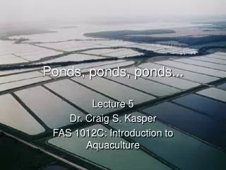
City of Austin Detention Ponds. Desktop Field Analysis Laton Carr. Detention Pond Classification . Watershed Protection and Development Review (WPDR) Texas Commission of Environmental Quality (TCEQ) Project to classify detention ponds. Building a Database.

E N D
City of Austin Detention Ponds Desktop Field Analysis Laton Carr
Detention Pond Classification • Watershed Protection and Development Review (WPDR) • Texas Commission of Environmental Quality (TCEQ) • Project to classify detention ponds
Building a Database • Existing point feature class data base • Electronic versions of maps • Berm heights via memory (maintenance crew) • Retrieval of any other existing maps • Result: Nearly empty data base
Course of Action So what do you do? Send out the intern!
Mission • Berm or Dam? • Berm/Dam dimensions • Take image inside the pond • Take image downstream • Description of what lies 100 yds downstream
Engineer’s Request Use of GIS to: • Find contributing drainage area into a pond • Estimate volume of pond • Estimate berm/dam height • Delineate inundation area • Determine what lies within this area
Project Parts Contributing Drainage Area Pond Volume Inundation Area
Contributing Drainage Area Gather data COA GIS Create base map:
Contributing Drainage Area Gather data (DEM) Create base map:
Contributing Drainage Area Building a geodatabase Geodatabase • Feature Classes Note: no feature data set. Create base map:
Contributing Drainage Area Building a geodatabase Create base map:
Contributing Drainage Area Projecting Data Create base map:
Contributing Drainage Area Terrain Processing Create base map: fdr Fac (boxed region detail) Dem_aus AgreeDem fac Dem_aus overlain by Creeks fil
Contributing Drainage Area Adding Vector Data Create base map: Add Streets Zoom to pond Add Contours
Contributing Drainage Area Find drainage area at pond inlet. Analyze Map: Flow accumulation = 2701 x (10 x 10) m2 x (1 km / 1000m)2 = 0.2701 km2
Volume of Pond Create new polygon feature class Analyze map:
Volume of Pond Export Table to .dbf file Analyze map:
Volume of Pond Open in Excel and Run Macro Analyze map:
Inundation Area Delineate inundation area Analyze map:
Results Use of GIS to: • Find contributing drainage area into a pond • Estimate volume of pond • Estimate berm/dam height • Delineate inundation area • Determine what lies within this area
Additional Work • Use a new tool TIN Volume tool for calculating pond volume • Finish procedure for estimating inundation area • Automate more of the analysis • Visual Basic • Model Builder • UML