Download
1 / 29
290 likes | 297 Views
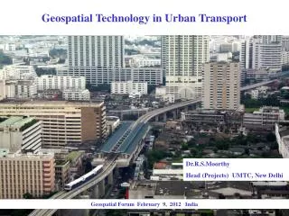
Geospatial Technologies for Sustainable Urban Transport. Innovative Transport Solutions (iTrans) Pvt. Ltd. Technology Business Incubation Unit (TBIU), Indian Institute of Technology-Delhi. www.itrans.co.in. A wealth of information creates poverty of attention

E N D
Geospatial Technologies for Sustainable Urban Transport Innovative Transport Solutions (iTrans) Pvt. Ltd.Technology Business Incubation Unit (TBIU), Indian Institute of Technology-Delhi www.itrans.co.in
A wealth of information creates poverty of attention - American political scientist, economist and psychologist Herbert Simon
We need to select and process data to generate meaningful and timely information to support the better management of resources. To improve decision making, the required information, tools, techniques, models and decision-making procedures need to be integrated in a user-friendly information processing system which is spatial to provide insights into assessments of tradeoffs between the various options open to decision makers.
Geospatial technologies are decision-making support tools than can be used to effectively ensure planning and investments in sustainable urban transport by highlighting the negatives of the business-as-usual scenario and demonstrating the benefits of investing in walking, cycling and public transport. These can be used by policymakers, transport planners and even NGOs promotion the paradigm shift of urban transport from automobile oriented planning toward the sustainable modes.
Tell me and I will forget Show me and I will remember Involve me and I will understand Step back and I will act. - Chinese proverb
Transit and NMT oriented development is efficient use of space
Thepublicspacetellsyouwho has priority (City-centre Popayán) 10.5 m: 1.25 8.00 1.25 (City-centre Bogotá) Wide footpath 10.5 m: 3.50 2.75 4.25
Geospatial technologies for sustainable urban transport Using geospatial technologies we can • Picture the data • Create different scenarios – what ifs • Decide course of action • Prioritize • Evaluate the impact – cost and benefits It is crucial in promoting sustainable mobility interventions because they are • Alternatives to the business-as-usual • Often counterintuitive in traffic engineering • Challenging existing planning practices • Fighting to justify investments in them
Case Studies • making of a city CMP – Patna • planning for walking and cycling infrastructure in a new township – Naya Raipur
GIS technologies in the making of a city CMP Comprehensive Mobility Plans are aimed at providing solutions for accessibility to amenities for all and minimise the externalities in the process, like congestion, pollution and accidents. GIS can be used at three levels • Modelling existing city trends • Short and Medium term recommendations • Horizon year scenario building
Modelling existing city trends • Replicating existing city network in a GIS platform • Existing models: TransCAD, VISUM, CUBE Voyager, EMME • Finding mode wise desired paths in the city • Shortest time path for private modes • Public transport accessibility based desired path • Safety +Shortest distance for Non Motorised trips • Identifying missing links in the existing city network to improve accessibility of different modes • Link wise traffic flows for different modes which form the basis for transport investment decisions like road widening, flyovers, demand for public transport
Models for existing city characteristics Activity bands along major roads showing entire city is within NMT range of main roads Traffic loads over existing road network which can be used to find any missing links
Short & Medium term recommendations • Modelling PT Corridor level interventions like BRT • Using Public Transit assignment to predict system feasibility • Predicting likely shift from other modes • Corridor demands and station loads for system designs • Modelling effect of NMT corridors through neighborhoods/ greenways • Likely shift to NMT from other modes • Environmental benefits through vehicle km shifted • Modelling likely effects of shifting existing facilities like cargo terminals etc. and find its effect in the city
Corridor level interventions NMT corridors planned near slums (dots in the network) and its likely loads Priority corridors for Public transport based on OD pairs and network parameters
Horizon year scenario building • Land-Use Transport interaction models • Mode choice models based on short/ medium term interventions proposed • Road network, Public transport and NMT requirements for the horizon year
Land-Use Transport interaction models • Land use changes are policy level interventions and hence need to be backed up with scenario analysis to make informed choices • Developing regression models to establish the relation between travel demand for different land use types and transport systems to be provided for different scenarios • Eg: Work Trips Attracttionj= 851.308+22.195 x residential areaj + 425.168 x commercial areaj – 182.412 x roadsj + 145.313 x terminalsj Education Trips Attracttionj= 1375.015 + 205.168 x educational areaj + 152.075 x commercial areaj
Land-Use Transport Model for Patna • Likely effect of densification along some corridors and developing that corridor more is modelled and the results are as follows • 1FSI scenario- more vehkm and urban sprawl • 2FSI scenario- less vehkm and high PT along some corridors
Mode choice models based on short/ medium term interventions proposed • Mode choice models contain utility functions with attributes derived from GIS based modelling like travel time alternatives • Short/ medium term interventions’ effect can be considered for horizon years and the likely scenarios for the horizon years can be developed
Road network, Public transport and NMT requirements for the horizon year • Travel demand modelling for horizon year • Determining infrastructure requirements Assignment model showing traffic loads on the horizon year network
Infrastructure recommendations BRT Corridors required for Horizon year, 2021 Bicycle Master plan for Horizon year, 2021
Case Study – Naya Raipur • Naya Raipur is a Newly Developing Capital for the state of Chhattisgarh • Naya Raipur has been selected as a demonstration city under GEF - UNDP - World Bank assisted Sustainable Urban Transport Programme (SUTP) of Ministry of Urban Development, Government of India. • As part of the Naya Raipur Sustainable Urban Project, the present study is titled “Preparation of Detailed Project Report and Bid Process Management for selection of contractor and development cycle tracks and pedestrian walkways and bid process management of PMC for development of cycle tracks and pedestrian walkways and bus shelters, bus depots and bus terminals in Naya Raipur”. • The study was awarded to the consortium of M/s Innovative Transport Solutions Pvt. Ltd (iTrans), M/s S.G. Architects (SGA) and M/s Urban Mass Transit Company (UMTC) Ltd.
At present Naya Raipur has a few urban villages (Abadi Villages) • The city has already witnessed development in terms of laying down of all arterial and sectoral roads, coming up of the Capitol Complex and few residential and recreational areas such as the cricket stadium Abadi Villages Existing two lane and three lane roads with light poles Apartment Buildings
NMT Usage: most of the people from Abadi villages are either cyclists or pedestrians and the existing motorized traffic is almost negligible.
Geospatial Applicability In Naya Raipur the Geospatial technology has been applied in making the following decisions Where to invest (to invest on motorised mobility/ do- Nothing or NMT mobility) On which roads investment is required When is this investment required ( Phase wise investments) Prioritization of investment based on trip purpose (work/ education or recreational)
Which Scenario to invest in Scenario 1/scenario 2 Scenario 3 bicycle passenger trips • Estimating number of people getting benefits from different types of investments • Choosing the better investments based on maximization of benefits Improving NMT infrastructure, the number of NMT trips increased on all the segments compared to do-nothing Scenario
On which roads investment is required Phase wise Development in Naya Raipur • Assigning the trips for each phase • Selecting the additional links, that requires, NMT infrastructure for each Phase for each purpose
When is this investment required ( Phase wise investments) Phase wise additional links that requires NMT infrastructure other than the proposed NMT Corridor
Prioritization of investment based on trip purposes In case of restricted funding, the tool will help to make a decision on which segments investment needs be invested primarily. Ex: Investment will be made on the links primarily, which are required for the mobility of work and education trips.