Download
1 / 16
160 likes | 280 Views
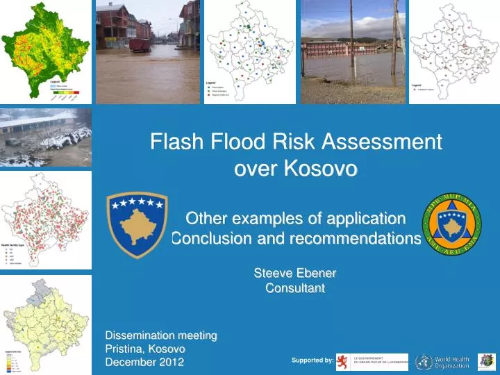
Flash Flood Risk Assessment over Kosovo Other examples of application Conclusion and recommendations. Steeve Ebener Consultant. Dissemination meeting Pristina, Kosovo December 2012. Supported by:. Supporting the response - Chemical truck accident.

E N D
Flash Flood Risk Assessment over KosovoOther examples of applicationConclusion and recommendations Steeve Ebener Consultant Dissemination meeting Pristina, Kosovo December 2012 Supported by:
Supporting the response - Chemical truck accident Ammonia (gas): A colorless gas with a strong odor. Mitrovica Long: 7489833 Lat: 4749936 Risks: Acute ammonia exposure can cause skin irritation; burn the eyes, resulting in temporary or permanent blindness; and cause headaches, nausea and vomiting. High levels can cause fluid in the respiratory system, which can cause death. Chronic exposure damages the lungs.
Supporting the response - Chemical truck accident What can you already do with the data collected during the pilot project? Mitrovicaregional police traffic unit Mitrovicanorthfire station Identify the location of the first line of response Mitrovica police station Mitrovicanorth city hospital Mitrovicaregionalhospital
Supporting the response - Chemical truck accident What can you already do with the data collected during the pilot project? Help organize the response - Block the traffic • Inform hospitals of the potential influx of patients • …
Supporting the response - Chemical truck accident What can you already do with the data collected during the pilot project? Working with other institutions: Predict the extension of the plume 1 hours Estimate the population living in this area 2 hours Identify key infrastructures that could be affected
Supporting the response - Chemical truck accident What could be done if more data was integrated?: Statistics Knowledge GIS (shelters, food supply,… Statistics (nbr of hospital beds, doctors,… Knowledge (expertise, documents) GIS Base for establishing an Emergency Management Information System (EMIS)
Improving the performance of Emergency Medical Services (EMS) Save time! Save lives!
Improving the performance of Emergency Medical Services (EMS) The location of past events… Can be used to predict where the next ones might occur
Improving the performance of Emergency Medical Services (EMS) The system can then calculate… Where to pre-position existing ambulances to obtain the best coverage possible
Improving the performance of Emergency Medical Services (EMS) And when a call is placed… Find out quickly which vehicle is the closest as well as guide it to the place of the event.
Conclusions of the pilot project • The country has access to a large amount of geographic information; • This information is often being generated in silos by different institutions and without agreed upon standards; • Existing information assets and technical capacities could be used to improve the quality of the existing data; • Data sharing issues remains; The country would benefit from the strengthening of the National Spatial Data Infrastructure (NSDI);
Conclusions of the pilot project • Geography is not systematically collected nor integrated into the different information system in the country to support emergency management; Absence of complete and up-to-date registry as well as mechanism to keep them up-to-date; Location of health facilities, police and fire stations collected for the first time in the context of the pilot project; Past flood events not systematically captured in a way that the information could be used to predict future flood events.
Conclusions of the pilot project • The implementation of the VRAM in Kosovo has therefore not only reached it’s initial objectives but contributed to address some of the above by: • Providing some guidelines to improve data compatibility in the country; • Generating a first set of registries; • Strengthening the technical capacity of both EMA and the MOH when it comes to geographic information and GIS; • Providing a base to establish a risk assessment capacity in the country. A starting point to build from
Recommendations For the Emergency Management Agency to: • Consider the action plan which has been presented to them as one of the components for establishing an Emergency Management Information System (EMIS) for the country; • Get a group of expert to analyze the result of the present flood risk assessment; • Use this pilot project as the base for developing a risk assessment capacity in the country and look at earthquakes as the next hazard to cover; • Promote emergency management as a driver for the strengthening of the National Spatial Data Infrastructure (NSDI) in the country; • Look at developing an flood event registry that would contain the mapping of the extent of flooded areas to facilitate the production of flood hazard maps
Recommendations For the Ministry of Health to: • Take advantage of the current development of the HIS to strengthen the integration of the geographic and time dimension into it by: • Developing official registries (starting with health facilities); • Deciding on official coding schemes; • Putting updating mechanism in place for these registries; • Making these registries publicly available; • Enforcing the use these registries and coding scheme; • Precisely locating all the facilities in the country • • Take advantage of the technical support provided by WHO in the context of the implementation of the VRAM to establish a real GIS technical capacity at the Ministry of Health.
Thank you ! • Ministry of Health • Ministry of Internal Affairs • Independent Commission for Mines and Minerals • Ministry of Infrastructure • Ministry of Environment and Spatial Planning • National Institute of Public Health • Ministry of Agriculture, Forestry and Rural Development • Kosovo Agency of Statistics • American University of Kosovo • Kosovo Cadastral Agency