Download
1 / 41
420 likes | 543 Views
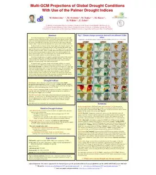
Developing the Self-Calibrating Palmer Drought Severity Index. Steve Goddard. Is this computer science or climatology?. Computer Science & Engineering, UNL. Outline. 1. What is Drought?. 2. The PDSI. 3. Self-Calibrating the PDSI. 4. Summary. What is Drought?. What is the PDSI?.

E N D
Developing the Self-Calibrating Palmer Drought Severity Index Steve Goddard Is this computer science or climatology? Computer Science & Engineering, UNL
Outline 1. What is Drought? 2. The PDSI 3. Self-Calibrating the PDSI 4. Summary Computer Science & Engineering, UNL
What is Drought? Computer Science & Engineering, UNL
What is the PDSI? • The PDSI is a drought index that models the moisture content in the soil using a supply and demand model. • Is an accumulating index • Developed during the early 1960’s by W. C. Palmer, published in 1965. • Designed to allow for comparisons over time and space. Computer Science & Engineering, UNL
Where is it used? Computer Science & Engineering, UNL
Moisture Departure How is it calculated? Latitude Temperature Average Temp Available Water Holding Capacity Estimate Potential Evapotranspiration Precipitation Estimate Moisture Demand Subtract Computer Science & Engineering, UNL
Moisture Departure Moisture Anomaly Current PDSI How is it calculated? Weighting process Climatic Characteristic Previous PDSI Weighted Combination Duration Factors Computer Science & Engineering, UNL
Problems with the PDSI Computer Science & Engineering, UNL
More Detail on PDSI Calculations • Step 1: Supply Demand Computer Science & Engineering, UNL
Moisture Departure: d • The moisture departure represents the excess or shortage of moisture. • The same value of d may have a different effect at different places, as well as at different times. • Examples: • A shortage of 1” will matter more during the growing season than during winter. • An excess of 1” will be more important in a desert region than in a region that historically receives several inches of rain each month. Computer Science & Engineering, UNL
Step 2: Adjustment • The moisture departure, d, is adjusted according to the climate and time of year to produce what is called theMoisture Anomaly, which is symbolized asZ. • Zis the significance ofdrelative to the climate of the location and time of year. • Zis calculated by multiplyingdbyK, which is called theClimatic Characteristic. Computer Science & Engineering, UNL
Climatic Characteristic: K • K is calculated as follows: where Computer Science & Engineering, UNL
Step 3: Combine with Existing Trend • The PDSI is calculated using the moisture anomaly as follows: The values of 0.897 and 1/3 are empirical constants derived by Palmer, and are called the Duration Factors. They affect the sensitivity of the index to precipitation events. Computer Science & Engineering, UNL
Self-Calibration Improving the spatial and temporal resolution of the index requires automatic calibration of: • Duration Factors • Climatic Characteristic Computer Science & Engineering, UNL
Duration Factors • The Duration Factors are the values of 0.897 and 1/3 that are used to calculate the PDSI. • They affect the sensitivity of the index to precipitation as well as the lack of precipitation. Computer Science & Engineering, UNL
Duration Factors - from Palmer Palmer calculated his duration factors by examining the relationship between the driest periods of time and the ΣZ over those periods. Computer Science & Engineering, UNL
Duration Factors - from Palmer The equation for this linear relationship is: Let b = -10.764 and m = -1.236. Then the duration factors can be found as follows: Computer Science & Engineering, UNL
Duration Factors - Wet and Dry • Most locations respond differently to a deficiency of moisture and an excess of moisture. • Calculate separate duration factors for wet and dry periods by repeating Palmer’s process and examining extremely wet periods. Computer Science & Engineering, UNL
Duration Factors - Automated Example from Madrid, NE Computer Science & Engineering, UNL
Climatic Characteristic • The climatic characteristic adjusts d so that it is comparable between different time periods and different locations. • The resulting value is the Moisture Anomaly, or the Z-index. • This process can be broken up into two steps. Computer Science & Engineering, UNL
Climatic Characteristic - Step 1 The first step adjusts the moisture departure for comparisons between different time periods. Computer Science & Engineering, UNL
Western Tennessee • West Central Ohio • Central Iowa • Scranton, Pennsylvania • Edwards Plateau, Texas • Southern Texas • Western Kansas • Texas High Plains • Northwestern North Dakota Climatic Characteristic - Step 2 The second step adjusts for comparisons between different regions. Computer Science & Engineering, UNL
All of the problems with the Climatic Characteristic come from Step 2. Climatic Characteristic - Redefinition What does this ratio really represent? Computer Science & Engineering, UNL
Climatic Characteristic - Redefinition Now what? Computer Science & Engineering, UNL
Climatic Characteristic - Redefinition Answer:use the relationship between the ∑Z and the PDSI Computer Science & Engineering, UNL
Climatic Characteristic - Redefinition What is the “expected average” PDSI? If there is one, it would be zero. Now what? Computer Science & Engineering, UNL
Climatic Characteristic - Redefinition • Besides zero, what other benchmarks does the PDSI have? • From a user’s point of view, what are the expected characteristics of the PDSI? Answer:A user would expect “extreme” values to be extremely rare. The only other benchmarks are the maximum and minimum of the range. Computer Science & Engineering, UNL
Climatic Characteristic - Redefinition • If extreme values are truly going to be considered extreme, they should occur at the same low frequency everywhere. • What should this frequency be? • There should be one extreme drought per generation. • Frequency of extreme droughts about 2% • 12 months of extreme drought every 50 years. Computer Science & Engineering, UNL
Climatic Characteristic - Redefinition • Consider both extremely wet and dry periods: • To make the lowest 2% of the PDSI values fall below -4.00, map the 2nd percentile to -4.00. • To make the highest 2% of the PDSI values fall above +4.00, map the 98th percentile to +4.00. Computer Science & Engineering, UNL
Climatic Characteristic - Final Redefinition Wait a second…. Isn’t K used to calculate the PDSI? How can the PDSI be used to calculate K? Computer Science & Engineering, UNL
Calibration Technique Computer Science & Engineering, UNL
Calibration Technique - Summary • Dynamically calculate the duration factors, following Palmer’s method and adjusting for poor correlation and abnormal precipitation. • Redefine the climatic characteristic to achieve a regular frequency of extremely wet and dry readings by mapping the 2nd percentile to -4.00 and the 98th to +4.00 Computer Science & Engineering, UNL
Calibration Technique • Effects: • The index is now calibrated for both wet and dry periods. • Almost all stations have about the same frequency of extreme values. • The same basic algorithm can be used to calculate a PDSI over multiple time periods. Computer Science & Engineering, UNL
Multiple Time Periods • Why? • To more easily correlate the PDSI with another type of climate data such as tree rings, or satellite data. • Valid monthly periods are divisors of 12: • Single month, 2-month, 3-month, 4-month, 6-month. • Valid weekly periods are divisors of 52: • Single week, 2-week, 4-week, 13-week, 26-week. Computer Science & Engineering, UNL
Analysis • How do we evaluate the Self-Calibrated PDSI? • Best way Try to correlate the Self-Calibrated PDSI to actual conditions. • Easy way Simply compare the Self-Calibrated PDSI to the original PDSI. • Computer Science way: Write a few number-crunching scripts to do the work; performing any number of statistical examinations of the Self-Calibrated PDSI. Computer Science & Engineering, UNL
Statistical Analysis • What to look for in the statistical analysis. • Frequency of extreme values • Stations that are wet more often than dry and vice versa. • Average range of PDSI values Computer Science & Engineering, UNL
Statistical Analysis Computer Science & Engineering, UNL
Spatial Analysis Percent of time the PDSI and SC-PDSI are at or above 4.0 Computer Science & Engineering, UNL
Spatial Analysis Percent of time the PDSI and SC-PDSI are at or below -4.0 Computer Science & Engineering, UNL
Conclusion • The SC-PDSI is now used throughout the world. • Increased spatial and temporal resolution than feasible with PDSI. • It is more spatially comparable than PDSI • Performs the way we believe Palmer meant his drought index to perform, and the way he would have implemented it if computers were as readily available as they are today. • Well, that is what we tell the climatologist anyway… Computer Science & Engineering, UNL
Questions Computer Science & Engineering, UNL