Download
1 / 29
290 likes | 441 Views
INSPIRE & SEIS because Good Decisions need Good Information timely available. INSPIRE: Scope of the Directive INSPIRE: State-of-Play Implementation INSPIRE, SEIS & e-Government. EC INSPIRE TEAM Joint Research Centre - Directorate-General Environment – EUROSTAT. European Commission

E N D
INSPIRE & SEISbecause Good Decisions need Good Information timely available INSPIRE: Scope of the Directive INSPIRE: State-of-Play Implementation INSPIRE, SEIS & e-Government EC INSPIRE TEAM Joint Research Centre - Directorate-General Environment – EUROSTAT European Commission Sustainable Development and Integration Directorate Hugo de Groof, Meropi.Paneli@ec.europa.eu
Better and timely Information, better and timely Decisions • The Sixth Environment Action Programme confirmed the crucial need for sound and robust information • Forest fires, floods and droughts, the challenge of adapting to climate change and the loss of biodiversity, underline the need for accurate environmental information to be made quickly and easily available. • Reporting and Monitoring requirements under Community law are the main drive for collecting data and information. European Commission – DG Environment Sustainable Development and Integration Directorate
But…….. • The vast amount of data collected by public authorities across the EU is not timely available when it is needed and matters for decision making • range of obstacles of a legal, financial, technical and procedural nature • Despite good progress with modernising and streamlining reporting obligations and systems e.g. WISE, the situation is still patchy: • Each piece of environmental legislation has it own reporting system and data flows. • In some cases this data is not even reported electronically • INSPIRE Directive: the EU is moving towards a distributed system for on-line access and sharing of spatial data • Limited capability to quickly (=seamlessly) turn data to policy relevant information and implement efficiently (seamlessly) integrated approaches to environmental policy.
Therefore… INSPIRE:Bringing data and services together through a Spatial Data Infrastructure Data and services easily discoverable and accessible to users Easier development of new applications and services Like a road infrastructure makes it possible to connect different places, a spatial data infrastructure makes it possible to connectdata and serviceslocated at different sources GEODATA: THE BACKBONE IN EFFECTIVE DIGITAL ADMINISTRATION The Danish E-government homepage
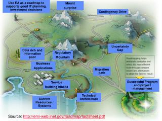
In order to built INSPIRE & SEIS, we need: Institutional framework: Collaboration & Co-ordination The KEYS • Infrastructure: • Technical Standards • Architecture Fundamental data sets Information Services
INSPIRE Directive (2007/2/EC)*:Into Force 15/5/2007 General Provisions • INSPIRE lays down general rules to establish an infrastructure for spatial information in Europefor the purposes of Community environmental policies and policies or activities which may have an impact on the environment. • This infrastructure shall build upon infrastructures for spatial information established and operated by the Member States. • INSPIRE does not require collection of new spatial data – electronic format • INSPIRE does not affect Intellectual Property Rights or statistical confidentiality * http://eur-lex.europa.eu
INSPIRE Scope • Spatial data held by or on behalf of apublic authority operating down to the lowest level of government when laws or regulations require their collection or dissemination • INSPIRE covers 34 Spatial Data Themes laid down in 3 Annexes – (required to successfully build environmental information systems)
INSPIRE - Data Sharing • Member States shall adopt measures for the sharing of data and services between public authorities for public tasks relating to the environment without restrictions occurring at the point of use. • Public authorities may charge, license each other and Community institutions provided this does not create an obstacle to sharing. • When spatial data or services are provided to Community institutions for reporting obligations under Community law relating to the environment then this will not be subject to charging. • Member States shall provide the institutions and bodies of the Community with access to spatial data sets and services in accordance with harmonised conditions. Implementing Rule
INSPIRE - Technical INSPIRE is a Framework Directive • Metadata • Interoperability of spatial data sets and services • Network services (discovery, view, download, transform, invoke) - European geo-portal • Data and Service sharing EU / MS • Coordination and measures for monitoring & reporting “Implementing Rules” for: “Implementing Rules” to adopt according to directive “roadmap” “Implementing Rules” bottom-up development with stakeholders
From Commission proposal to Community Directive implementation • Preparatory phase (2004-2006) • Co-decision procedure • Start of preparation of Implementing Rules • Transposition phase (2007-2009) • Directive entered into force 15 May 2007 • INSPIRE Committee starts its activities 26 June 2007 • Continuation of preparation of Implementing Rules • Transposition into national legislation • Adoption of Implementing Rules by Comitology • Implementation phase (2009-2013) • Implementation and monitoring of measures • Continuation of preparation of Implementing Rules • Adoption of Implementing Rules by Comitology
* = date proposed by Commission Roadmap forIR adoption(http://inspire.jrc.it/reports/transposition/INSPIRE_IR_WP2007_2009_en.pdf)
* = date proposed by Commission Roadmap(Implementation)
Commission Services co-ordinate INSPIRECommitteevotes EP Council scrutiny EC adopts INSPIRE Expert Groupadvises Proto-types test Pilotsvalidate MS apply Public reviews Projectscontribute CEN, ISO, OGC contribute Experts are proposed Review Formal Internet Consultation Draft Implementing Rules Implementing Rules Existing Reference Material Call for Interest EC Consolidation Team Drafting Teams LMOsre-view Spatial Data Interest Communities participate Association phase Drafting phase Review phase 2008 2005 2007 INSPIRE IR Development process
Work Programme 2007-2009 Implementing Rule development cycle Directive Requirements Reference materials Drafting of IR INSPIRE Drafting Teams Testing of draft IR INSPIRE Stakeholders (SDICs, LMOs): 1. Reference material 2. Experts 3. Projects Manage evolution of IRs Stakeholder/Public consultation Commission Decision Regulatory process INSPIRE Committee Commission inter-service consultation Open registration at: http://inspire.jrc.it/sdic_call/index.cfm
Results of the call for ExpertsOpened on 1 March 2005Experts registered per country
The INSPIRE EU Geoportal • Required by the INSPIRE directive (art.15) • Provides access to the Member States INSPIRE services • Development under EC responsibility • Aim to provide an operational platform to satisfy the requirements of the directive and IR • Geoportal dependent on the IR development • The INSPIRE Geoportal will be operated by the EC
Current & Future Developments • Alignment of metadata editor, search criteria and discovery with INSPIRE (draft) IR (2007-2009) • View services according to INSPIRE (draft) IR (2007-2010) • Multi-lingual (2007-2010) • Provide reference info to DTs (continuous) • feature catalogues, glossary etc • Download services, incl. security (2009-2011) • Registries (continuous) Under development at: http://www.inspire-geoportal.eu/
INSPIRE Governance Structures • The Commission (Article 22) • Shall be assisted by a Committee -> Comitology Procedure • Coordinating INSPIRE at Community level assisted by relevant organisations and, in particular, by the European Environment Agency • The Member States • Are members of the Committee (Article 22) • Contact points to the Commission supported by a coordination structure, taking account of the distribution of powers and responsibilities within the Member State. (Article 19) • Other Parties • European standardisation bodies (Article 20) • Representatives of Member States at national, regional and local level as well as other natural or legal persons, including users, producers, added value service providers or any coordinating body (Article 7) • The European Parliament and Council
Implementing INSPIRE • The implementation of INSPIRE needs to consider the broader context of existing initiatives which could contribute • The INSPIRE implementation should interface with those partnerships and initiatives where relevant and establish synergy* • SDIC bundle the human expertise of users, producers and transformers of spatial information, technical competence, financial resources and policies. Many SDIC exist today, generally organised by region, thematic issue or sector (industry). concept of Spatial Data Interest Communities (SDIC) *e.g. GEOSS, GMES, GALILEO, GSDI, Aarhus Clearing House?
Conclusions • Innovative dual approach • Top-down: INSPIRE is a framework Directive with implementing rules to be adopted in the coming years. • Bottom-up: Highest involvement of key stakeholders (through the “Spatial Data Interest Community” concept) needed for development, implementation and sustained operation • Openness and transparency in drafting implementing measures a must • Pilots and Projects important to define/validate the implementing rules • Links and interfaces with Community (GMES, eGov etc..) and other international initiatives (GEOSS, GSDI etc.) essential • Transposition of INSPIRE, within the fixed time, to National Legislation in each Member State is crucial • Urgent need of establishing coordinating bodies and structures to start INSPIRE implementation
SEIS is a collaborative initiative of the Commission, the EEA and MSs to establish an integrated, common, shared, multipurpose and sustained information system in Europe serving two main purposes: • improve the timely availability, sharing and quality of environmental data and information (or data impacting environmental policies) within Europe and provision of e-Government/e-Environment services to public policy makers and citizens; • offer to MSs and EU institutions an efficient reporting system to fulfil their reporting obligations related to Community environmental policies and legislation, avoiding duplication of efforts, overlapping and redundancies Therefore…the SEIS • A System where the public authorities are the providers but also the main end-users and beneficiaries
SEIS: Good Information, Good Decisions SEIS concept: • integrated but distributed web-enabled "system of systems" in which current systems based on reporting data and information (including documents) centrally are increasingly replaced by e-Reporting systems based on access, sharing and interoperability. • SEIS will be based on a distributed network virtual and institutional of public information providers(or other providers acting on behalf of public providers) for sharing environmental data and information. • It will be built incrementally upon existing infrastructures, systems and e-Services in both MSs and EU institutions, virtually interconnecting them and making them to 'talk to each other' (inter-operable).
SEIS: Good Information, Good Decisions Five issues as prerequisites for a good and efficient SEIS, meeting its objectives: • deployment of an efficient, interoperable infrastructure for on-line accessing and sharing data and information and provision of information services; • modernising the reporting requirements and systems with a view to developing a coherent, common and shared reporting system based on access, sharing and interoperability; • enhance quality and comparability of the data and information going into the SEIS system • availability of ‘interoperable’ methodologies (e.g. for integrated cross-sectoral assessments or risk assessment and forecast) and e-Governement services to seamlessly implement them (e.g. decision support systems); • "interoperability of policies", i.e. policy coherence.
SEIS: Good Information, Good Decisions INSPIRE and GMES: key partners in developing the SEIS • The effective implementation of the INSPIRE directive: main basis for delivering those aspects of the SEIS system that have to do with interoperability, sharing and access of spatial environmental data. • SEIS beyond INSPIRE: • non-spatial data and non-numerical information • provision of information services related to a coherent reporting system and e-Government/e-Environment to support decision making and inform the citizens. • The GMES would contribute to SEIS with the provision of e-Environment services such as the fast track services in Land, Marine, Emergency Response which will allow to turn quickly and seamlessly data to policy relevant information (e.g. information integration for indicators and enabling integrated assessments How about UNECE Clearing House?
Communication on SEIS: From Concept to Reality SEIS: Good Information, Good Decisions • Will set out overall framework/ vision for an integrated Shared Environmental Information System • Concrete measures in the Communication: • Carefully monitor INSPIRE implementation and GMES further development to fit real needs • Early revision of standardised reporting directive (before November 2008) • Assessment of potential to further harmonise in-situ monitoring • EEA to make SEIS centre of its strategy for fulfilling its mandate • Allocation of Community funds (LIFE+, structural) Adoption in January 2008
Conclusions 1 • INSPIRE & SEIS are ‘tools’ for developing, implementing and monitoring environmental policies more timely and more cost-efficiently • Their benefits will be tangible for all levels of society • INSPIRE is a Directive developed by – and for the benefits of the stakeholders – the bottom-up approach
Conclusions 2 • INSPIRE includes also a technical framework with implementing rules developed and adopted in the coming years • INSPIRE is an essential pillar, a first step, of a broader vision for a European Shared Environmental Information System which includes the many applications for environmental management and reporting built on the INSPIRE foundations • There is a lot of scope for collaboration between UNECE Clearing House and INSPIRE/SEIS • More info at: http://inspire.jrc.it, www.ec-gis.org; ENV-SEIS@ec.europa.eu
SEIS data and information content data and information required by : • EC Environment legislation, existing or upcoming • State of the Environment Information (including information provided voluntarily) –EEA’s data flows • Data collected in the context of International environmental conventions in which the EU is a party • Environment-related information and data collected/required by other EC policies . • The ambition of SEIS however is to develop a flexible infrastructure that would allow other data collections, flows and systems beyond the above four categories to ' plug in' on the basis of mutual benefits.
SEIS Information Services • E.g. of Information Services for Public Policy Makers and Citizens that can ‘plug in’ to SEIS/INSPIRE infrastructure: • Software applications implementing in a transparent and traceble way methodologies for integrated assessments across policy domains (DPSIR : driving forces, pressures, state, impact, response), integrated assessment of ecosystems and of climate changes. • Decision support systems for assessment of environmental impacts of big infrastructures/installations taking into account also socio-economic aspects). • Dissemination and public information portals on DPSIR, geo -referenced emergency alerting systems-, forecasting of risks . • Automated report generators etc: to decrease the administrative burden of MSs from reporting obligations to EC


![Designing with Empathy [Breaking Development Nashville 2013]](https://cdn4.slideserve.com/7565465/designing-empathy-dt.jpg)