Download
1 / 15
150 likes | 160 Views
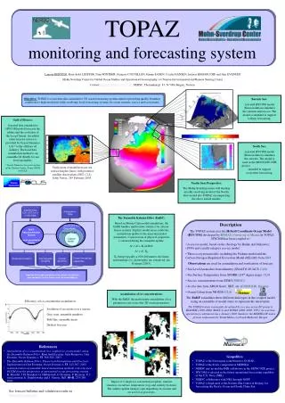
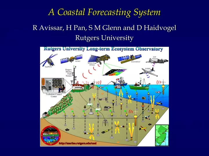
A Coastal Forecasting System. R Avissar, H Pan, S M Glenn and D Haidvogel Rutgers University. Regional Atmospheric Modeling System (RAMS) Pielke et al., 1992, Meteor. Atmos. Phys. , 49 , 69-91.

E N D
A Coastal Forecasting System R Avissar, H Pan, S M Glenn and D Haidvogel Rutgers University
Regional Atmospheric Modeling System (RAMS)Pielke et al., 1992, Meteor. Atmos. Phys., 49, 69-91 • 3D, non-hydrostatic, compressible dynamic equations, thermo-dynamic equation, and set of microphysical equations; • C-Grid, Terrain-Following Coordinate System; • 2-way interactive multi-grid nesting capability; • Numerical scheme: Leapfrog in time, second and higher order in space, … • 4DDA (NCEP or ECMWF reanalysis or Forecasts, or network of radiosondes,…); • Boundary conditions: • Lateral (cyclic, radiative, constant flux, ...); • Top (rigid lid with Raleigh friction absorption layer, …); • Bottom (land-surface parameterization, imposed fluxes or surface temperature and humidity, free slip, …); • Physics and subgrid-scale parameterization: • Turbulence (Mellor-Yamada , Deardorff, K profile); • Radiation (Chen and Cotton, Mahrer and Pielke); • Land system (Kessler and Tremback, Avissar and Pielke, …).
Numerical Experiment • Seven 3-days forecasting cycles: July 8-11; July 11-14; July 14-17; July 18-21; July 21-24; July 25-28; July 28-31, 1999; • Two nested grids in the atmosphere (33 levels, varying from 10 m near the surface to 1,000 m near the tropopause): • Grid A: 64x54 elements (16x16 km each); • Grid B: 114x114 elements (4x4 km each); • Time step is 30 s and 60 s in the atmospheric module; • Initial and Boundary Conditions: • Atmosphere: NCEP Eta reanalysis at initialization; 48-hour Eta forecast for lateral boundary conditions, and AVN forecast for the following 48-72 hours; • Sea-surface temperature derived from AVHRR composite in the day prior to initialization.
Conclusions The results from the extensive field campaign carried out in July 1999 indicate that the RAMS predicts quite accurately weather conditions in the Northeastern US, including the coastal region; Wind intensity and direction, air temperature and humidity are significantly affected by SST and LST (or DT between land and sea). Conversely, marine coastal circulation are strongly affected by the atmosphere. This emphasizes the need to develop a fully interactive coastal ocean-land-atmosphere modeling system to simulate coastal processes. A preliminary version of such a coupled model has been developed and applied to a lake. It proved to be quite reliable.