Download
1 / 26
260 likes | 265 Views
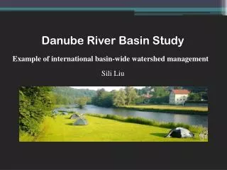
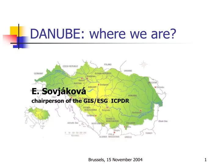
DANUBE: where we are?. E. Sovjáková chairperson of the GIS/ESG ICPDR. Danube River Basin (DRB). The second largest river basin of Europe 18 states including EU-Member States (AT, CZ, DE, HU, IT, PL, SK, SI) Accession Countries (BG, HR, RO) other states (AL, BA, MK, MD, CS, CH, UA)

E N D
DANUBE: where we are? E. Sovjáková chairperson of the GIS/ESG ICPDR Brussels, 15 November 2004
Danube River Basin (DRB) • The second largest river basin of Europe • 18 states including • EU-Member States (AT, CZ, DE, HU, IT, PL, SK, SI) • Accession Countries (BG, HR, RO) • other states (AL, BA, MK, MD, CS, CH, UA) • Convention on Cooperation for the Protection and Sustainable Use of the Danube River (DRPC) Brussels, 15 November 2004
Delineation of the Danube River Basin District (DRBD) • DRB • the coastal basins of the Black Sea tributaries lying on Romanian territory • coastal waters of the Black Sea Brussels, 15 November 2004
Overview map of the DRBD Brussels, 15 November 2004
When the GIS task starts? How to implement the EU Water Framework Directive • Organisation measures in 2000 • Forming RBM Expert Group (RBM EG) • Forming GIS Expert Sub-Group (GIS ESG) The work plan of the GIS ESG is a part of the work plan of the RBM EG Brussels, 15 November 2004
Advantages of the GIS ESG Mighty backing: • Permanent Secretariat of International Commission for the Protection of the Danube River • Support of the Contracting Parties to the DRPC (the European Community is also a Contracting Party) • Support of UNDP DRB Project • working with web Brussels, 15 November 2004
Common GIS, unavoidable part of common implementation for the water framework directive They were identified: • Essential needs • Problems • Steps to solution of short-time problems Brussels, 15 November 2004
Short-time problems • Making ready common maps to Roof report, part A • Preparing a review of data sources in participating countries • Preparing a review of national GIS capabilities • Working out a recommendation how to continue • Financial securing of those activities Brussels, 15 November 2004
Financing • Preparation of basic data will be financed by member states • UNDP DRB project goal – its financial backing allows: • Compiling common maps for Roof Report, part A • Preparing consulting papers • Start of Project: The Development of a Danube GIS for WFD implementation Brussels, 15 November 2004
Sources of the ICPDR Contracting parties National geoinformation infrastructure Expert groups of the ICPDR (RBM, EMIS, MLIM, APC ECO, FP) Brussels, 15 November 2004
Other significant outsourcing • Direct dealing with EuroGeographics • Evaluation licence assistance to EGM product, version 1.0 • First term of evaluation report: April 2004 • Evaluation licence assistance, version 1.1 • Second term of evaluation report: November 2004 • EGM user license requirements Brussels, 15 November 2004
Placing an order to common maps compilation Compilatory subject: FLUVIUS, Vienna Result: 16 overview maps of the Danube River Basin District • Overview • Relief and Topography • Annual Precipitation • Surface Water Bodies • Significant Point Sources of Pollution Brussels, 15 November 2004
Placing an order to common maps compilationCompilatory subject: FLUVIUS, ViennaResult: 16 overview maps of the Danube River Basin District • Land Use • Major Hydraulic Structures • Potential Accident Risk Spots • Old Contaminated Sites in Potentially Flooded Areas • Heavily Modified Surface Waters of Basin-wide Importance • Risk of failure to reach the Environmental Objectives – Organic Pollution Brussels, 15 November 2004
Placing an order to common maps compilationCompilatory subject: FLUVIUS, ViennaResult: 16 overview maps of the Danube River Basin District • Risk of failure to reach the Environmental Objectives – Hazardous Substances • Risk of failure to reach the Environmental Objectives – Nutrient Pollution • Risk of failure to reach the Environmental Objectives – Hydro morphological Alterations • Important Transboundary Groundwater Bodies • Water-related Protected Areas for Species and habitats of Basin-wide Importance Brussels, 15 November 2004
Consultation ordering • Compilatory subject: KTH, Department of Land and Water Resources Engineering, Stockholm • Results: • User Needs Assessment • GIS Hardware and Software Considerations • Evaluation of EuroGlobalMap • Conceptual Design of the Danube GIS/DANUBIS Brussels, 15 November 2004
Different addressees, different needs • RBM on the basin wide scale • Information about results of the first analysis • Information on the progress of WFD implementation Brussels, 15 November 2004
Open questions • Are common maps sufficiently detailed? • To whom will the created maps serve? • Represent the created layers a good foundation to future grow of the common GIS? • To what goal it should serve? • Do our work impulses to GIS expanding in member states? • What we find out? • Common coding system of hydro geographic features Brussels, 15 November 2004
More detailed analyse necessaryBackground documents – in discussion Brussels, 15 November 2004
Results of the GIS/ESG For background discussion: • Assessment of the national GIS capabilities • Issues of Reference Geographical Data to the GIS supporting WFD and their rational solution Brussels, 15 November 2004
Changes of the national GI No hitch but substantial changes of geoinformation infrastructure Example: the Czech Republic Brussels, 15 November 2004
Agreement about DRB GIS project principles Strategic Plan for the development of the Danube River Basin GIS May 2004, GIS ESG June 2004, RBM EG Brussels, 15 November 2004
Agreement about DRB GIS project principles • ToR Term of reference and steps for implementation (July 2004) • Decision to place an order of the project to UBA Austria • Base Document (February 2004) • Start of work (August 2004) Brussels, 15 November 2004
Two parts of the project • Expected results: Inception Report Day to day mode of collaboration Periodical progress meeting • Work plan: Inception Report - September 2004 Final Report - February 2005 Brussels, 15 November 2004
Further questions in viewContinuing • WFD reporting Dec. 2006 and Dec. 2009 requirements • Resolution of the DRB GIS • Common system of codes of the hydrological features (rivers, sub-basins, water bodies) • Transboundary data needs • Forcing development of the national water information systems Brussels, 15 November 2004
Further questions in viewNew • ISO standards for quality assurance • Accessibility of data • Harmonisation of tools for basic measurements (sizing of area, length rivers • CORINE Land Use – how to deal with remote sensing imagery • Statistical methods Brussels, 15 November 2004
If you need further information go to the Internet address www.icpdr.org Brussels, 15 November 2004