Download
1 / 25
290 likes | 542 Views
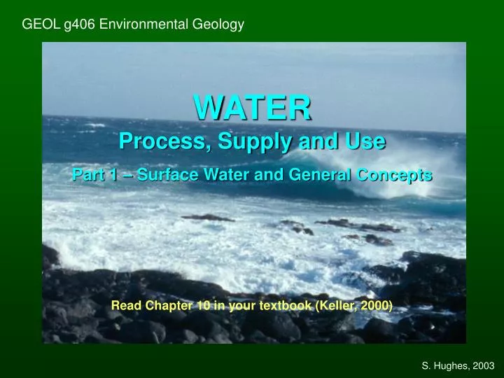
GEOL g406 Environmental Geology. WATER Process, Supply and Use Part 1 – Surface Water and General Concepts Read Chapter 10 in your textbook (Keller, 2000). S. Hughes, 2003. Water on Earth. Types of water: Surface water = water in rivers , lakes , oceans and so on.

E N D
GEOL g406 Environmental Geology WATERProcess, Supply and Use Part 1 – Surface Water and General Concepts Read Chapter 10 in your textbook (Keller, 2000) S. Hughes, 2003
Water on Earth • Types of water: • Surface water = water in rivers, lakes, oceans and so on. • Subsurface water = groundwater, connatewater, soil • moisture, capillary water. • Groundwater exists in the zone of saturation, and may be • fresh or saline. • Meteoric water = water in circulation. • Connate water = "fossil" water, often saline. • Juvenile water = water from the interior of the earth. • QUESTIONS: • Which of these can be or is polluted in some places? • Which of these are used most by humans? • What is the relative residence time of water in each one? • Read Tables 10.1 and 10.2 in the textbook. GEOL g406 Environmental Geology S. Hughes, 2003
The Earth’s Water Supply Usable water - 0.3% Unusable water - 99.7% (oceans, ice caps, glaciers) Rivers Fresh-water lakes Ground water Although water is abundant on a global scale, more than 99% is unavailable for our use. A mere 0.3% is usable by humans, with an even smaller amount accessible! The oceans, ice caps, and glaciers contain most of the Earth’s water supplies. Ocean water is too saline to be economically useful, while glaciers and ice caps are "inconveniently located." S. Hughes, 2003
GLOBAL WATER SOURCE AND VOLUME Water source Water volumePercent ofTotal (in cubic km) Oceans1,230,000,00097.2% Icecaps, glaciers28,600,0002.15% Groundwater8,300,0000.61% Fresh water lakes123,0000.009% Inland seas104,0000.008% Soil moisture67,0000.005% Atmosphere 12,7000.001% Rivers 1,2000.0001% Total Water Volume1,360,000,000100% SOURCE: USGS, 1984, The Hydrologic Cycle – Pamphlet GEOL g406 Environmental Geology S. Hughes, 2003
Global Cycle of Water Movement Annual flow of water on earth in thousands of km3 Figure from Keller (2000) 1. Evaporation from oceans 2. Precipitation to oceans 3. Transfer of water from atmosphere to land 4. Evaporation from land to atmosphere 5. Precipitation to land 6. Runoff of surface water and groundwater from land to oceans GEOL g406 Environmental Geology S. Hughes, 2003
Figure from Keller (2000) Surface runoff plays an important role in the recycling process. Not only does it replenish lakes, streams, and groundwater; it also creates the landscape by eroding topography and transporting the material elsewhere. S. Hughes, 2003
Factors Affecting Surface Runoff Runoff = a function (ƒ) of geology, slope, climate, precipitation,saturation,soil type, vegetation, and time. Geology includes rock and soil types and characteristics, as well as degree of weathering. Porous material (sand, gravel, and soluble rock) absorbs water far more readily than does fine-grained, dense clay or unfractured rock. Well-drained material (porous) has a lower runoff potential, and therefore has a lower drainage density. Poorly-drained material (non-porous) has a higher runoff potential, resulting in greater drainage density. Drainage density is a measure of the length of channel per unit area. Many channels per unit area means that more water is moving off of the surface, rather than soaking into the soil. GEOL g406 Environmental Geology S. Hughes, 2003
Figure from Keller (2000) Drainage basinsor watersheds have different shapes and sizes. Large drainage basins are usually divided into smaller ones. Size and shape have a direct effect on surface runoff. GEOL g406 Environmental Geology S. Hughes, 2003
DRAINAGE BASINS • Long, narrow drainage basins generally display the most dramatic effects of surface runoff. They have straight stream channels and short tributaries. • Storm waters reach the main channels far more rapidly in long narrow basins than in other types of basins. • Flash floods are common in long, narrow drainage basins, resulting in greater erosion potential. • Topography (relief) andslope (gradient) affect water velocity, infiltration rate, overland flow rate, and subsurfacerunoffrates. • Precipitation (type, duration, and intensity) is the key climatic factor. Infrequent torrential downpours easily erode sediment-laden topography, while soft drizzly rain infiltrates the soil. • Vegetation aids slope stability. Removal of vegetation by fire, clear-cutting (logging), or animal grazing often results in soil erosion, adding to the sediment load. S. Hughes, 2003
2 1 3 Figure from Keller (2000) • Throughflow = shallow subsurface flow above the water table • Requires good infiltration capacity • Common in humid climates with thick soil layers and good vegetation cover. • Overland flow occurs when precipitation > infiltration rates. • Rejected infiltration = due to saturated soil conditions • Common in semi-arid regions, and in clay-rich soil layers.
Stream Transport Types of sediment = dissolved load, suspended load, and bed load. Dissolved Load: Chemical weathering of rocks produces ions in solution (examples- Ca2+, Mg+, and HCO3+). High concentrations of Ca2+ and Mg+ are also known by another name - hard water. Suspended Load: Fine sediment, mostly clay and silt, makes water look cloudy or opaque. The greater the amount of sediment, the muddier the water. Bed load: Coarse sediment (silt- to boulder-sized, but mostly sand and gravel) settles on the bottom of the channel. Bed load sediment moves by bouncing or rolling along the bottom. The distance that bed load travels depends on the velocity of the water. GEOL g406 Environmental Geology S. Hughes, 2003
Use of Surface Water • Surface water use includes instream and offstream uses. • Offstream use either removes or diverts the water. Consumptive use, a form of offstream use, is water used by industry, irrigation, and households. Eventually, water is returned to the stream or groundwater system. • Instream use is not removed or diverted. Examples of instream use include cooling, navigation, salmon runs, and fishing. Desalination is the removal of salt from seawater. It is a very expensive process (~ 10 times that paid for traditional water supplies) and is considered a last resort alternative. GEOL g406 Environmental Geology S. Hughes, 2003
Water Budget for the Conterminous United States Figure from Keller (2000) GEOL g406 Environmental Geology S. Hughes, 2003
Instream Water Use Figure from Keller (2000) • Discharge is the amount of water passing by a particular location • measured in cubic meters per second (cms) GEOL g406 Environmental Geology S. Hughes, 2003
Conserving and managing water Frequently population density and major water supplies do not coincide. Therefore, water must be transported great distances to the consumers. California is a good example. Population density is greatest in the lower 2/3 of California, south of San Francisco, while water supplies are greatest in the upper 1/3. Major water diversion projects were implemented to transport water to densely populated areas. Los Angeles and Owens Valley (opposite sides of the Sierra Nevada) are fighting over water rights. This has been an ongoing problem since the early 1900’s! The LA-Owens River Aqueduct was constructed, completed in 1913. So much water has been diverted to LA that the Owens Valley has suffered from desertification (transformed into a more desert-like environment). By limiting water diversion, environmental degradation may be reduced. S. Hughes, 2003
California Aqueducts and Irrigation Canals • The construction of each canal or aqueduct represents diversion of water runoff. • Many regions that were once supplied by water from mountains lost water rights. • Most water goes to large cities, such as Los Angeles, and to large corporations that produce fruits and vegetables. • Much of the land has been desertified in the process. Figure from Keller (2000) GEOL g406 Environmental Geology S. Hughes, 2003
Conserving and managing water As our population increases, the need for water conservation and management also increases. An example of river management is the Colorado River. The Colorado River is the most regulated river in the U. S. Numerous dams, reservoirs and canals are "part of" the Colorado River system. The Colorado basin encompasses parts of Wyoming, Colorado, Utah, New Mexico, Arizona, California, and Mexico. All want their fair share of water! Thus, water management is important. Equally important is water quality. Salinity, a by-product of water flowing over salt beds, salt springs, and irrigation and evaporation, increases with distance downstream. A large desalination plant is under construction on the lower Colorado River, upstream from the Imperial Dam. After treatment, water should be of usable quality. Mexico would then be able to use it for agricultural purposes. S. Hughes, 2003
Upper basin Lower basin The Colorado River Basin Figure from Keller (2000) GEOL g406 Environmental Geology S. Hughes, 2003
Colorado River Water (see Table 10.7) • Legal and actual distribution of water: • Legal Actual • Entitlement Distribution • STATE (106 ac ft/year) (106 ac ft/year) • California 4.400 4.400 • Arizona 3.800 2.050 • Nevada 0.300 0.300 • Lower Basin 8.500 6.750 • Colorado 3.881 2.406 • Utah 1.725 1.070 • Wyoming 1.050 0.651 • New Mexico 0.844 0.523 • Upper Basin 7.500 4.650 • Mexico 1.500 1.500 • TOTAL 17.500 14.500 S. Hughes, 2003
Wetlands Not too long ago, wetlands had a bad image. Wetlands were just dank, murky swamps. Fortunately, we now realize wetlands have a vital role in our environment. Wetlands are a natural filter system. Wetland plants remove toxins from water and sediment. Freshwater wetlands act as sponges and soak up excess water, reducing flood conditions. Coastal wetlands are buffer zones. They reduce the erosion impact of storms and high waves. Wetlands also provide a habitat for numerous wildlife and plant species. S. Hughes, 2003
AQUEOUS SOLUTION GEOCHEMISTRY - 1 • Acid = substance containing hydrogen which gives free hydrogen (H+) when dissolved in water • Base = substance containing the OH group that yields free (OH-) when dissolved in water • An acid solution is one containing an excess of free H+, and a base is one containing excess of free OH-. A reaction between an acid and a base is usually called neutralization. • For example: • HCl (acid) + NaOH (base) H2O + NaCl • which are dissociated into ions:H+ + Cl- + Na+ + OH- H2O + Na+ + Cl- • i.e. Na+ and Cl- are unaffected. GEOL g406 Environmental Geology S. Hughes, 2003
AQUEOUS SOLUTION GEOCHEMISTRY - 2 • pH = inverse log of the concentration (activity) of free H+ • pH = -log [H+] • Important: Water dissociates into H+ and OH- • Dissociation constant: Kwater = [H+] [OH-] =10-14 • NOTE: There must be 10-7 moles each of H+ and OH- in a kilogram of neutral solution at standard temperature of 25°C. One mole is 6.023 x 10²³ atoms (or molecules) and H2O has a molecular weight of 18 grams per mole. One kilogram of water has about 1000/18 = 55.6 moles of water or about 3.35 x 1025 atoms of oxygen. It has about twice that number (6.7 x 1025 atoms) of H+ (the amount of free H+ or free OH- is relatively small compared to the amount of undissociated H2O). • pH ranges at 25°C from 0 to 14; pH < 7 = acidic solution; pH > 7 = basic solution. If and acid such as HCl is added then pH decreases; if a base such as NaOH is added then pH increases. GEOL g406 Environmental Geology S. Hughes, 2003
AQUEOUS SOLUTION GEOCHEMISTRY - 3 • pH increases as carbonic acid (a weak acid) dissociates: When carbon dioxide combines with water, such as what happens in the atmosphere when fossil fuels are burned, carbonic acid is formed: H2O + CO2 H2CO3. Free H+ are made available during successive dissociations: • H2CO3 H+ + HCO3- carbonic acid to bicarbonate • occurs at pH ~6.4 • HCO3 H+ + CO32- bicarbonate to carbonate • occurs at pH ~10.3 • Remember, free H+ is available only when acidic, or when pH < ~7. The dissociation of bicarbonate to carbonate occurs when there is too much OH- in the system and H+ is "released" to balance out the base. GEOL g406 Environmental Geology S. Hughes, 2003
AQUEOUS SOLUTION GEOCHEMISTRY - 4 • Cations= electron donors, positive charge: Na+, K+, Mg++, Ca++, Fe++ or Fe+++, Mn++, Al+++ • Anions = electron acceptors, negative charge: Cl-, F-, I-, Br-, SO4--, CO3--, HCO3-, NO3--, NO2- • Metals = act like cations mostly: Cu, Zn, Pb, Co, Ni, Cr, As, Se, Mo, etc. • Water Analyses - Need to have cation-anion balance • millequivalent (MEQ) = mole equivalent charge or anion or cation, measure of total charge due to the ion dissolved in the solution: MEQ = XX mg/L / MW x CHG • Example: NaCl in solution, Na = 50 mg/L (50 ppm): 50/23 x 1 = 2.17 MEQ; and Cl = 77 mg/L (77 ppm): 77/35.5 x -1 = -2.17 MEQ • So, if the total cation and anion MEQ’s are not balanced, some error exists in the analysis. S. Hughes, 2003
WATER (surface and ground water) • antecedent water • aquifer • artesian well • base flow • bed load • capillary fringe • climate • cone of depression • connate water • drainage basin • drainage density • dissolved load • erosion • evaporation • groundwater • hydrologic cycle • infiltration • irrigationion • irrigationion • juvenile water • overdraft • overland flow • meteoric water • precipitation • runoff • saturation • slope • suspended load • topography • transpiration • throughflow • vadose zone • water quality • water table • watershed • wetland TERMS FOR UNDER- STANDING S. Hughes, 2003