Download
1 / 60
610 likes | 762 Views
Databases in Soil Survey. Objectives. Identify databases used for population, analysis, and publication of soils data Understand concepts in NASIS 6.x Identify correlation procedures used in the NASIS database to create fully reversible correlation. Soil Databases.

E N D
Objectives • Identify databases used for population, analysis, and publication of soils data • Understand concepts in NASIS 6.x • Identify correlation procedures used in the NASIS database to create fully reversible correlation
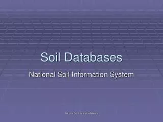
Soil Databases • Soil Characterization Database (NSSL) • National Soil Information System (NASIS) • Pedon PC (access db) • Analysis PC (access db) • Official Series Descriptions (OSDs) • Soil Classification Database (SC) • Soil Survey Geographic Database (SSURGO) • Spatial (ArcGIS) • Staging Server • Soil Data Warehouse • Soil Data Mart • SSURGO template (access db) • U.S. General Soil Map (STATSGO)
Pedon Description Lab Data Properties Interpretations
Field digitizing Spatial Data Product Development Pedon Data NASIS 6.x Transactional database NSSL Data National Soil Information System
Soil Properties for Modelers • drainage class • ecec • fine sand separate • flooding duration class • flooding frequency class • geomorph feat name • geomorph feat type name • horizon depth to bottom r • horizon depth to top r • horizon designation • horizon thickness • hydrologic soil group • kf factor • kw factor • layer depth • linear extensibility percent • map unit symbol • mapunit acres • mapunit name • organic matter percent l, rv, h • particle density • ph 01m cacl2 • ph 1to1 h2o • pore quantity, shape, size • restriction depth to top h • restriction depth to top l • rock frag 3 to 10 in • rock frag > 10 • sand coarse separate • sand total separate • sat hydraulic conductivity • sieve number 4 • silt total separate • slope l, h • soil texture and modifier • sum of bases • t factor • water fifteen bar r • water one tenth bar • water one third bar • water satiated • albedo dry • area name • area symbol • area type name • base saturation • bulk density fifteen bar • bulk density one third bar • bulk density oven dry • caco3clay ratio • calcium carbonate equivalent • cec nh4oac ph7 • clay total separate r • coarse fragment volume • comonth.month • component interp • component restriction • component kind • component name • component percent r • cosoilmoist.soimoiststat • cosoimoistdept l
Data Management • Point data is collected then populated using PedonPC or NASIS • Soil boundaries are captured or modified • Many methods are available to analyze data • After data is collected, compiled, and analyzed, the map unit concept is built • Soil property estimates are developed based on the population used for the map unit concept
Data Entry • The first basic correlation decision is made when you decide to record a complete or partial pedon description or a field note. • This data is populated into: • NASIS • Pedon PC
Data Analysis • NASIS • Pedon PC • Analysis PC • Excel • Access • Word
NASIS Analysis Filtering Point data in NASIS6
Pedon Analysis Analysis PC is designed to analyze pedons from NASIS to gather data in building components
Analysis PC • Established relationships among the tables • Built in queries available for use • New queries easily written or imported • Can use access queries or form analysis • Can analyze data in the spatial world • Can be joined with other Access databases for further analysis
Results Table columns can be moved or hidden as in any other Access table. Choose fields for statistics Statistics are only as good as the data in the selected set
Analysis PC and Spatial Data Map unit information • Analyzing map unit and pedon data Point data information
NASIS 6.x Concepts • Client/Server application • Mapunit object • Independent of a legend • Mapunits are now linked (shared) • National Mapunit Symbol • Project object • Technical Soil Services object
NASIS • NASIS is the transactional database for soil survey activity • NASIS provides the ability to electronically populate, compile, and analyze soil data • NASIS data builds soil interpretations
Creating a new map unit • Insert a row in the map unit table • Populate the new name, kind and status • Open the child tables and populate the Mapunit History table • Create a new DMU • Link the new DMU to the map unit via the correlation table • After correlation, link the new map unit to the legend(s) in which it is mapped
New Mapunit Bold font is required field New symbol Row status Add new row
Document History First step is to populate Mapunit History table
Link Mapunit and Datamapunit Choice list allows for filtering of data to easily identify new DMU
Link Mapunit to a Legend Publication Symbol Choice list allows for filtering of data to easily identify new MU
Fully Reversible Correlation • All decisions recorded in NASIS • Map Unit correlation documentation • changing map unit name • changing map unit status • changing map unit symbol • combining map units • splitting map units
Recording Correlation Decisions • Changing map unit name Changes are recorded in the Mapunit History table.
Correlation Decisions Any time a correlation decision is made on a map unit it is documented in the Mapunit History table Insert new row in Mapunit History table Enter previous name and status; open text editor and document
Recording Correlation Decisions • Changing map unit status Changes are recorded in the Mapunit History table.
Map Unit Status • Provisional – initial map unit concept • Approved – Map unit concept approved by MLRA Project Leader and SDQS • Correlated – Signed correlation document (initial) by MO Leader and State Conservationist • Additional – replaced by another map unit concept
Recording Correlation Decisions • Combine map units • Changes are recorded in the Mapunit History table. Combine unit 4B consociation into unit 21B complex
Combining map units First step is to load/identify the map units in the mapunit table. The map units are highlighted, then using the icon (load related), the parameter box appears and the Mapunit table is chosen from the choice list. This will load the two map units in the Mapunit table.
Combining map units Combine unit 4B consociation into unit 21B complex What legends are these map unit linked to? Where’s Waldo???
Combining map units Editing is required to insert a DMU link into the Correlation table. Therefore, the data must be “checked out”.
Combining map units • Copy the DMU link from the 4B consociation map unit and Paste into 21B complex map unit. • Then make sure the REP DMU box is not checked for the 4B consociation DMU. • Change the 4B consociation map unit to “additional”
Combining map units Load the related Data Mapunit and adjust the Component percentages to reflect the new map unit concept.
Combining map units Return to the Legend table. Notice that the map unit Status is changed in the Legend Mapunit table. Any changes made to a map unit impact those Legends where the map unit is linked. How can you identify those Legends that will be impacted?
Record Correlation Decisions Populate the Mapunit History table Type note
Spatial Objectives Recognize the importance of using geospatial tools in assisting with correlation activities.