Download
1 / 22
220 likes | 344 Views
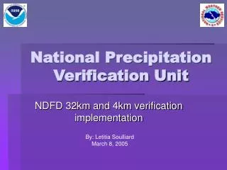
National Precipitation Verification Unit. Letitia L. Soulliard RSIS & NOAA/NWS/OCWWS. RFC Verification Workshop August 15, 2007 Salt Lake City, UT. What is the NPVU?. N ational P recipitation V erification U nit

E N D
National Precipitation Verification Unit Letitia L. Soulliard RSIS & NOAA/NWS/OCWWS RFC Verification Workshop August 15, 2007 Salt Lake City, UT
What is the NPVU? • National • Precipitation • Verification • Unit • Verifies the QPF from the NGM, NAM, GFS, HPC, Conus RFCs, Conus WFO’s (NDFD), and Puerto Rico (NDFD)
Who oversees the NPVU? • Office of Climate, Water, and Weather Services • Performance Branch (Douglas Young) • Located at : • Hydrometeorological Prediction Center/NCEP (Ed Danaher)
What is the History of the NPVU? • 32km Verification – Started October 2000 • Eastern RFCs • Had day 1 totals starting in August 2000 • Had 6hr amounts starting October 2000 • Western RFCs • CN and CB started in November 2000 • NW started in January 2001 • Mosaic of all RFCs • Started January 2001 • NDFD • Conus WFO’s - Started October 2004 • Puerto Rico – Started June 2005 • 4km Verification – Started October 2004
How does the NDFD relate to the RFC data? • It doesn’t • Different domain areas make it impossible to directly compare • Both are individually compared to HPC and the models but not to each other
Why should you use the NPVU’s products? • To see if there is an improvement over HPC’s forecast • To see if HPC is improving upon the models • To see which model might be better for each season or for each RFC area • To view QPF products for other RFCs and view continuity issues
What are the different NPVU Products found on the web? • QPF Verification Statistics • Comparison Plots • RFC “Live” Data • Archive Data • RFC QPE • HPC QPF • Offline request form
What is verified by the NPVU and when is it updated? • 12Z QPF for RFCs, WFO’s and HPC • 00Z QPF for Models • Updated Once a Month approximately around the 10th for the previous month • E-mail notification
How does the data get from the RFCs to the NPVU? RFC’s QPF & QPE Network Control Facility AWIPS WAN SBN dbnet Offices of Systems Operations IBMSP NPVU FTP
How are the forecast and observation grids modified in order to be compared?
What statistical scores are calculated by the NPVU? NPVU Statistics 32km / 4km Categorical Contingency Table Continuos Both, Obs, For Graphs Bias POD FAR TS ETS Threshold Distribution Text HSS Graphs ME MAE RMSE Volume Bias Interval Distribution Text x and of For and Obs Bias of the Envelope for Categories Reduction of Variance Linear Correlation Coefficient Threshold Values (in.) X >= 0.01 X >= 0.10 X >= 0.25 X >= 0.50 X >= 1.00 Interval Values (in.) 0.00 <= X < 0.01 0.01 <= X < 0.10 0.10 <= X < 0.25 0.25 <= X < 0.50 0.50 <= X < 1.00 1.00 <= X
What do all these numbers really mean? • Online Help Guide • http://www.hpc.ncep.noaa.gov/npvu/help/
What is the difference between the Continuous Interval Types? • Observed – Forecast Pair • Obs: 0.2” • For: 0.3” • Observed Only • Pair is put in A • Forecast Only • Pair is put in B • Observed and Forecast (Both) • Pair is put in A & B A 0.10 – 0.2499 B 0.25 – 0.499
How are Categorical Scores Calculated? • Contingency Table • High-Low Misses
What are some common confusions about the NPVU statistics? • What verification periods are covered? • All verification is done at 6hr intervals • Day 1 is four 6hr periods • Why create an interval distribution graphic? • Important for identifying how significant the statistics really are
What constraints are there in the statistics? • Small sample sizes can result in anomalous scores • The eastern RFCs differ from the western RFCs due to Mountain Mapper • Re-mapping can introduce small discrepancies
Eastern RFCs ABRFC LMRFC MARFC MBRFC NCRFC NERFC OHRFC SERFC WGRFC Western RFCs CBRFC CNRFC NWRFC APRFC Which RFCs are considered eastern and which are western?
Eastern RFCs 00Z and 12Z Forecast 18Z forecast AB, MA, MB and NC RFC Forecast out to 24hr Some forecast more (but not verified) QPE are stage III multi-sensor data Western RFCs 12Z forecast ONLY (due to MM restrictions) Forecast out to 72hr (and verified) QPF is made for points QPE is gauge data Both are gridded using Mountain Mapper What are the differences between the Eastern RFCs and the Western RFCs?
What is Mountain Mapper and how does it affect the NPVU's product/process? • Developed at CBRFC to convert point data into gridded data • Uses PRISM precipitation Climatology • Since both QPE and QPF are run through this they are both “biased” toward the climatology where as the models and HPC are not
What is the NPVU doing about this Mountain Mapper Issue? • HPC provided forecast run through Mountain Mapper • For the CNRFC, CBRFC, and NWRFC areas • Since January 2003 • Statistics have been run for each month, warm and cool season, and annual • Mountain Mapper has not improved HPC’s forecast as much as expected
Thank You NPVU web site: • http://www.hpc.ncep.noaa.gov/npvu My e-mail • letitia.soulliard@noaa.gov