Download
1 / 10
100 likes | 222 Views
Land Cover & Vegetation Change, Pond 3 & Fagan Marsh, North Bay Area. Lacy Smith Geog 342 12/13/2010. Project Sites & Background. Objective. Pond 3: Can I assess Spartina foliosa colonization using true color aerial photography? How has the pond land cover changed since restoration?

E N D
Land Cover & Vegetation Change, Pond 3 & Fagan Marsh, North Bay Area Lacy Smith Geog 342 12/13/2010
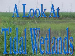
Objective • Pond 3: Can I assess Spartinafoliosa colonization using true color aerial photography? • How has the pond land cover changed since restoration? • Fagan Marsh: Can I isolate salt marsh channels using true color aerial photography?
Methods • ArcGIS • NAIP 2005, 2009 imagery for Solano and Napa counties • Site polygon outlines • Training set polygons -> spectral signatures • Pond 3: Spartinafoliosa, algae, water, mudflat • Fagan Marsh: channels, bare ground, marsh vegetation • Spatial Analyst • Multivariate • Maximum Likelihood Classification • Classification to image comparison
Pond 3 – final classification Land Cover % of Pond 2005 % of Pond 2009 Spartinafoliosa -- < 1 Algae 27 31 Water 64 54 Mudflat 9 15
Conclusions • Difficult to distinguish vegetation types using imagery with only 3 spectral bands • If you want it to be much more accurate essential to invest the extra money • Tidal channels with different water levels have too many spectral signatures that are similar to those of the vegetation and bare ground