Download
1 / 82
840 likes | 1.1k Views
Study Land Cover Change from Climate Model and Satellite Remote Sensing. Menglin S. Jin Department of Meteorology and Climate Science San José State University UC Davis, May 18 2011. Outline. 1. Rationale of this topic 2. Hypothesis for Regional Land Climate Change 3. Results

E N D
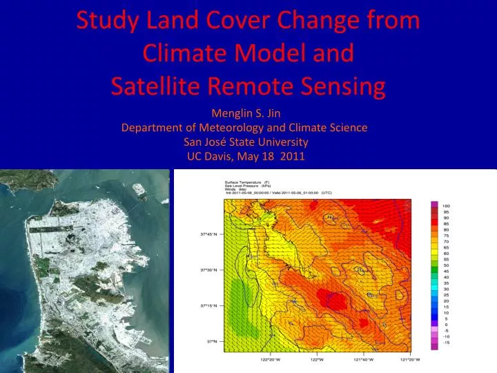
Study Land Cover Change from Climate Model and Satellite Remote Sensing Menglin S. Jin Department of Meteorology and Climate Science San José State University UC Davis, May 18 2011
Outline 1. Rationale of this topic 2. Hypothesis for Regional Land Climate Change 3. Results Global Regional – CA in 2000-2010 Local Scale – Urbanization Simulation CA Beijing -WRF-urban studies Aerosol Experiment Albedo Experiment 4. Future Directions
Based on 20 leading-author papers Jin, M. and R. E. Dickinson, 2010:Land Surface Skin Temperature Climatology: Benefitting from the Strengths of Satellite Observations. Environmental Research letters, 5 044004 Jin, M., J. M. Shepherd and W. Zheng, 2010: Aerosol Direct Effects on Surface Skin Temperature: A Study from WRF modeling and MODIS Observations. In press by Advances in Meteorology Jin, M. 2009: Greenland surface height and its impacts on skin temperature: A study using ICEsat observations. Advances in Meteorology. Volume 2009, Article ID 189406, doi:10.1155/2009/189406. Jin, M., and J. M. Shepherd 2008, Aerosol relationships to warm season clouds and rainfall at monthly scales over east China: Urban land versus ocean, J. Geophys. Res., 113, D24S90, doi:10.1029/2008JD010276.
Funded by -NSF Large-scale Dynamics and Climate Program (PI, co-PI: Robert Dickinson) -NASA Precipitation Program (PI-Marshall Shepherd, co-PI Jin, Steve Burain) - Dept of Defense Threat Reduction Agency (PI –Steve Burain)
Surface Temperatures Skin Temperature 2-m Air Temperature (Tsfc) (T2m) 1. Two Land Surface Temperatures in Climate Change
Global Land Surface Temperature Trend Skin Temperature Tsfs 0.43°C/decade 2-m Air Temperature T2m 0.23°C/decade (Jin and Dickinson 2002, GRL)
Regional climate have different changes Annual temperature trends (°C/decade), 1976-2000. (Folland et al., 2001, IPCC 2001) In a changing climate, we need to detect, understand, and predict regional climate change
2. Hypothesis for Regional Land Climate Change Large-scale Dynamics Mechanism ENSO, etc Clouds, Rainfall Satellite Observations AVHRR, MODIS, ICEsat Regional Land Climate Change Local Mechanism Land cover change Snow cover Soil moisture Climate Model Approach NCAR CAM/CLM, WRF Offline CLM, single column urbanization
Large-scale Dynamics Mechanism NAO, etc Clouds, Rainfall Jin 1999 Jin et al. 2005a Jin and Shepherd 2007 Satellite retrieval Tskin AVHRR, MODIS, ICEsat Jin 2006 Jin and Dickinson 1999, 2000 2010 Jin and Treadon 2003 Jin 2004 Jin 2007 Change in Water and Heat Cycles Local Mechanism Land cover change Albedo Soil Moisture Model Approach Jin and Zhang 2002 NCAR CAM/CLM. WRF Offline CLM, single column Jin et al. 1997 Jin and Liang 2006 Jin et al. 2005b Jin and Shepherd 2005 Jin et al. 2007 Jin and Shepherd 2008 Jin et al. 2010 Jin et al. 2007 Jin 2009 urbanization
Downscaling 1-10 km grid size Coarse grid size Regional climate is strongly influenced by features such as mountains, coastline, lakes, urbanization and so on, cannot accurately represented on the GCM grids
include the atmospheric, land-surface and chemistry components similar to those in the GCM Fine spatial resolution Refined temporal resolution – typical 5 minute in RCM vs. 30 minute in GCM
(1-α)Sd +LWd-εσTskin4 -H-LE - G= 0 Rn The skin temperature used in calculating heat fluxes and radiation: G = f( Tskin- Tsoil) Eq. (1) H = CDHU(Taero-Ta) Eq. (2) LE =CDEU(qTskin*-qa) Eq. (3) Surface temperature is used in H, LE, G calculations
The past, present and future of climate models Early 2000s During the last 25 years, different components are added to the climate model to better represent our climate system Urban model http://www.usgcrp.gov/usgcrp/images/ocp2003/ocpfy2003-fig3-4.htm
History of Land Surface Model • Gen-0 (prior to 60s): lack of land-surface processes (prescribed diurnal cycle of surface temperature) • Gen-1a (mid 60s): simple surface model with time-fixed soil moisture • Gen-1b (late 60s): Bucket Model (Manabe 1969): time- and space-varying soil moisture • Gen-2 (70s): Big-leaf model (Deardorff 1978): explicit vegetation treatment; a major milestone • Gen-3 (late 80s): development of more sophisticated models including hydrological, biophysical, biochemical, ecological processes (e.g., BATS, Dickinson 1986; SiB, Sellers 1987) • mid 90s: implementation of advanced LSMs at major operational numerical weather prediction (NWP) centers • 2000s – community land model (Dai et al. ) Modified after F. Chen, 2007
CAM/CESM WRF CLM Urban model
Our emphasis: Use Satellite Observations to Better Simulate Urban Climate System in model Satellite Observations MODIS observation at 1km land cover, albedo, emissivity, vegetation index clouds, water vapor, and aerosol observations Aster 30 m ICEsat 1km surface elevation Derived soil wetness, building densitivity MODEL NCAR Community Land Model (CLM) – urban model NCAR WRF NCAR CAM/CLM
WRF • The Weather Research and Forecasting (WRF) Model is a next-generation mesoscale numerical weather prediction system designed to serve both operational forecasting and atmospheric research needs. It features multiple dynamical cores, a 3-dimensional variational (3DVAR) data assimilation system, and a software architecture allowing for computational parallelism and system extensibility. WRF is suitable for a broad spectrum of applications across scales ranging from meters to thousands of kilometers. http://www.wrf-model.org/index.php
Land Model CLM 4.0 • CLM4.0 is the community land model developed in NCAR and community • CLM4.0 is the latest version, (CLM0, CLM1, CLM2, CLM3.5) CLM Technical Notes (Oleson et al.)
CLM4 City core Industry/commercial suburban
Problem in CLM4 Urban Scheme and our Urban approach • Currently. the urban landunit has five columns (roof, sunlit and shaded wall, and pervious and impervious canyon floor) (Oleson et al. 2010). • Problem is: No detail information for these columns Jin, Shepherd, and Lidard-Peters developed UMCP-GSFC Urban Scheme (Jin et al. 2007) to represent urban from satellite data Specifically, 1. Treat urban as fractions of dense building, roads, water, grass, suburban 2. Change albedo, emissivity, NDVI/LAI, Vegetation fraction, soil moisture from satellite 3. Add human heat fluxes into original Surface Energy Balance Calculate the first order urban effects on local and regional weather
Satellite provides new information of urbanfor a model Land Cover Vegetation index Vegetation fraction Albedo Emissivity Skin temperature Snow coverage Soil moisture (derived) Building fraction ….
NASA Earth Science Spacecraft in Orbit Landsat 7 4/15/99 TRMM 11/27/97 Terra 12/18/99 • ICESat • 10/02
Snow Coverage Video available at http://www.met.sjsu.edu/~jin/PersonalLib.html Global Snow movie
The Sierra Nevada The Sierra Nevada Sacramento Sacramento Central Valley Central Valley Fresno Fresno
NIR-RED NDVI = NIR+RED NDVI –Normalized Difference Vegetation Index • NDVI is directly related to the photosynthetic capacity and hence energy absorption of plant canopies.
Region-Local Scale – Urbanization U.S. Defense Meteorological Satellites Program (DMSP)
Urbanization is anextremecase of human activity-induced land cover change. urban heat island effect (UHI) urban aerosol-cloud-rainfall interactions
MODIS land cover WRF-urban 5/9/2011, 8 PM 3 Km
WRF 1km 5/5/2011 5 PM