Download
1 / 17
170 likes | 173 Views
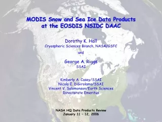
MODIS Snow and Sea Ice Data Products. George Riggs SSAI Cryospheric Sciences Branch, NASA/GSFC Greenbelt, Md. E-mail:george_riggs@ssaihq.com Dorothy K. Hall Cryospheric Sciences Branch, NASA/GSFC Greenbelt, Md. E-mail: Dorothy.K. Hall@nasa.gov.

E N D
MODIS Snow and Sea Ice Data Products George Riggs SSAI Cryospheric Sciences Branch, NASA/GSFC Greenbelt, Md. E-mail:george_riggs@ssaihq.com Dorothy K. Hall Cryospheric Sciences Branch, NASA/GSFC Greenbelt, Md. E-mail: Dorothy.K. Hall@nasa.gov MODIS Land Collection5/LTDR Workshop UMUC College Park, Md. January 17-18, 2007
Overview of Collection 5 Changes • Major product additions • Fractional snow cover @ 500m • Monthly snow cover • Primary snow product changes • Revisions in sea ice products • Examples of the primary changes
Primary Changes in C5 Snow Products MOD10_L2 Consistent use of screens for erroneous snow at all snow decision points in the algorithm. Fractional snow cover has been added as a data array in the swath product for both Terra and Aqua. The snow cover map with reduced cloud approach was deleted from the data product. MOD10A1 A fractional snow cover data array has been added to the product. Fractional snow cover data is input from the MOD10_L2 product. MOD10CM Monthly, global snow extent data product has been added to the sequence of MODIS snow products for both Terra and Aqua.
Sea Ice Product Revisions in Collection 5 MOD29 In the C5 MOD29 products the user is given the flexibility to generate maps of sea ice extent by ice surface temperature (IST) and a combined sea ice by reflectance and IST map. Those maps were in the C4 products but were abandoned in C5. The C5 products have sea ice by reflectance maps and IST maps, same as in C4, that the users can utilize for their purposes. Affects MOD29, MOD29P1D and MOD29P1N products.
New in Collection 5 • General • The bit encoded spatial quality assessment data has been replaced with an integer spatial quality assessment data value. • A local attribute named “Key” has been included with all SDSs. This is the key to meaning of data values in the data array. • A naming convention for the SDS was implemented so there is greater naming consistency through the data products. Some SDS names are different in Collection 5. • HDF internal compression is applied to the level-3 and higher products to reduce the volume of the data files. The internal compression should be invisible to users and software packages that can read the HDF, HDF-EOS format. • The level-2 swath products are compressed using the NCSA HDF hrepack compression tool instead of internal compression which may or may not be invisible depending on software used to access the data products. It may be necessary to uncompress the level-2 using hrepack.
Data Product Consistency C4 to C5 • Thematic snow map and snow albedo very consistent; no significant changes were made in the algorithms. • Minor improvement in quality of snow maps due to screening for erroneous snow. • Also some improvement attributable to improved cloud mask (MOD35_L2) over snow covered surfaces. • Fractional snow in MOD10_L2 and MOD10A1 only in C5, they were not in C4 products • Land/ocean mask better and consistent through C5. The land/ocean mask had changed in C4. • Sea ice extent and ice surface temperature (IST) are consistent; no significant changes were made in the algorithms.
Collection 5 Documentation Versions of the product user guides for C5 are available on line at MODIS snow and iceproducts website:http://modis-snow-ice.gsfc.nasa.gov/ The user guides contain more information on the quality of the data products and some discussion of errors observed in them.
Validation and Accuracy • All snow products are validated both with ground measurements and in comparison to higher-resolution remote-sensing data, and as compared to operational snow-cover products • The accuracy of the products varies with season, location, type of snow and time of day (see “Accuracy Assessment of the MODIS Snow Products,” D.K. Hall and G.A. Riggs, Hydrological Processes (in press)) • Also see MODIS Land Group validation website: http://landval.gsfc.nasa.gov/
MODIS thematic snow map (left) and fractional-snow-cover product (right) - 500-m resolution December 14, 2000 MT ND SD WY NE CO KS cloud After Salomonson & Appel (2004)
Fractional Snow Cover MODIS snow cover map from swath of MOD10_L2 for 3 January 2003 1745 GMT in A. Fractional snow cover map in B and fractional snow map in sinusoidal projection in C. C B A
Thematic Quality Assessment MODIS snow cover map (A) and corresponding snow cover pixel QA map (B) from swath of MOD10_L2 for 3 January 2003 1745 GMT. A B
Fractional Snow Cover MOD10A1.A2007004.h11.v03.005 Daily product thematic snow and fractional snow maps
Monthly Snow Maps MODIS Monthly Snow Maps on the Climate-Modeling Grid (CMG) with fractional snow cover in each cell
Possible Enhancements for C6 • Improved snow/cloud discrimination • Improved screening for erroneous snow detection • Fractional snow with error/uncertainty estimates • Revised snow albedo algorithm with error/uncertainty estimates • A daily snow (level 3) product based on surface reflectance and land cover product inputs • Higher resolution CMG products • Quarter degree resolution CMG product for climate modeling community
Daily global 4-km resolution ice extent & IST products - composites from May 15-19, 2000 North Polar View South Polar View MOD29E1D MOD29E1D cloud Hall et al. (2004)
Terra MODIS IST 1-km resolution product acquired on March 12, 2003 (18:45 UTC), in the northern Greenland Sea