Download
1 / 30
300 likes | 413 Views
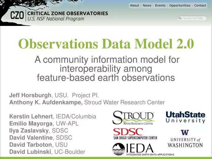
Observations Data Model 2.0. A community information model for interoperability among feature -based earth observations. Jeff Horsburgh , USU. Project PI. Anthony K. Aufdenkampe , Stroud Water Research Center Kerstin Lehnert , IEDA/ Columbia Emilio Mayorga , UW-APL

E N D
Observations Data Model 2.0 A community information model for interoperability among feature-based earth observations Jeff Horsburgh, USU. Project PI. Anthony K. Aufdenkampe,Stroud Water Research Center Kerstin Lehnert, IEDA/Columbia Emilio Mayorga, UW-APL IlyaZaslavsky, SDSC David Valentine, SDSC David Tarboton, USU David Lubinski, UC-Boulder
Critical Zone Science Atmosphere Biosphere Hydrosphere Lithosphere Minutes Decades Millenia Eons Hillslope Catchment Watershed • Earth's permeable near-surface layer from the tops of the trees to the bottom of actively cycling groundwater. • Where rock, soil, water, air, and living organisms interact and shape the Earth's surface. • Critical to sustaining the earth’s sustaining services • Clean water • Productive soil • Balanced atmosphere
CZO Disciplines • Biogeochemistry • Biology/Ecology • Biology/Molecular • Climatology/Meteorology • Data Management/CyberInfrastructure • Engineering/Method Development • Geochemistry/Mineralogy • Geology/Chronology • Geomorphology • Geophysics • GIS/Remote Sensing • Hydrology • Modeling/Computational Science • Outreach/Education Research • Soil Science/Pedology • Water Chemistry
CZO Disciplines Big Data Long Tail Data Biogeochemistry Geomorphology Biology/Ecology Geophysics Biology/Molecular GIS/Remote Sensing Hydrology Climatology/Meteorology Modeling/Computational Science Data Management/CyberInfrastructure Outreach/Education Research Engineering/Method Development Soil Science/Pedology Geochemistry/Mineralogy Water Chemistry Geology/Chronology
CZO Disciplines Big Data Long Tail Data Sample-based Sensor-based Geospatial Grids & Vectors Categorical
ODM2: Common to Most Data Types Sensor Extension Equipment & Lab Extensions Observations Core Feature Model Generic Extension Common Semantics for Earth Observations CZOData IOOS CUAHSI HIS EarthChem Domain Cyberinfrastructures
ODM2: Common to All Components Legend Database Encoding XML Schema Encoding Catalog Metadata Catalog Data and Metadata Transfer Metadata Transfer Metadata Transfer Metadata Harvesting Data Discovery Information Model Data Storage Data Delivery Data Server Clients Data Transfer
ODM2: Additional Goals • Driven by Community & Use Cases: • 3 workshops + ~12 data models + much feedback • use cases: CZOData, Little Bear River, PetDB, IOOS • Balance between general vs. understandable • External unique identifiers, vocabularies & taxonomies • Rich Specimen, Site & other Sampling Features • Granular Methods, Data Quality & Equipment • Dataset publishing & archiving via: • Result “packages”, Versions, Citations, Provenance • Strong Annotations & general extensibility
NSF Scientific Software Integration BiG CZ SSI project (2014-2015): The community-driven BiG CZ software system for integration and analysis of bio- and geoscience data in the critical zone • Community Engagement in Software Designthrough co-design, training & testing workshops. • BiGCZ Portal web application for high-performance map-based discovery, visualization, access & publication of data on critical zone structure & function • BiGCZ Toolbox to enable cyber-savvy CZ scientists & data managers to manage and publish the data they produce through a single scientist-focused toolkit • BiG CZ Central software stackto bridge data systems developed for multiple critical zone domains
Thank You Funded by the National Science Foundation EAR 1224638 EAR 1332257 ACI 1339834 ODM2 is on GitHUB: https://github.com/UCHIC/ODM2
What can we do with ODM2?(that we couldn’t do before) • Add multiple comments/annotations to any entity • Represent Actions and sequences of Actions that lead to observation Results • More granularly represent people and organizations • Store information about Actions that do not have Results
What can we do with ODM2?(that we couldn’t do before) • Separate Results from ResultValues – enables multiple ResultTypes • Move DataValues out of the Core – better facilitates cataloging • Add taxonomic classifiers to Results, adding an additional dimension to observations • Create relationships among Results and store provenance • Group Results into Datasets
What can we do with ODM2?(that we couldn’t do before) • Store information about the equipment used to create observations • Add extension properties to any record in any entity • Link many entities to external identifier systems • Support SamplingFeatures of multiple types - Sites and Specimens, among others • Not limited to a single spatial offset • Not Limited to a single qualifier
Observation Data Model 2.0 • NSF funded project: PI. Jeff Horsburgh • “Developing a Community Information Model and Supporting Software to Extend Interoperability of Sensor and Sample Based Earth Observations” • To achieve interoperability between IEDA, EarthCHEM, CUAHSI HIS, and other data systems • Better support for samples and unique identifiers (IGSN/SESAR) • Extensibility to table attributes • Better annotation and provenance • Enable integrated web service based publication of a broader class of CZO data
ODM2 Functional Use Cases StorageEncoding (USU/LDEO) CatalogEncoding (SDSC) Archival Encoding (USU) Information Model (All) Web Service Interface (UW) XML Schema Encoding (SDSC)
Future Directions for CZO Science Report prepared by CZO community, Dec. 2010 • Develop a unifying theoretical framework of CZ evolution; • Develop coupled systems models to explore how CZ services respond to anthropogenic, climatic, and tectonic forcings; • Develop four dimensional data setsthat • document differing CZ geologic and climatic settings, • inform our theoretical framework, • constrain our conceptual and coupled systems models, • test model-generated hypotheses.
EarthCube Critical Zone Domain Workshop Engaging the Critical Zone community to bridge long tail science with big data Convened by A.K. Aufdenkampe, C.J. Duffy, G.E. Tucker Univ. of Delaware: Jan. 21-23, 2013 Organizing Committee: Kerstin Lehnert, IEDA/Columbia. IlyaZaslavsky, SDSC. David Tarboton, USU Jeff Horsburgh, USU. Emilio Mayorga, UW-APL James Syvitski, CSDMS. Susan Brantley, PSU & SH-CZO. Susan Gill, SWRC.
103 Participants from 16 Disciplines • Biogeochemistry (30) • Biology/Ecology (15) • Biology/Molecular (3) • Climatology/ Meteorology (15) • Data Management/CyberInfrastructure (46) • Engineering/Method Development (8) • Geochemistry/Mineralogy (13) • Geology/Chronology (14) • Geomorphology (15) • Geophysics (8) • GIS/Remote Sensing (31) • Hydrology (46) • Modeling/Computational Science (36) • Outreach/Education Research (7) • Soil Science/Pedology (16) • Water Chemistry (14) Early-Career (28)