Download
1 / 19
190 likes | 590 Views
Remote Sensing software. Software, HQ special strength ERDAS (Atlanta, USA: 1979) – vector integration PCI (Toronto, Canada: 1982) – orthophotos / breadth ENVI (Boulder, USA: 1991) - hyperspectral ER Mapper (Perth, Australia:) - image web server

E N D
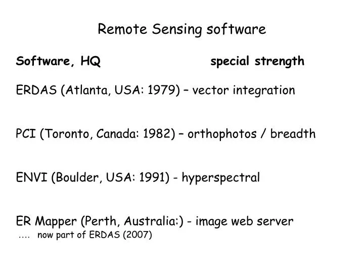
Remote Sensing software Software, HQ special strength ERDAS (Atlanta, USA: 1979) – vector integration PCI (Toronto, Canada: 1982) – orthophotos / breadth ENVI (Boulder, USA: 1991) - hyperspectral ER Mapper (Perth, Australia:) - image web server …. now part of ERDAS (2007)
Prior to ERTS / Landsat (1972), little was known about image processing except how to contrast stretch and rectification CCRS first to acquire Image100 system developed by GE - $1million OVAAC 8 by Dick Economy (formerly GE), on standard VAX system, … sold to PCI in 1985 Hardware 1970-80 Specialised hardware 1981 IBM PC (2 bit colour = 4 colours) 1990 UNIX workstations 8 bit colour 2000 PC – windows with 24 bit colour Early software history
ERDAS Earth Resources Data Analysis System – 1979 Unix / Windows / Mac Live link raster-vector 1988 Partnered with ESRI Owned by Leica (since 2001) Current version: Imagine (filetype .img)
ERDAS extensions for ArcGIShttp://www.erdas.com/Products/tabid/56/cdf/1139/default.aspx
PCI Geomatics 1982: formed as Perceptron Computing Inc. Windows and Linux First versions (FORTRAN) were command line: EASI/PACE Tutorials: http://www.pcigeomatics.com/support/tutorials/ Technical papers: http://www.pcigeomatics.com/services/support_center/tech_papers/techpapers_main.php
Co-registration of Optically Sensed Images and Correlation (COSI CORR) for movements – landslides, earthquakes, sand dunes, glaciers ENVI Windows / Unix / Linux / Mac
Other software: Microimages TNTmips http://www.microimages.com/ - windows / Mac / Unix / Linux
IDRISI Worcester (Boston)http://www.clarklabs.orghttp://www.idrisi.ca Who was Idrisi? http://en.wikipedia.org/wiki/Muhammad_al-Idrisi http://www.bestofsicily.com/mag/art91.htm
Started in 1982 by U.S. Army - Construction Engineering Research Laboratory (USA-CERL) in Champaign, Illinois. USA-CERL completed its last release of GRASS as version 4.1 in 1992. GRASS development was assumed by academia in 1997, an international team manages the source code. GRASS - http://grass.itc.it/
Other software: DIMPLE and BILKO “DIMPLE is the leader in easy-to-use remote sensing image analysis for Mac OS and Windows.” [NOT] http://www.mpassociates.gr/software/distrib/science/rock/dimple.html UNESCO- BILKO (free): http://www.noc.soton.ac.uk/bilko/ Micropips: An early raster-based microcomputer image processing system
Object-oriented classifier Feature based not pixel Per pixel classifiers: Unsupervised/Supervised Knowledge-based/context eCognition – geog499 project (Jay Fyvie) eCognition: ttp://www.definiens.com/
http://earth.esa.int/rtd/Events/ESA-EUSC_2006/Oral/Pr18_Ohlhof.pdfhttp://earth.esa.int/rtd/Events/ESA-EUSC_2006/Oral/Pr18_Ohlhof.pdf
Feature Analyst for ESRI and ERDAS http://www.vls-inc.com/feature_analyst/platforms/arcgis.htm PCI Feature ObjeX (FOX)http://www.pcigeomatics.com/products/FeatureObjeX.html SPRING: http://www.dpi.inpe.br/spring/english/ Feature based / segmentation software http://gis.unbc.ca/courses/geog499/projects/2006/andersk/index.htm
Free image processing softwarehttp://www.maproom.ruc.dk/software/remote-sensing http://micromsi-for-windows.software.informer.com/
Free viewers See also for more remote sensing software: http://archeologiamedievale.unisi.it/NewPages/REMOTESENS/REMOTE11.html http://www.gis4biologists.info/gis_software_options.htm http://biodiversityinformatics.amnh.org/index.php?section=rsr_links_image