Download
1 / 19
190 likes | 306 Views
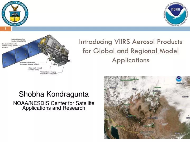
Introducing VIIRS Aerosol Products for Global and Regional Model Applications. Shobha Kondragunta NOAA/NESDIS Center for Satellite Applications and Research. VIIRS Aerosol Cal/Val Team. NOAA Team. Navy Global Aerosol Forecasting.

E N D
Introducing VIIRS Aerosol Products for Global and Regional Model Applications ShobhaKondragunta NOAA/NESDIS Center for Satellite Applications and Research
VIIRS Aerosol Cal/Val Team NOAA Team
Navy Global Aerosol Forecasting • Operational at FNMOC from September 2009 (over ocean) • Land and ocean MODIS assimilated in operations since February 2012 • Assimilation system is “2D-VAR” for total column AOD based on NAVDAS 3DVAR system • Large development effort required for producing DA-quality products from off-the-shelf MODIS data • Operational AOD assimilation reduces RMS error in analyzed AOD by >50% • Publications about aerosol DA • Zhang, J. L., et al.: Evaluating the impact of assimilating caliop-derived aerosol extinction profiles on a global mass transport model, Geophys. Res. Lett., 38, L14801, doi:/10.1029/2011gl047737, 2011. • Zhang, J. L., et al.: A system for operational aerosol optical depth data assimilation over global oceans, J. Geophys. Res.-Atmos., 113, D10208, D10208, doi:/10.1029/2007jd009065, 2008.
GEOS-5/GOCART Forecasts CO Smoke SO4 http://gmao.gsfc.nasa.gov/forecasts/ • Global 5-day chemical forecasts customized for each campaign • O3, aerosols, CO, CO2, SO2 • Resolution: Nomally 25 km • Driven by real-time biomass emissions from MODIS • Assimilated aerosols interacts with circulation through radiation
NOAA GFS Aerosol Component (NGAC) • Model Configuration: • Forecast model: Global Forecast System (GFS) based on NOAA Environmental Modeling System (NEMS), NEMS-GFS • Aerosol model: NASA Goddard Chemistry Aerosol Radiation and Transport Model, GOCART • Phased Implementation: • Dust-only guidance is established in Q4FY12 • Dust, sea-salt, OC/BC, and sulfate aerosol forecast once real-time global smoke emissions are developed and tested (NWS/NCEP-NESDIS/STAR-NASA/GSFC collaboration) • Near-Real-Time Dust Forecasts • 5-day dust forecast once per day (at 00Z), output every 3 hour, at T126 L64 resolution • ICs: Aerosols from previous day forecast and meteorology from operational GDAS
VIIRS Granule: 86 seconds; 48 scan lines; 3040 km swath width; 16 M-bands (412 nm to 12 µm); 768 X 3200 fixed array size per granule. Outputs (HDF5): (1) AOT Intermediate Product, IP; (2) AOT Environmental Data Record, EDR; (3) Suspended Matter; (4) Aerosol Model Information; (5) Geolocation file for IP; (6) Geolocation file for EDR. Need to know: IP is a pixel level AOT retrieval; EDR is an aggregate of about 8 X 8 IP pixels; IP product has Navy Aerosol Analysis and Prediction System AOT filled in for pixels with no retrievals but this is not included in EDR; no AOT over inland water bodies; no negative retrievals allowed; no AOTs over 2.0 reported;VIIRS products come with several quality flags that are useful to screen the data.
IP AOT to EDR AOT • 8 x 8 750m IP pixels aggregated to 6 km EDRs; • For EDR to be of “best quality”, at least a minimum of 16 out of 64 IP pixels should have “best quality” AOT; • During the aggregation process, top 40% and bottom 20% “best quality” IP pixels are discarded. IP (750m) EDR (6 km) In contrast to VIIRS, MODIS retrieves AOT by averaging 500m reflectances in a 10 km x 10 km grid and discarding the top 50% (25%) and bottom 20% (25%) pixels over land (ocean)
Daily global mean AOT Production Error Algorithm Upgrade
AOT (VIIRS – MODIS) • Data: • February and March 2013 • MODIS C5 • VIIRS IDPS • AOT data mapped to 0.25o grids • AOT data not paired; some sampling differences exist Upgrades to the algorithm to reduce the high bias over land are in the plans. NDVI dependent spectral surface reflectance ratios will be implemented soon.
Smoke from fires on March 15, 2013 seen in the visible RGB image (left panel) nicely captured in the quantitative retrieval of aerosol optical thickness (right panel). These images are generated at the STAR IDEA (Infusing satellite Data into Environmental Applications) website using direct broadcast SDRs, VCM, and fire hot spot data. Data latency is ~2 hrs. The website (www.star.nesdis.noaa.gov/smcd/spb/aq/) is routinely accessed by air quality forecasters for satellite aerosol imagery that provides the spatial extent of smoke, dust, and haze.
VIIRS true color image of blowing dust from different sources in Alaska on April 28, 2013 VIIRS Pixel Level AOD VIIRS Dust Flag
Important Dates: Software production error Aerosol product candidate provisional status Initial instrument check out. Tuning cloud mask parameters Aerosol product at Beta status Beta status 15 Oct 2012 today 28 Oct 2011 2 May 2012 22 Jan 2013 27 Nov 2012 Red periods: DO NOT USE the product. Beta: Use with caution. Known biases. Provisional: Use data bearing in mind that further validation is ongiong
Data (not SM) are available through CLASS: http://www.class.noaa.gov A “back door” for data via the IDEA site: https://www.star.nesdis.noaa.gov/smcd/spb/aq/index_viirs.php?product_id=4 Users’ guide available at: http://www.star.nesdis.noaa.gov/jpss/ATBD.php#S126472 README file under VIIRS aerosol (AOT) at: http://www.nsof.class.noaa.gov/saa/products/welcome Other documents are available at: http://npp.gsfc.nasa.gov/science/documents.html
JCSDA Atmospheric Composition (AC) Working Group Update • WG is made up of scientists working on data assimilation methods for atmospheric composition modeling • Mostly there are operational customers behind these efforts • Only one telecon held since the last annual meeting. All working group members working on AC working group topics with “leveraged” funding
JCSDA Atmospheric Composition Working Group Update • Several Aerosol-related applications are making their way to operations • Zhiquan Liu at NCAR has developed and implemented aerosol optical depth DA in GSI. Air Force Weather Agency intends to operationalize this. • NASA LANCE is now producing DA-ready AOD from MODIS based on Naval Research Lab / University of North Dakota algorithm • Dust aerosol is now operational in GFS • NASA GMAO is assimilating MODIS data for aerosols, and includes aerosol direct effects in GEOS-5 • Development of global biomass burning emissions as input for NGAC is progressing well
JCSDA Atmospheric Composition Working Group Update • CRTM is being used in these efforts, with difficulty • CRTM trunk has GOCART speciation and microphysical properties hard-coded; cannot modify without altering source code; • CRTM for CMAQ exists; this is another fixed, inflexible configuration • CRTM developers could future-proof current systems and speed development of future systems by extracting the aerosol microphysics into a flexible framework
Aerosol Algorithm Differences between VIIRS and MODIS