Download
1 / 21
210 likes | 313 Views
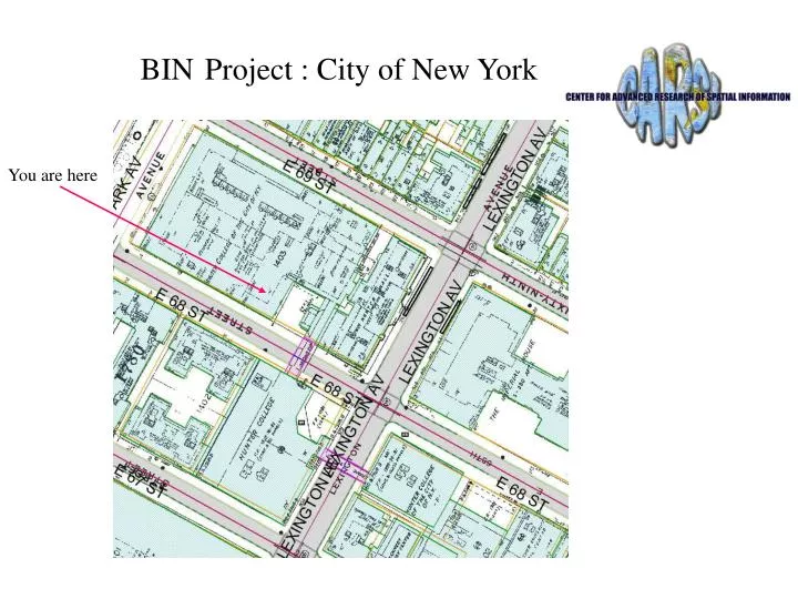
BIN Project : City of New York. You are here. Objective. Assign all NYCMAP building polygons with a Building Identification Number (BIN) Associate a Borough-Block_Lot (BBL) to each Building Polygon

E N D
BINProject : City of New York You are here
Objective • Assign all NYCMAP building polygons with a Building Identification Number (BIN) • Associate a Borough-Block_Lot (BBL) to each Building Polygon • Maintain “real time” Building status by tracking permit to COO process and building footprint changes
Automatic BIN Assignment • Overlay parcel geometries with building geometries • each BBL has zero, one or many BINs • Assign BINs to building geometries when there is a one to one correspondence given: • 75% overlap of building polygon with parcel or • 60% overlap and centroid of building within parcel • For matches fill in Rpad fields: • cogis_borough; cogis_tax_block; cogis_tax_lot: cogis_bbl; rpad_high_house #; rpad_low_house #; rpad_street_name.
Building Layer Assignment & Verification Process • Automated assignment of Borough, Block and Lot - • Parcel data was extracted from COGIS layer using a point-in-polygon operation. • The specified criteria for building polygons to become associated with a lot’s BBL • 75% of the building polygon overlaps with a parcel, or • 60% overlap occurs and the centroid of that building is within the parcel. COGIS Layer: access BBL number Associate BBL with building polygon Building Layer: with newly inserted BBL number
B U I L D I N G A T T R I B U T E S
Manual Verification Process • Building Polygons with unverified or no BINs • Address from Sanborn verify in GOAT • Multiple buildings or too few buildings per parcel • use Sanborn as guide • fewer buildings, then split • too many building components merge • more than one address range use PACS to get address then query GOAT to assign BIN • for discrepancies use secondary sources such as aerial photographs and call a contact person • no BIN found assign as problem • New, Demolished or Altered Buildings • On Sanborn and GOAT: create new building poly, delete or addition • DOB/HPD source
Work Environment Work Environment
Validation Procedure (Attr.) • Automatic Validation Procedures • Check for duplicate BIN • 7 digit BIN and first digit less than 6 • if bbl_source = Rpad or Geo and no record found in Geo_Rpad table using current BBL • invalid BBL flag raised • if bbl_source = Geo and bin_source = Geo but no record in Geo_Rpad of BBL/BIN combination • invalid BIN/BBL combination flag raised
Validation (Geometry) Cont. • Trigger attribute setting • split/merge action ----> poly mod <---- split/merge • digitize action ----> poly mod <---- new • User input • source type <---- photogrammetric (default) • source type <---- other (manual) • source type <---- site plan
Data Model Permits Geo-Rpad m:n 1:n m:n (bin) (bbl) Buildings COGIS (bbl) m:n (bin) 1:n Address
Breezy Point - more buildings than BIN’s BBL 4163500400 BIN list contains 82 entries - there are at least 200 buildings. COGIS inaccuracy also shown by “missing lot” buildings at left center. This problem also occurs frequently in new condominium developments.
Inaccuracy of COGIS coverage Misalignment results in automatic matching with incorrect lot, frequently extending down entire block. In addition, polygons are missing for Central Park, JFK Airport, Flushing Meadows Park and perhaps other parks.
MTA Coney Island Yard - no BIN’s BBL 3072080040 In addition to MTA yards and the airports, this is frequently found in Con Edison substations, parks, universities and hospitals.
One building covering multiple lots BBL 3050500051 Building covers (w to e) lots 76, 71, 66, 62, 60 and 51. All lots except 51 have “3000000” as BIN in GOAT.
BIN without a building - lot is underwater! BBL 3088960550 There are many other GOAT BIN’s for which no buildings are found. PACS frequently lists these either as “vacant land”, or with buildings built early in the 20th century.
A “long lot” 4 feet wide! BBL 4088920135 Many other bizarre shapes are found, occasionally with a BIN. Many other lots have been found in which the GOAT address entry obviously applies to a totally separate block.
Garages with and without BIN’s BBL 2055320101 The great majority of garages do not have their own BIN’s listed in GOAT. Occasionally, a group of garages with BIN’s is found, and the Douglaston area of Queens appears to be unique in that nearly every garage has its own BIN.
Garage and gas station - built 1800? BBL 3084330052 This PACS entry is obtained for a significant number of vacant lots. Perhaps 1800 is a default date?
Church on a condominium lot BBL 1018597501 Tempted as one might be to assert that God works in mysterious ways, further investigation reveals that PACS does not list the church as lot owner, and the church is not listed in the Manhattan telephone directory. It is therefore likely that this is an instance of Sanborn’s maps being out of date.