Download
1 / 24
240 likes | 354 Views
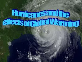
Possible Aerosol Effects on Lightning Activity and Structure of Hurricanes. Khain , A., N. Cohen, B. Lynn, and A. Pokrovsky, 2008: Possible aerosol effects on lightning activity and structure of hurricanes. J. Atmos. Sci. , 6 5 , 3652–3677. OUTLINE. Introduction

E N D
Possible Aerosol Effects on Lightning Activity and Structure of Hurricanes Khain , A., N. Cohen, B. Lynn, and A. Pokrovsky, 2008: Possible aerosol effects on lightning activity and structure of hurricanes. J. Atmos. Sci., 65, 3652–3677
OUTLINE • Introduction • Aerosol effects on the microstructure • Aerosol effects on the TC approaching the land • Discussion and conclusions
Introduction FIG. 1. Lightning in Hurricane Katrina (2005) at different times (after Shao et al. 2005). Zones of lightning are marked by dots; the TC eye is marked with a shaded circle. Dashed circles have a radius of about 300 km around the TC center. One can see the high lightning intensity (which even exceeds that over the land) within the 250–300-km radii.
FIG. 2. SST in the area of Hurricane Katrina calculated by the TC forecast model of the Graduate School of Oceanography, University of Rhode Island (I. Ginis 2007, personal communication). The line denotes the TC track. The light areas indicate zones of he decreased SST caused by TC–ocean interaction (mixing and upwelling). Times correspond to those in Fig. 1.
FIG. 3. (a) The time dependence of total flashes in Katrina, 24–28 Aug 2005. (b) Flash zonesin Katrina (denoted by dots), 2051–2055 EDT 27 Aug. The figures are plotted using theLightning Imaging Sensor (LIS) data. The data above indicate the total flashes for the 6° 6° area composited to Hurricane Katrina’s best-track center (http://thunder.nsstc.nasa.gov/data/#LIS_DATA).
FIG. 6. CWC (droplets with radii below 50 m) in the (left) M_tail and (right) M_c_tail simulations at t 25min. The CWC is significantly higher and reaches higher levels in the clouds developing in polluted air.
FIG. 7. (top) Crystal, (middle) graupel, and (bottom) hail/frozen drops contents in the (left) M_tail and (right)M_c_tail simulations. These contents are higher in the clouds developing under high aerosol concentrations.
FIG. 8. Vertical velocity in the (left) M_tail and the (right) M_c_tail at t 25 min. The vertical velocities in the clouds developing within the high AP concentration air are higher by several meters per second than in the clouds developing under low aerosol concentrations.
FIG. 9. (top) Radar reflectivity in the (left) M_tail and (right) M_c_tail simulations representing clouds in the eyewall and at the peripheral cloud bands with simulated continental aerosol intrusion.
Aerosol effects on the TC approaching the land Grid : 9 / 3 km Vertical layer : 31
Maximum values of the supercooled CWC above the 5-km level in simulations with (left) warm rain permitted and (right) no warm rain at surface wind speeds exceeding 35 m /s, for three different times.
Total ice content in simulations with warm rain (left) included and (right) switched off.
Vertical cross sections of the differences (NWRP30 WR) between the azimuthally averaged fields of (a) total ice contentQt, ice, (b) rain content (Qr), (c) cloud water content (Qc), and (d) vertical velocity.
Lightning probability at different times of TC evolution in the cases of clouds developing in (left) clean air and (right) continental air. The LP is calculated as the maximum product of updrafts, CWC, and total ice contents.
Precipitation rates in the runs with (left) warm rain allowed over the entire computational area (WR) and (right) warm rain turned off at the TC periphery (NWRP-30)
Time dependences of spatially averaged 3-h accumulatedprecipitation within the TC zone (the internal grid) in“warm rain” and “no warm rain” (NWRP-30) simulations.
Discussion and conclusions • Continental aerosols with CCN concentrations increase the amount of both supercooled cloud water and ice even under a high concentration of large CCN. • the vertical updrafts were several meters per second higher in the polluted clouds. • a droplet concentration Nd of 1000 cm3 indicate some increase in central pressure and an increase in the supercooled CWC, quite similar to those obtained in the case when the droplet concentration was set equal to 30 cm3.
TC intensity. This decrease can be attributed to the fact that the convection invigoration at the TC periphery leads to a decrease in the air mass penetrating to the TC eyewall and also to a decrease in the mass flux there.