Download
1 / 28
320 likes | 621 Views
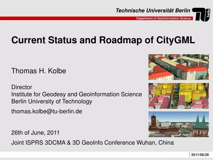
Current Status and Roadmap of CityGML. Thomas H. Kolbe Director Institute for Geodesy and Geoinformation Science Berlin University of Technology thomas.kolbe@tu-berlin.de 26th of June, 2011 Joint ISPRS 3DCMA & 3D GeoInfo Conference Wuhan, China. Queries to a 3D City Model / 3D GIS:

E N D
Current Status and Roadmap of CityGML Thomas H. Kolbe Director Institute for Geodesy and Geoinformation Science Berlin University of Technology thomas.kolbe@tu-berlin.de 26th of June, 2011 Joint ISPRS 3DCMA & 3D GeoInfo Conference Wuhan, China
Queries to a 3D City Model / 3D GIS: • How many buildings, monuments, trees? • How many storeys? • Total sealed area? • From which windows can I see place XY? • What is the total window area of the buildings? • Where are the entrances / exits? • What is the energy demand for heating and electricity? Image: Berlin Partner, Google
3D City Modelling • … is far more thanthe 3D visualizationof reality • In fact, the geometryand its appearanceare only one aspectof an entity! • Key issue: Semantic Modelling
BuildingInstallation (Dormer) BuildingPart Building BuildingPart Building surface (WallSurface) Building Example for a Semantic Building Model 3D-Modell: Stadt Coburg
Urban Information Modelling with CityGML • Application independent Geospatial Information Model for semantic 3D city and landscape models • comprises different thematic areas(buildings, vegetation, water, terrain, traffic etc.) • data model(UML) according to ISO 191xx standard family • exchange format results from rule-based mapping of the UML diagrams to a GML3 application schema • Adopted OGC standard since 08/2008 • CityGML represents • 3D geometry, 3D topology, semantics and appearance • in 5 discrete scales (Levels of Detail, LOD)
Multi-scale modelling: 5 levels of details • LOD 0 – Regional model • 2.5D Digital Terrain Model • LOD 1 – City / Site model • “block model“ w/o roof structures • LOD 2 – City / Site model • textured, differenciated roof structures • LOD 3 – City / Site model • detailed architecture model • LOD 4 – Interior model • “walkable“ architecture models
Modular Structure of CityGML Application Domain Extensions (ADE) Generics Appearance Bridge Tunnel CityObjectGroup Transportation Building CityFurniture LandUse Relief Vegetation WaterBody … CityGML Core OGC GML 3.1.1
International Adoption of CityGML • Cities / Municipalities • e.g. nearly all German cities with 3D city models; Rotterdam (NL), Zurich (CH), Geneva (CH), Vancouver (CA), Paris (FR), Marseille (FR), Istanbul (TR), Kuala Lumpur (MY), Yokohama (JP), Doha (Katar); limited awareness in USA (Boston, Chicago) • Organisations • e.g. IGN France, Ordnance Survey UK, State mapping agencies of Bavaria and North-Rhine Westphalia in Germany, BIMTAS in Istanbul, many Research Institutes and Universities • CityGML is being used as a reference in the European INSPIRE Initiative • INSPIRE Building model is nearly identical to CityGML • The new national 3D standard of The Netherlands will be based on CityGML
Semantic 3D City Model of Berlin >500,000 buildings were automatically reconstructed using 2D building footprints from cadastre and airborne LIDAR data. Textures were automatically extracted from oblique aerial images. Semantic information is also transferred from cadastre. www.virtual-berlin.de
New Applications: Solar Potential Analysis • Example: Solar Atlas Berlin • Semantic information (here: estimated solar energy production) is used both to cartographically style the visualization and to provide the values shown in the „information balloons“
3D Visualisation of CityGML Models KML /COLLADA • One 3D City Model • may comprise (or link) thematicdata from differentapplications • can be stored and exchanged as oneCityGML dataset KML KML /COLLADA • Multiple, different visualizations withapplication specific cartographic stylings
3DCityDB – Open Source CityGML Software • Free software to manage and visualize CityGML data: • http://www.3dcitydb.net • 3D City Database (new version 2.0.5) • SQL scripts, PL/SQL functions for Oracle Spatial 10g R2 and above • Comprehensive documentation (incl. mapping of CityGML to relations) • 3DCityDB Import/Export Tool (new version 1.3) • Executable Java binaries; tested with Windows, MacOS X, Linux • Complete source code, comprehensive documentation • fast CityGML import/export (supports arbitrary file sizes, even >> 4GB) • KML/COLLADA exporter • citygml4j (current version 1.0) • Java class library and API for reading and writing CityGML datasets • Library files for Java5 and Java6 • Source code, comprehensive documentation, tutorials
Energy Atlas: Urban Information Fusion Solar Irradiation LOD1 Heat Emission Utility Networks Bild: Hoegner / Stilla, TU München Heating Energy Requirements Thermal Remote Sensing Solar Potential Energy Atlas
CityGML 1.1 Roadmap CityGML 1.0International OGC Encoding Standard 20.08.2008 Formation oftheCityGML 1.1 SWGThe Standards Working Group (SWG) is in chargeof all changesoftheCityGMLspecification 09.12.2009 Public Call for Change Requests (CR)17 CRs receivedwhichhavetobeprocessedbythe SWG 26.02.2010 SWG processesCRsCRshavetobediscussedandvotedon; draftversionoftheCityGML 1.1 specificationisbeingcreatedcurrently Since March 2010 today Request for Comments (RFC)The candidateCityGML 1.1 specification will bereviewedandcommented on bythepublic in a 30-day RFC phase July/August 2011 Final editorialchangesbased on receivedcomments End of 2011 – Beginningof 2012 Release ofCityGML 1.1
Received Change Requests comprise... • New thematic modulesfor the representation of • Bridges and Tunnels • Walls in cities • Extensions of existing modules • Building module • explicit representation of storeys (as own object class) • additional thematic boundary surfaces (OuterCeilingS., OuterFloorS.) • LOD 0 representation (roofprint, footprint as 3D Multipolygons) • Generic attributes • Unit of measure (e.g. meters, dollars, etc.) can be given for attributes • Grouping of generic attributes and relation with a unique namespace • Miscellaneous • Compressed archive format for CityGML (like KMZ) • Topologic Network Model • new CityObject attributesrelativeToTerrain, relativeToWater
CityGML 1.1 Bridge Model • Similar / coherent structure with the Building model • Bridges may be decomposed into BridgeParts • Bridges have Thematic Boundary Surfaces (from LOD2) like WallSurface, RoofSurface, FloorSurface, etc. • Thematic Boundary Surfaces can have openings (from LOD3) • Bridges / BridgeParts can have BridgeInstallations (from LOD2) • in LOD4 they can also have a representation of their interiors given by BridgeRooms and BridgeFurniture • All feature types have thematic attributes (like class, function, and usage) • Terrain Intersection Curves • Bridges and BridgeParts can be further decomposed into BridgeConstructionElements (required for static stability)
Bridge Components BridgePart BridgeInstallation (here: signalling lamp) BridgeConstructionElement BridgePart BridgePart BridgeConstructionElement Bridge
Examples for Bridges in LODs 1-4 LOD 1 LOD 2 LOD 3 LOD 4 Models source: Google 3D Warehouse
CityGML 1.1 Tunnel Model • Similar / coherent structure with the Building model • Tunnels may be decomposed into TunnelParts • Tunnels have Thematic Boundary Surfaces (from LOD2) like WallSurface, RoofSurface, GroundSurface, FloorSurface etc. • Thematic Boundary Surfaces can have openings (from LOD3) • Tunnels / TunnelParts can have TunnelInstallations (from LOD2) • in LOD4 they can also have a representation of their interiors given by HollowSpaces and TunnelFurniture • All feature types have thematic attributes (like class, function, and usage) • Terrain Intersection Curves
Tunnel Model in UML [draft; simplified] 29. Februar, 2008
Example for a Tunnel in LODs 1-4 Image source: Karl-Heinz Häfele, KIT
Modeling a Metro System using CityGML These two objects also could be represented as oneBuilding with two BuildingParts Metro station + tunnel Digital Terrain Model (e.g. in LOD1) Above ground entry to the metro station (LOD3 Building) Connecting tunnel between two metro stations (Tunnel object, e.g.in LOD3) Underground part of the metro station (underground LOD3 Building object)
Summary • Semantic 3D City Models (= Urban Information Models) • allow for 3D visualizations AND thematic analyses • facilitate comprehensive analyses on the urban scale in the fields of e.g. energy assessment, environmental simulation, urban planning • CityGML intended to be used as a basis for standardized information structuring and data exchange • extension mechanisms like Generics & ADE provide flexibility • International adoption and system implementations are making steadyprogress • Increasing number of cities worldwide are using CityGML • Activefurtherdevelopment within SIG 3D and OGC • CityGML 1.1to be released by end of 2011 / beginning of 2012
Research Topics with Relations to CityGML • 3D city model validation • 3D generalization • 3D data integration • Automatic extraction of semantic 3D city models from sensor data or CAD/CG models • Reconstruction of Building Information Models from CityGML • Dynamic models, relation to procedural models • Urban data mining • (DB) index structures for efficient visibility analyses • 3D Cartographic Styling of 3D City Models • Label Placement, Symbolization