Download
1 / 1
10 likes | 84 Views
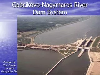
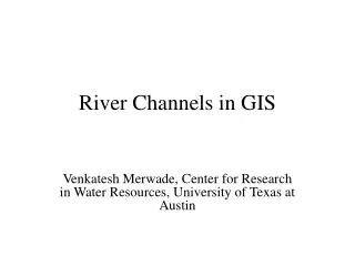
Glass. Fiber. , 0,7 mm. DOC. -. HgCl. 2. (300. M. Hg. ). m. Electrical. Conductivity. 63°0'0"W. 62°0'0"W. 61°0'0"W. 60°0'0"W. 63°0'0"W. 63°0'0"W. 62°0'0"W. 62°0'0"W. 61°0'0"W. 61°0'0"W. 60°0'0"W. 60°0'0"W. 10°0'0"S. pH. DIC. HgCl. Niskin. Bottle. Shimadzu. 9°0'0"S.

E N D
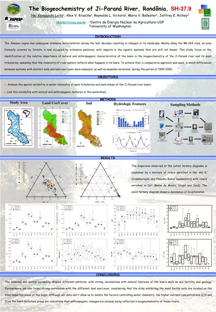
Glass Fiber , 0,7 mm DOC - HgCl 2 (300 M Hg ) m Electrical Conductivity 63°0'0"W 62°0'0"W 61°0'0"W 60°0'0"W 63°0'0"W 63°0'0"W 62°0'0"W 62°0'0"W 61°0'0"W 61°0'0"W 60°0'0"W 60°0'0"W 10°0'0"S pH DIC HgCl Niskin Bottle Shimadzu 9°0'0"S 9°0'0"S 2 (300 M Hg ) m Pasture Pastagem TOC 5000A Baren Soil Solo Exposto Clouds Nuvens 9°0'0"S 9°0'0"S Floresta Forest 9°0'0"S 9°0'0"S Regrowth Rebrota 10°0'0"S 10°0'0"S 10°0'0"S 10°0'0"S Oxygen Savanna Cerrado and Temperature Água Water Thymol Dionex DX – 500 Cellulose Acetate , Cidades Urban (10 mg/100mL ) Cations , Anions 0,45 mm 11°0'0"S 11°0'0"S 11°0'0"S 11°0'0"S 11°0'0"S 11°0'0"S 12°0'0"S 12°0'0"S 12°0'0"S 12°0'0"S 12°0'0"S 12°0'0"S 13°0'0"S 13°0'0"S 13°0'0"S 13°0'0"S 63°0'0"W 63°0'0"W 63°0'0"W 62°0'0"W 62°0'0"W 62°0'0"W 61°0'0"W 61°0'0"W 61°0'0"W 60°0'0"W 0 0 0 0 15 15 15 15 30 30 30 30 60 60 60 60 90 90 90 90 120 120 120 120 km km km km • The Biogeochemistry of Ji-Paraná River, Rondônia.SH-37.9 • Nei Kavaguichi Leite1, Alex V. Krusche1, Reynaldo L. Victoria1,Maria V. Ballester1, Jeffrey E. Richey2 • nkleite@cena.usp.br - 1Centro de Energia Nuclear na Agricultura-USP • 2University of Washington INTRODUCTION The Amazon region has undergone intensive deforestation during the last decades resulting in changes in its landscape. Mainly along the BR-364 road, an area formerly covered by forests is now occupied by extensive pastures, with impacts in the aquatic systems that are still not known. This study focus on the identification of the relative importance of natural and anthropogenic characteristics of the basin in the biogeochemistry of the Ji-Paraná river and its main tributaries, assuming that the chemistry of river waters reflects what happens in its basin. To achieve that, a comparative approach was used, in which differences between systems with distinct soils and land use/cover were analyzed, as well as seasonal variations, during the period of 1999-2002. OBJECTIVES • Analyze the spatial variability in water chemistry of main tributaries and main steam of the Ji-Paraná river basin; • Link this variability with natural and anthropogenic features in this watershed. METHODS Study Area Land Use/Cover Soil Hydrologic Features Sampling Methods RESULTS The dispersion observed at the cation ternary diagrams is explained by a mixture of rivers enriched in Na+ and K+ (Comemoração and Pimenta Bueno headwaters) with rivers enriched in Ca2+ (Rolim de Moura, Urupá and Jarú). The anion ternary diagram shows a dominance of bicarbonates. CONCLUSIONS The seasonal and spatial variability showed different patterns, with strong correlations with natural features of the basi,n such as soil fertility and geology. Furthermore, we also found strong correlation with the different land use/cover, considering that the sites exhibiting the most fertile soils are located on the most impacted areas of the basin. Although our data don't allow us to isolate the factors controlling water chemistry, the higher nutrient concentrations (C,N and P) on the most disturbed areas are indications that anthropogenic changes are already being reflected in biogeochemistry of these rivers.