Download
1 / 27
270 likes | 402 Views
UN Geographic Information Working Group and UN Geographic Database. 1 st meeting – March 2000, New York, hosted by Cartographic Section. 2 nd meeting – March 2001, Rome, hosted by FAO. UN Geographic Information Working Group UNGIWG.

E N D
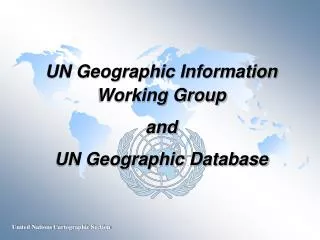
UN Geographic Information Working Group and UN Geographic Database
1st meeting – March 2000, New York, hosted by Cartographic Section 2nd meeting – March 2001, Rome, hosted by FAO UN Geographic Information Working Group UNGIWG An inter-agency group consists of focal points and professionals working or interested in GI within the UN 3rd meeting – February 2002, Washington D.C., hosted by World Bank
UNGIWG Objectives • To promote the use of geographic information within the United Nations system and Member States for better decision-making • To identify and implement protocols for sharing, maintaining and assuring the quality of geographic information within the United Nations system for efficient and cost effective use of such information with close co-operation with Member States, non-governmental organizations, research institutions and industry • To develop and maintain a common geographic database as a crucial capacity-building effort to enhance normative, programme and operational capabilities and efficiencies within the United Nations system
UNGIWG Task Groups Metadata and clearinghouses Framework data – international boundaries (land and maritime) and coastlines Framework data – administrative boundaries Remote sensing and satellite imagery Field operations Cartographic guidelines Training And a UN GI Strategic Plan
Call for Co-ordination ECOSOC resolution of 19 February 1948 calls for co-ordination of cartographic services of specialized agencies and international organizations by… promoting the exchange of technical information and the development of uniform international standards co-ordinating the plans and programmes of the United Nations and specialized agencies in the field of cartography developing close co-operation with cartographic services of Member Governments
General Assembly ResolutionDRAFT by Germany Co-ordination of geographic data and services of the United Nations, specialized agencies and national mapping organizations Calls upon the Secretary-General to strengthen and centralize the cartographic and geographic information activities within available budgetary limits and to further develop close cooperation in these fields in the programmes and plans of the United Nations and Specialized Agencies Calls also upon the Member States to further such efforts by coordinating their programmes of international mapping with the United Nations, in particular, with the United Nations Geographic Information Working Group, and by supporting the aims and development of a common United Nations Geographic Database by providing its content and updating it regularly
United Nations Geographic Database “To develop and maintain a global geographic database consisting of basic cartographic elements and toponymic information, which would serve as a geo-referenced base for overlaying and exchanging information within the UN system. Such a database would reflect appropriately the views and policies of the United Nations, and should be viewed as a crucial capacity building effort that will transform the way various components of the Organization interact in pursuit of common goals.”
OPERATION STABILISE: INTERFET PRESENCE CORRECT AS AT 13 1600 (NEW YORK) OCT 99 10 Oct Militia 9 Oct HQ WESTFOR COUNTRIES DEPLOYED ARE: AUSTRALIA, NEW ZEALAND, UK, US, BRAZIL, PHILIPPINES, MALAYSIA, FRANCE, THAILAND (Deputy Commander) INTERFET PRESENCE MILITIA ACTIVITY
Mile 91 Waterloo Guinea Kabala Lungi Loi Makeni Port Loko Lungi Masiaka Freetown Kailahun Benduma Bo Kenema Liberia
OCHA Coordination of Humanitarian Affairs Humanitarian Affairs
Database Requirements SHARE not re-create ; Interoperate not re-design Multi-scale ; Seamless Distributed network with participating agencies as the custodians of their respective data layers Must be shared freely within the UN System Must be MAINTAINABLE
Creating a UN Geographic DatabaseProposal approved by the UN Foundation Phase 1 – programme development Duration: 9 months Implementing Partners: Cartographic Section, Department of Public Information Department of Political Affairs Department of Peace-keeping Operations Office for the Coordination of Humanitarian Affairs UNGIWG serves as an advisory body and provide project monitoring and technical support
Programme Activities • Strategic Plan • Needs assessment • Data models and ISO compliant standards • System architecture • Data policy • Collaborative arrangement • Project sustainability including capital investment plan Geographic Data Inventory and Clearinghouse Inventory survey Clearinghouse architecture and metadata conventions UN geographic data clearinghouse
Programme Activities (cont.) • Quick Impact Data Development • Data format and coding scheme • Framework data sets • Country profile database • Assemble available global data sets Application Pilot Information dissemination
Security Council Life Saving Technology !!! FALD MilAd MPS Mission & Sector HQs Peacekeepers locations Rebels GOSL Army, Refugees LOC: roads, air/sea ports Hydrographic features Mine field & Land usage Topographic features GPS Satellite Peacekeeper Rebel Mission & Force HQ . . . You will get a map in a near real-time basis. Peacekeeping Missions GIS Operational Concept for Peacekeeping Situation Center DPKO UNHCR Situation Map Storage UNICEF OCHA UNDP Operations/Planning WFP Logistics UN Geo Database Cartographic Section Base Map Storage Operational Map Storage Terrain Analysis Current Operations & Future Planning Special Map Storage GIS
For more information, please visit website: • http://www.reliefweb.int/hcic/
For more information, please visit website: • http://www.unep.net/
DATA PROVIDERS TECHNOLOGIES STANDARDS USERS and DECISION MAKERS UN Agencies UNEP/FAO ISO/TC211 International And Regional NGOs UN Agencies Industry GSDI Security Council ISCGM PCIDEA PCGIAP Member States UNGIWG Industry MONITORING UN Geographic Database UN Geographic Database UN Views
Address of UN Secretary-Generalat AAG conference in March 2001 • “...last year we at the United Nations established a Geographic Information Working Group to improve the way in which the many entities in our far-flung system use cartographic and geographic information. One of the Group’s main goals is to establish a common UN Geographic Database. It will be working with national mapping agencies, non-governmental organizations, industry groups and research institutions.” • “…I encourage you to contact us and get involved, if you have not done so already.”
For more information, please visit website: • http://www.un.org/Depts/Cartographic/english/htmain.htm