Download
1 / 17
320 likes | 511 Views
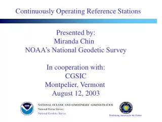
Continuously Operating Reference Stations (CORS). Neil D. Weston National Geodetic Survey, NOS, NOAA. Outline. Introduction Continuously Operating Reference Stations Network Applications Products Selection Criteria Business Model. Introduction - CORS.

E N D
Continuously Operating Reference Stations (CORS) Neil D. Weston National Geodetic Survey, NOS, NOAA
Outline • Introduction • Continuously Operating Reference Stations • Network • Applications • Products • Selection Criteria • Business Model
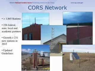
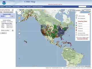
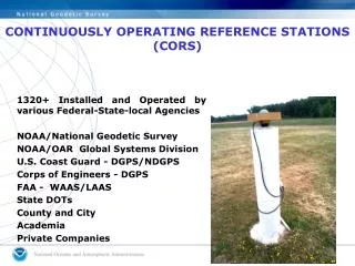
Introduction - CORS • CORS – Nationwide network of GPS/GNSS receivers – 1900+ stations • Multi-purpose, cooperative endeavor • Federal – NOAA, Federal Aviation Administration • State – Departments of Transportation • Academic – Universities • Others – Private • 226 partners • $1.2 Billion in economic benefits for USA -2012
CORS Applications Geodesy / Surveying / Hydrography Meteorology / Space Weather Geophysical applications / Monitoring Geographic Information Systems (GIS/LIS) Mining / Forestry Interference Detection
CORS Products and Activities GNSS (GPS + GLONASS) – Data Reference Frames and Coordinates Station Metadata Online Positioning User Service (OPUS) Antenna Calibration Geoid Modeling Remote Sensing / Photogrammetry Surveying Orbit Production
Antenna Calibrations • Absolute Antenna Calibrations • For use with IGS08, epoch 2005.00 • For use with NAD 83 (2011, MA11, PA11) epoch 2010.00 • Relative Antenna Calibrations • For use with ITRF00, epoch 1997.00 • For use with NAD 83 (CORS96, PACP00, MARP00) epoch 2002.00
GPS Orbits • Ultra-rapid (iguWWWWD.sp3) • 6 hour latency, 24 hour file, sp3 format • Rapid (igrWWWWD.sp3) • 13 hour latency, 24 hour file, sp3 format • Final (igsWWWWD.sp3) • 12 to 14 day latency, 24 hour file, sp3 format
CORS Selection Criteria 70 Km Spacing • Meet and support NOAA mission • Higher density sites – excessive redundancy • NOAA and other federal agency needs • Data quality of nearby CORS • Equipment – receivers and antennas • Collection rate • GNSS / GPS – observations available
Business Model Executive and Agency Summary Continuously Operating Reference Stations (CORS) CORS Products and Services Market Analysis Operational Components Management and Organization Costs and Associated CORS Activities Geodetic Resources External Dependencies
CORS Statistics Data Type 2012 2013 CORS FTP 44,774,666 41,276,983 UFCORS 1,212,604 1,263,519 OPUS 286,599 232,591 OPUS-RS 136,450 129,218
Thank YouDr. Neil D. Westonneil.d.weston@noaa.gov+1 301-713-3169