Download
1 / 23
1.31k likes | 3.85k Views
Land—land resource. Land Evalution - Land use- Land use planning. Xie Jun- Qi Prof. China land Serveying and Planning Institute. Land .

E N D
Land—land resource Land Evalution- Land use- Land use planning Xie Jun-Qi Prof. China land Serveying and Planning Institute
Land Land refer to a delineable area of the earth's terrestrial surface, encompassing all attributes of the biosphere immediately above or below this surface, including those of the near-surface climate, the soil and terrain forms, the surface hydrology (including shallow lakes, rivers, marshes and swamps), the near-surface sedimentary layers and associated groundwater and geohydrological reserve, the plant and animal populations, the human settlement pattern and physical results of past and present human activity (terracing, water storage or drainage structures, roads, buildings, etc.) (FAO/UNEP, 1997)
Functions of Land • (The Future of Our Land, FAO/UNEP,1999) • a store of wealth for individuals, groups, or a community • production of food, fibre, fuel or other biotic materials for human use • provision of biological habitats for plants, animals and micro-organisms • co-determinant in the global energy balance and the global hydrological cycle, which provides both a source and a sink for greenhouse gases • regulation of the storage and flow of surface water and groundwater • storehouse of minerals and raw materials for human use • a buffer, filter or modifier for chemical pollutants • provision of physical space for settlements, industry and recreation • storage and protection of evidence from the historical or pre-historical record (fossils, evidence of past climates, archaeological remains, etc.) • enabling or hampering movement of animals, plants and people between one area and another 。
Characteristic • Fixed location • Limited area • Suitable and limited • Change of Land quality ,land cover and land use • Economic ,social and environmental influence
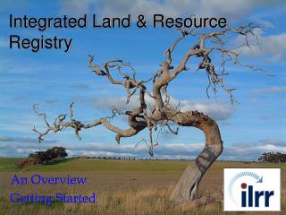
Land Resource • Land Resource: can be used land under technology in present or future • Land use means to utilize the different functions including production, ecology and space etc. • From this point, almost all the land can be regarded land resource • Rational land use is based on scientific land evaluation and land use planning.
Land Evaluation (Assessment) • Land evaluation is the process of assessment of land performance when used for specific purposes • The major is the evaluation for land quality • Aim: rational land use
Land evaluation • Requirement of land evaluation: suitable, restricted, productivity , land value • Suitability : analyze the natural , social and economic environment of land. • Restricted degree diagnosing technology for land quality • Capability based on bioscience and economics • Value : economic assessment, including analysis , forcasting of market. and so on .
Type of land evaluation • Land suitability evaluation: suitability : high ,medium and low not suitable : not suitable in present, not suitable forever • Land capability evaluation: eight classification • Land economic assessment: land grade and value
Major type of land evaluation • Land suitability evaluation serve for economic development and land use planning • Land capability evaluation serve for making macro policy • Land ecologic and economic evaluation serve for land ecological safety, such as ecological environment and economic effect. • Sustainable land use evalution to evaluate sustainability of land use system for sustainable development.
Land Quality a land quality (or limitation) is a complex attribute of land which acts in a manner • distinct from the actions of other land qualities in its influence on the suitability of land • for a specified kind of use. • A listing of the various land qualities in relation to crop growth, animal production, forest productivity and inputs/management levels is already given in the Framework for Land Evaluation of 1976 • Another listing, related to the vertical components of a natural land unit, is given in FAO(1995), (5 types and 33 factors): • ATMOSPHERIC QUALITIES • Atmospheric moisture supply: rainfall, length of growing season, evaporation, dew formation. • Atmospheric energy for photosynthesis: temperature, daylength, sunshine conditions. • Atmospheric conditions for crop ripening, harvesting and land preparation: occurrence of dry spells.
Land Quality • LAND COVER QUALITIES • Value of the standing vegetation as "crop", such as timber. • Value of the standing vegetation as germ plasm: biodiversity value. • Value of the standing vegetation as protection against degradation of soils and catchment. • Value of the standing vegetation as regulator of local and regional climatic conditions. • Regeneration capacity of the vegetation after complete removal. • Value of the standing vegetation as shelter for crops and cattle against adverse atmospheric influences. • Hindrance of vegetation at introduction of crops and pastures: the land "development" costs. • Incidence of above-ground pests and vectors of diseases: health risks of humans and animals. • LAND SURFACE AND TERRAIN QUALITIES • Surface receptivity as seedbed: the tilth condition. • Surface treatability: the bearing capacity for cattle, machinery, etc. • Surface limitations for the use of implements (stoniness, stickiness, etc.): the arability. • Spatial regularity of soil and terrain pattern, determining size and shape of fields with a capacity for uniform • management. • Surface liability to deformation: the occurrence or hazard of wind and water erosion. • Accessibility of the land: the degree of remoteness from means of transport. • The presence of open freshwater bodies for use by humans, animals or fisheries. • Surface water storage capacity of the terrain: the presence or potential of ponds, on-farm reservoirs, bunds, etc. • Surface propensity to yield run-off water, for local water harvesting or downstream water supply. • Accumulation position of the land: degree of fertility renewal or crop damaging by overflow or overblow.
Land Quality • SOIL QUALITIES • Physical soil fertility: the net moisture storage capacity in the rootable zone. • Physical soil toxicity: the presence or hazard of waterlogging in the rootable zone (i.e. the absence of oxygen). • Chemical soil fertility: the availability of plant nutrients. • Chemical soil toxicity: salinity or salinization hazard; excess of exchangeable sodium. • Biological soil fertility: the N-fixation capacity of the soil biomass; and its capacity for soil organic matter turnover. • Biological soil toxicity: the presence or hazard of soil-borne pests and diseases. • Substratum (and soil profile) as source of construction materials. • Substratum (and soil profile) as source of minerals. • Biological soil toxicity: the presence or hazard of soil-borne pests and diseases. • SUBSTRATUM OR UNDERGROUND QUALITIES • Groundwater level and quality in relation to (irrigated) land use. • Substratum potential for water storage (local use) and conductance (downstream use). • Presence of unconfined freshwater aquifers. • Substratum (and soil profile) suitability for foundation works (buildings, roads, canals, etc.)
Land evaluation in Chian • 1949---1980 special land evaluation such as latex ,orange etc. • 1980—2000 learn land evaluation approach from FAO and the other country, such as AEZ , etc • After 2000 land assessment for agricultural land and construction land in city for land use management and administration.
Base on P-S-R frame, land quality indicator system is researched specially for soil erosion, The aim is to explore the relation or soil erosion and land quality ,and bring land use pattern indicator into indicator system, which set up the base for researching the relation of landscape pattern and procession.
Sustainable Land Management • "Sustainable land management combines technologies, policies and activities aimed atintegrating socio-economic principles with environmental concerns so as to simultaneously: • - maintain or enhance production/services (Productivity) • - reduce the level of production risk (Security) • - protect the potential of natural resources and prevent degradation of soil andwater quality (Protection) • - be economically viable (Viability) • - and socially acceptable (Acceptability)."
Land Use Planning Land-use planning is the systematic assessment of land and water potential, alternatives for land use and economic and social conditions in order to select and adopt the best land-use options.. (UN,1993)
Why land use planning is needed? • Its purpose is to select and put into practice those land uses that will best meet the needs of the people while safeguarding resources for the future. • Land unit is muti-suitable • Different land use is controdicted. • Land use can be controlled
Goals Goals may be grouped under the three headings of efficiency, equity and acceptability and sustainability. • Efficiency. • Land use must be economically viable, so one goal of development planning is to make efficient and productive use of the land. For any particular land use, certain areas are better suited than others. Efficiency is achieved by matching different land uses with the areas that will yield the greatest benefits at the least cost. • Equity and acceptability. • Land use must also be socially acceptable. Goals include food security, employment and security of income in rural areas. Land improvements and redistribution of land may be undertaken to reduce inequality or, alternatively, to attack absolute poverty. • Sustainability. • Sustainable land use is that which meets the needs of the present while, at the same time, conserving resources for future generations. This requires a combination of production and conservation: the production of the goods needed by people now, combined with the conservation of the natural resources on which that production depends so as to ensure continued production in the future
Land use planning ---National level • National land use planning outline • Implementing national goal and national strategy • Land use strategic goal and strategic importance. • Making and dividing land use indicator for controlling. • Arrange land for key infrastructure and project • Put out regional land use policy • Put out measures for implementing land use planning
Land use planning ---Province level strategy • carry out indicator for controlling by higher level • harmonize with relative planning • arrange land for key infrastructure and project • make land use division • put out measures of implementing planning
Land use planning---municipality level control • carry out indicator for controlling by higher level • harmonize with relative planning • arrange land for key infrastructure and project • make land use division • put out measures of implementing planning
Land use planning – country level implementation • carry out indicator for controlling by higher level • harmonize with relative planning • arrange land for key infrastructure and project • make land use zoning • put out measures of implementing planning