Download
1 / 31
320 likes | 789 Views
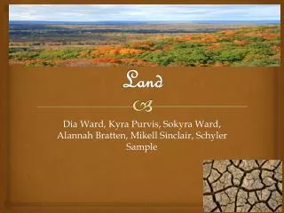
Chapter 14. LAND. Section 1. How We Use Land. Urban. Rural. Land that contains relatively few people and large areas of open space. Land that is covered mainly with buildings and roads is called urban land. Land use and Land cover. Primary Land-Use Categories. Rangeland Forest Land

E N D
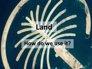
Chapter 14 LAND
Section 1 How We Use Land
Urban Rural Land that contains relatively few people and large areas of open space. • Land that is covered mainly with buildings and roads is called urban land. Land use and Land cover
Primary Land-Use Categories • Rangeland • Forest Land • Cropland • Parks and Preserves • Wetlands, mountains, deserts, and other • Urban land • Land used to graze livestock and wildlife • Land used for harvesting wood, wildlife, fish, nuts and other resources • Land used to grow plants for food and fiber • Land used for recreation and scenic enjoyment and for preserving native animal and plants • Land that is difficult to use for human purposes • Land used for houses, businesses, industry, and roads
Where We Live • Until about 1850 people lived in rural areas. Many were farmers and others managed the forests, worked in local mines or mills, or manufactured the necessities of life for a town. • The Industrial Revolution changed this pattern because new machinery made it possible for fewer people to operate a farm or mill. Also, better transportation allowed manufacturers to be located far from their customers. • So, thousands of jobs in rural areas were eliminated. Many people had to move to cities to find jobs. • As a result, urban areas grew rapidly during the 20th century and spread over more land.
The Urban-Rural Connection • Whether people live in cities or in the country, people are dependent upon resources produced in rural areas such as drinking water, fertile soil and land for crops, trees for wood and paper, and much of the oxygen we breathe.
The resources that are produced by natural and artificial ecosystems are called Ecosystem Services • Examples: • Purification of air and water • Preservation of soil and renewal of soil fertility • Prevention of flood and drought • Regulation of climate • Maintenance of biodiversity • Movement and cycling of materials • Detoxification and decomposition of wastes • Aesthetic beauty
The area of rural land needed to support one person depends on many factors, such as the climate, the standard of living, and how efficiently resources are used. • Each person in a developed country uses the ecosystem services provided by about 8 hectares of land and water. • Many people in developing nations use less than 1 hectare of land per person. • In the United States, each person uses the ecosystem services from more than 12 hectares!! • 1 hectare = 2.471 acres
Section 2 Urban Land Use
People live where they can find the things that they need and want, such as jobs, schools, and recreational areas. For most people today, this means living in an urban area.
Urbanization • The movement of people from rural areas to cities is known as urbanization. • People usually leave rural areas for more plentiful and better paying jobs in towns and cities.
The Urban Crisis • When urban areas grow rapidly, they often run into trouble. • A rapidly growing population can overwhelm the infrastructure and lead to traffic jams, substandard housing, and polluted air and water. • This growth problem has become so widespread throughout the world that the term “urban crisis” was coined to describe the problem.
Infrastructure: • All of the things that a society builds for public use….. • Roads • Sewers • Railroads • Bridges • Canals • Fire and police stations • Schools • Libraries • Hospitals • Water mains • Power lines
Urban Sprawl • Rapid expansion of a city into a countryside around the city is called Urban Sprawl. • Much of this growth results in the building of suburbs, or housing and associated commercial buildings on the boundary of a larger town. • People living in the suburbs generally commute to work in the city by car. • Many of these suburbs are built on land that was previously used for food production. • In 2000, more Americans lived in suburbs than in cities and the countryside combined.
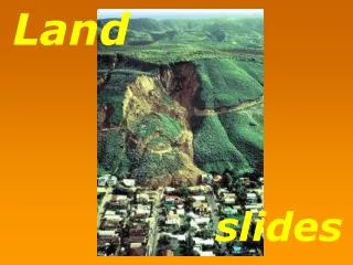
Development of Marginal Lands • Marginal land: • Land that is poorly suited for building • Examples: places that are prone to landslides, close to rivers (that flood their banks)
Heat Islands • Cities both generate and trap more heat, and the increased temperature in a city is called “heat island” • Heat is generated by the infrastructure that makes a city run: • Roads and buildings absorb more heat than vegetation does • They also retain heat longer • Atlanta, GA is an example city that is a significant heat island • Scientists are beginning to see that heat islands can affect local weather patterns….Hot air rises over a city, cooling as it rises, and eventually produces rain clouds. Increased rainfall is a side effect of the heat island
Land Use Planning • Land-use planning is determining in advance how land will be used-where houses, businesses, and factories will be built, where land will be protected for recreation, and so on… • Making land-use plans is complex and often controversial. The government requires detailed reports, the public gets to have input, and projects often affect large or environmentally sensitive areas.
Geographic Information System(GIS) • The most important technological tools for land-use planning involve using the geographic information system. • A GIS is a computerized system for storing, manipulating , and viewing geographic data. • GIS software allows a user to enter different types of data about an area, such as the location of sewer lines, roads, and parks, and then create maps with the data.
Section 3 Land Management and Conservation
As the human population grows, the resources of more rural land are needed to support the population. • The main categories of rural land are: • Farmland, rangeland, forest land, national and state parks, and wilderness • Throughout history, we have sometimes managed these lands sustainably so that they will provide resources indefinitely • Other times, we have reduced their productivity by overusing or polluting them. • The condition of rural land is important because of the ecological services that are provided.
Farmlands • Land that is used to grow crops & fruits • The U.S. contains more than 100 million hectares of prime farmland, however, in some places, urban development threatens some of the most productive farmland. • In 1996, the U.S. government established a national Farmland Protection Program to help state, county, and local governments protect farmland in danger of being paved over or otherwise developed.
Rangelands • Land that supports different vegetation types like grasslands, shrub lands, and deserts, and that is not used for farming or timber production. • The most common human use of rangeland is for grazing of livestock. • Most damage to rangeland comes from overgrazing. • Much of the rangeland in the U.S. is degraded, and the Public Rangelands Improvement Act of 1978 was enacted to reverse this trend and improve land management practices.
Forest Lands • Land used for trees to be harvested to provide products we use everyday, such as paper, furniture, and lumber and plywood for our homes. • There are many ecosystem services provided by forests, however, one of the most important is removal of CO2 from the air.
Harvesting Trees • People use enormous amounts of wood. • The timber industry classifies forest lands into 3 categories • 1. Virgin Forests: has never been cut • 2. Native Forests: is planted and managed • 3. Tree Farms: areas where trees are planted in rows and harvested like other crops.
Clear cutting Selective cutting The process of cutting and removing only middle-aged or mature trees. Selective cutting is more expensive than clear-cutting, but selective cutting is usually much less destructive. • The process of removing all of the trees from an area of land. • Clear cutting large areas destroys wildlife habitat and causes soil erosion. Harvesting Trees: The 2 most widely used methods of harvesting trees are clear-cutting and selective cutting.
Harvesting Trees • Deforestation is the clearing of trees from an area without replacing them. • Forests are cleared to convert the land into farmland. • People also clear forests to make space for roads, homes, factories, and office buildings. • Reforestation is the process by which trees are planted to re-establish trees that have been cut down in a forest land. • In some places, surprisingly, reforestation is happening faster than trees can be cut down!
Parks and Preserves • Yellowstone was our first national park because Congress took an interest in protecting this land from development in the 1870s because a group of explorers approached them with concern. • Today, the U.S. has about 50 national parks. If you are a citizen, you share ownership of these lands. • Benefits of protected areas: protects species & unspoiled forests and provides recreation for people. • Threats to protected areas: when people visit, they leave behind litter, cause traffic jams, etc…
Creating a Land-Use Model • Planner (1): • Wants to attract businesses & new citizens • Developer (2): • Interested in the right to build housing and a shopping center • Conservationist (3): • Interested in preserving open space and natural areas • Law Enforcer (4): • Ensures all laws are met
Bellringer: Soil Contamination • Pick up the Soil Contamination sheet from the side counter, read it, and then answer the following questions on your own paper • What are 3 ways a human could be hurt by soil contamination? • How is soil contamination contained? • How does soil become contaminated? • How does a plant become contaminated by soil? • What are the 3 general approaches to cleaning up contaminated soil?
Soil Lab • A few quick points: • When outside never get out of my eyesight • DO NOT BREAK THE METERSTICKS!!! • Do not get water on yourself or anyone else, this should not be a problem if you are following instructions • You will only be given 15-20 minutes to complete this lab activity, if you are not done, your grade will be affected due to the work being incomplete! • Stay Focused!