Download
1 / 11
110 likes | 293 Views
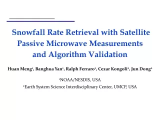
NESDIS Snowfall Rate (SFR) Product Training Session for Alaska Huan Meng , Ralph Ferraro, Brad Zavodsky NOAA/NESDIS NASA/ SPoRT October 3 , 2014. Snowfall Rate Product. Satellite retrieved liquid equivalent snowfall rate (SFR) over land Need snow to liquid ratio to convert to solid snow

E N D
NESDIS Snowfall Rate (SFR) ProductTraining Session for AlaskaHuanMeng, Ralph Ferraro, Brad ZavodskyNOAA/NESDISNASA/SPoRTOctober 3, 2014
Snowfall Rate Product • Satellite retrieved liquid equivalentsnowfall rate (SFR) over land • Need snow to liquid ratio to convert to solid snow • The ratio is dependent on the local climatology and environmental conditions such as surface air temperature and temperature profile • SFR uses data from polar-orbiting microwavesensors: four Advanced Microwave Sounding Unit-A (AMSU-A)/Microwave Humidity Sounder (MHS) pairs and one Advanced Technology Microwave Sounder (ATMS) aboard NOAA POES, EUMETSAT Metop, and S-NPP satellites, respectively • Generally, each satellite passes a location twice per day at mid-latitudes, more in higher latitudes. Each satellite’s passes are 12 hours apart providing up to ten daily SFR estimates, 5 morning; 5 afternoon overpasses (up to 50 daily estimates near the poles). • SFR resolution is 16 km at satellite nadir with lower resolution at limbs • Maximum liquid equivalent snowfall rate is 0.2 in/hr; minimum is 0.0015 in/hr
Product Applications • Identify snowstorm extent and the location of the maximum intensity within the storm • Provide quantitativesnowfall information to complementsnowfall observations or estimations from other sources (stations, radar, GOES imagery data etc.) • Fill observational gaps in mountains and remote regions where radar and weather stations are sparse or radar blockage and overshooting are common • Locate snowstorms at higher latitudes where the quality of the subjective GOES IR and VIS imagery data deteriorates • Track storms and derive trending information (e.g. strengthening or weakening of the storm) by pairing with GOES IR/VIS/WV images
Use Case 1 – Tracking Snowstorm Hard to determine snowing clouds from GOES Difficult to tell rain from snow in radar SFR Product at 17:05Z Snow max later rotated and moved north GOES IR image at 17:00Z Radar at 17:06Z Snow edge and max intensity easy to infer • How do I use the SFR Product? • SFR adds additional information to radar and GOES data • SFR makes it easy to identify edge of snowfall and area of maximum intensity • The movement and strength of a feature identified in SFR can be tracked using radar or GOES imagery between SFR overpasses • In addition, radar and GOES images can also be used to infer storm trending information SFR Product at 19:40Z
Use Case 2 – Filling Radar Gaps ABQ WFO on January 23, 2014: The areal coverage of the product was very good compared with the observations. There is very limited radar coverage in that area and it filled in the gap from northeastern NM to southeastern CO well. We were already issuing nowcasts for the snowfall but the product helped increase confidence in the area where the snowfall was reported. Radar Quality Maximum SFR falls in radar gap SFR at 1607Z on 1/23/2014
SFR Assessment • AMSU/MHS SFR assessment during winter 2014 • SPoRT led effort: training, data formatting/dissemination, collecting feedback, preparing final report etc. • Participants: Albuquerque, NM (ABQ); Burlington, VT (BTV); Charleston, WV (RLX); and Sterling, VA (LWX) NWSWOs; and the NOAA/NESDIS Satellite Analysis Branch (SAB) • Very valuable feedback! • 26 surveys, 10 blog posts, 50+ emails • Most forecasters rated the product ‘Useful’ or ‘Very Useful’ • Revealed product issues impacting its applications in operations • Large latency • No retrievals under cold conditions (reason for all three ‘Not useful at all’ ratings) • Inadequate detection of light snow
New Development – Reduced Latency • Previous operational data had latency of 30 minutes to 3 hours • Forecasters noted that product was not timely enough for use in making forecast decisions but still had utility for providing more confidence in trends and ground reports • Products over CONUS now use direct broadcast (DB) data from University of Wisconsin/CIMSS to reduce latency to less than 30 minutes • Product over Alaska uses one satellite DB data from GINA (up to 10 overpasses/day)
New Development: Cold Extension • All of the ‘Not useful at all’ ratings and 2 of 3 ‘Low’ confidence level responses were a result of undetected snow under cold conditions • More advanced algorithm aids snow detection under cold conditions • RLX, BTV, and LWX identified the case below where radar (right) showed a large swath of snow, but SFR (left) showed very little snow due to colder temperatures • Use of cold extension (middle) better matches both coverage and intensity compared to radar No Cold Extension w/Cold Extension Radar Reflectivity
New Development: More Light Snow • ABQ identified late season snow event where SFR product missed detection of light snow over eastern CO (left; orange circles) • Adjusting minimum SFR value lower provides better coverage of light snow (right) Minimum SFR (old) = 0.1 mm/hr Minimum SFR (new) = 0.04 mm/hr
What to be Aware of • This is a liquid equivalent snowfall rate • Product is currently only retrieved over land • There usually is a time lag between the retrieved SFR and the best correlated ground observation, due to the slow terminal velocity of snow particles • Satellite microwave signal can penetrate cloud, so SFR represents snowfall throughout the precipitation layer • The current product does not produce a SFR estimate where the atmospheric temperature is cold (corresponds to surface temperature around 7°F or below) • Not applicable to shallow-cloud snow (e.g., lake effect) • Still may miss some light snowfall
Product Summary • SFR is liquid equivalent snowfall rate retrieved over land • SFR uses observations from microwave sensors aboard polar orbiting satellites • Ten SFR estimates a day grouped into 5 morning and 5 afternoon overpasses in mid-latitude; up to 5 times more in polar regions • Most important applications: • Identify snowstorm extent and area with the most intense snowfall • Fill gaps in radar coverage and ground observations