Download
1 / 15
150 likes | 357 Views
Southwest Regional Gap Analysis Project: An Overview of Project Goals and Organization. Julie Prior-Magee USGS - Biological Resources Discipline. Southwest Regional Gap Analysis Project Arizona, Colorado, Nevada, New Mexico, Utah.

E N D
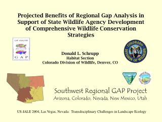
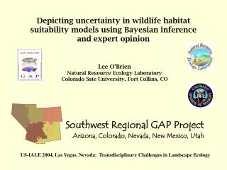
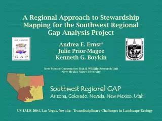
Southwest Regional Gap Analysis Project: An Overview of Project Goals and Organization Julie Prior-Magee USGS - Biological Resources Discipline Southwest Regional Gap Analysis Project Arizona, Colorado, Nevada, New Mexico, Utah US-IALE 2004, Las Vegas, Nevada: Transdisciplinary Challenges in Landscape Ecology
SWReGAP The Southwest Regional Gap Analysis Project A Multi-agency Initiative USGS BRD USGS EDC US EPA BLM CDOW USU NMSU NAU CSU
What is GAP – mission, objectives, and products SWReGAP – project organization, responsibilities, and timeline Benefits of a regional approach Presentation Topics
What Is GAP? A “gap” is the lack of representation or under-representation of an element of biodiversity (plant community or animal species) in an area intended for its long term maintenance. Gap analysis is a process to keep common species common by plugging the gaps in our network of lands managed for biodiversity.
MissionStatement “To promote conservation of biodiversity through information... by providing conservation assessments of natural communities and native species,.. and to facilitate the application of this information to land management.”
GAP Objectives 1) map the distributions of natural communities using NVCS – LAND COVER MAPPING 2) map predicted habitat of native animal species –ANIMAL HABITAT MODELING 3) map the degree of management for biodiversity maintenance of land tracts and water bodies focusing on intent – STEWARDSHIP MAPPING 4) analyze the representation of biotic elements in the conservation network to identify “gaps” in long-term security – GAP ANALYSIS 5) provide this information to the public and those entities charged with land use research, policy, planning, and management.
Analyses: Animals Who are the land stewards and how well is the animal species protected? % USFS: 53.0% % BLM: 0.85% % Protected: 7.3%
Products of GAP Digital products on CD-ROM and the Internet: • Land Cover GIS Coverage • Animal Habitat GIS Coverages • Stewardship/Ownership GIS Coverages • Analyses of “gaps” and general representation • Areas of species richness • Ancillary data used in modeling • A report of methods and results
CDOW & BLM NSTC Denver NREL/CSU USU Logan EPA Las Vegas CPFS Flagstaff The Southwest Regional Gap Analysis Project (SWReGAP) maps according to biogeographic zones rather than state boundaries to achieve a regional seamless biotic data set. Work is coordinated as a regional effort among 5 state-based institutions, NatureServe, and other cooperators. NMCFWRU Las Cruces
Who is SWReGAP? State Project Principle Investigators and NatureServe Cooperator: AZ: Kathryn Thomas, USGS Colorado Plateau Field Station, Northern Arizona University, Flagstaff. CO: Don Schrupp, Colorado Division of Wildlife; Lee O’Brien, NREL, Colorado State University; Dianne Osborne, BLM-NSTC. NV: William Kepner and David Bradford, EPA – National Exposure Research Lab, Las Vegas. NM: Ken Boykin, USGS Cooperative Fish and Wildlife Research Unit, New Mexico State University, Las Cruces. UT: Doug Ramsey and John Lowry, Utah State University; Collin Homer, USGS EROS Data Center. NatureServe: Regional plant ecology coordination – Pat Comer and Keith Schulz
Project Components and Responsibilities • Land cover mapping is coordinated by the RS/GIS Lab at Utah State University. • Animal habitat modeling is coordinated by the NMCFWRU at New Mexico State University. • Stewardship mapping and analysis are also coordinated by the NMCFWRU. • Individual state labs work cooperatively through the regional labs to produce regionally consistent and seamless data sets for the Southwest.
Project Timeline 1998 First organizational workshops held. 1999 Planning workshop held and initial GAP funds distributed. Regional and State coordinators hired. 2000-1 Primary landsat imagery acquired along with field data. Regional animal habitat modeling methods established. Land cover mapping and animal habitat modeling work ongoing. 2002-3 Land cover mapping and animal modeling continues. Stewardship mapping begins in 2003. 2004 Land cover mapping and stewardship mapping will be complete in September 2004. 2005 Animal modeling will be complete in March 2005. Analysis completed, report written, and data published by fall 2005.
Some SWReGAP Vital Statistics • Project area: 530, 415 sq mi, 339,465,600 ac - 93% of the size of Alaska • BLM lands: 31% of area • USFS lands: 14% of area • State lands: 7% of area • Tribal lands: 9% of area
Benefits of Regional SWReGAP Partnership • Consistent data provides a common base for interagency analysis (regional consistency spatially and thematically with NVCS). • Regional data will allow regional planning as a context for site-level management and NEPA compliance. • A high quality data set will permit regional assessments of landscape health and trends and reveal patterns only visible at that scale. • It provides a sampling frame for finer-scale data collection and study.
Contacts • Regional Coordinator: Julie Prior-Magee jpmagee@nmsu.edu • SWReGAP website: http://leopold.nmsu.edu/fwscoop/swregap/default.htm • National GAP website: http://www.gap.uidaho.edu or search “gap analysis” Contains all GAP contacts, state project status and links, and state data. • The National GAP Office: 208/885-3555