Download
1 / 11
110 likes | 212 Views
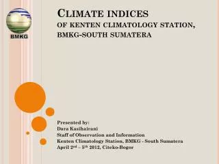
International Workshop on The Digitization of Historical Climate Data, The New SACA&D Database and Climate Analysis in The Asean Region 02-05 April 2012, Citeko, Bogor, Indonesia. CLIMATE INDICES IN WEST SUMATERA. Sugeng Nugroho Global Atmosphere Watch (GAW) Bukit Kototabang Station

E N D
International Workshop on The Digitization of Historical Climate Data, The New SACA&D Database and Climate Analysis in The Asean Region 02-05 April 2012, Citeko, Bogor, Indonesia CLIMATE INDICES IN WEST SUMATERA Sugeng Nugroho Global Atmosphere Watch (GAW) Bukit Kototabang Station Jln. Raya Bukittinggi-Medan Km.17, Palupuh, Kab. Agam, Prop. Sumatera Barat Telp.: 0752-7446089, Fax.: 0752-7446449 e-mail: sugeng.nugroho@bmkg.go.id
OUTLINE • INTRODUCTION • Background • Aim of study • METHODOLOGY • Site of study • Data • Data analysis • Climate extreme indices • RESULTS • SUMMARY
Aim of study Background INTRODUCTION Monitoring CO2 concentration in Bukit Kototabang GAW Station One of the most significant consequences of global warming due to increase in greenhouse gases would be an increase in magnitude and frequency of climate extreme events (temperature & precipitation). The main aim of this study is to determine the annual air temperature variations and extreme rainfall event in West Sumatra by using ETCCDMI extreme indices. CO2 annual average concentration in Bukit Kototabang GAW Station has been increasing from 373.1 ppm in 2004 to 381.9 ppm in 2009
METHODOLOGY Site of study Study was carried out in Teluk Bayur, Padang and Sicincin as representation of lowland areas, Padang Panjang and Bukit Kototabang for highland areas. Mentawai Strait
METHODOLOGY Data This study using daily observation data for the last 20 years at BMKG West Sumatera Stations
METHODOLOGY Data Analysis Data were analyzed by using RClimDex 1.0 and nonparametric statistic method (Mann-Kendal test) to analyze the trend variation
Climate Extreme Indices METHODOLOGY Using 18 extreme indices from ETCCDMI (Expert Team for Climate Change Detection Monitoring and Indices). 9 indices for extreme air temperature (TXx, TNx, TXn, TNn, TN10p, TX10p, TN90p, TX90p and DTR) • 9 indices were used for extreme rainfall event (RX1D, RX5D, SDII, R125,CDD, CWD, R95p, R99p and PrcpTOT)
Extreme Temperature Indices RESULTS All site show negative trend for TX10p (cool days) index All site show positive trend for TX90p (warm days) index
Extreme Rainfall Event Indices RESULTS All site show positive trend for RX5D (max 5-day prec amount) All site show positive trend for R99p (extremely wet days) All site show positive trend for SDII (simple daily intensity index) All site show positive trend for RX1D (max 1-day prec amount)
SUMMARY • Result showed that generally the observed areas indicated positive trends for extreme rainfall event indices • Extreme air temperature index, positive trends were mostly observed on TXx, TNx, TXn, TNn, TN90p and TX90p indices, whereas negative trends were found on TN10p and TX10p indices • Statistical analysis showed not all of trend variations were significant at 95% of convidence level • Result suggested that there is no difference between lowlands and highlands in terms of extreme climate condition in West Sumatra.