Download
1 / 9
90 likes | 167 Views
Operational use of satellites for RIVM core tasks. Reinout Woittiez Director Environment and Safety Division, RIVM. The National Institute for Public Health and the Environment (RIVM). Research & implementation (“objective” info and knowledge). Political responsibility

E N D
Operational use of satellites for RIVM core tasks Reinout Woittiez Director Environment and Safety Division, RIVM
The National Institute for Public Health and the Environment (RIVM) Research & implementation (“objective” info and knowledge) Political responsibility (Departments of Health and Environment)
National Air Quality Monitoring Network • Legal obligation (EU) • SMOG: information to the public • Policy monitoring (long-term trends) • Input and validation of air quality models • RIVM has a statutory National "reference function". • Assessment regional monitoring networks and model calculations - This reference function is becoming more and more of importance
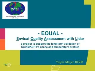
RIVM, Atmosphere and Satellites (1) • Ozone layer (Montreal protocol) • Monitor the expected recovery • Study interaction with Climate Change • Monitoring is well developed (ground based + satellites) • RIVM: Monitoring Ozone Layer (NDACC, Lauder) • RIVM: Satellite validation (EQUAL project) • RIVM: Monitoring UVB, calculation of health effects
RIVM, Atmosphere and Satellites (2) • Air Quality (a.o. CLRTAP) • Issues are: aerosols (PM10, PM2.5), Ozone, local NO2 • Smog • Long range transport • Global emissions and trends • Interaction with Climate Change • Monitoring well developed and regulated (mainly groundbased) • RIVM: National Air Quality Monitoring Network • RIVM: Emission and deposition measurements • RIVM: Modeling • RIVM: Smog Forecast
RIVM, Atmosphere and Satellites (3) • Climate Change (Kyoto protocol, IPCC) • Greenhouse gases (sources, sinks and trends) • Aerosols, clouds and the radiation balance • Research on the Climate System • Testing of Climate models • RIVM: Greenhouse gas monitoring • RIVM: Participation in CESAR station at Cabauw • RIVM: Climate Lidar in BSIK project • RIVM: Satellite validation (aerosols, clouds, tropospheric ozone)
TROPOMI ? • RIVM needs information on the state of the atmosphere, and is interested in the most efficient way to obtain it • Satellites must either provide unique info, or better info, or cheaper info to be relevant for operational users • In general, the best solution will be a combination of sources: groundbased, satellite and modeling. • The scale of the problem is relevant (global vs. regional) • There are opportunities in Climate Change as legislation is less far developed and the scale of the problem is global • Continuity of the information stream is a prerequisite for operational use • We are just beginning to explore the use of SCIAMACHY and OMI data for RIVM core products. This summer: first use of satellite data in operational smog forecast